Featured Quizzes
User Quizzes
Create Quiz
Data and Charts
Badges and Games
About JetPunk
JetPunk Shop
Dark Mode
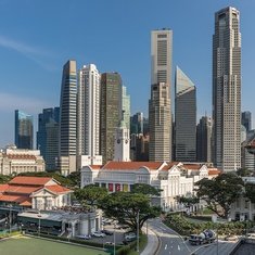
Urban Planning Areas of Singapore on a Map
How many of Singapore's planning areas can you name?
Estimated population from: citypopulation.de (2019)
Map Source: Here
Rate:
Last updated: September 23, 2020
You have not attempted this quiz yet.
More quiz info >>
| First submitted | September 23, 2020 |
| Times taken | 300 |
| Average score | 60.0% | Report this quiz | Report |
6:30
Enter planning area here
0
/ 55 guessed
Time Used
00:00
Best Time
00:00
The quiz is paused. You have remaining.
Scoring
You scored / = %
This beats or equals
% of test takers
also scored 100%
The average score is
Your high score is
Your fastest time is
Keep scrolling down for answers and more stats ...
|
|
|
HinesBrothers
+2
Level 75
Sep 23, 2020
2/55
peardestroyer
+2
Level 57
Sep 25, 2020
Cool :)
New and Popular
Save Your Progress
Inventory of First-Level Country Subdivisions
Quiz series by ThatOnePunk
Copyright H Brothers Inc, 2008–2024
Contact Us | Go To Top | View Mobile Site