Featured Quizzes
User Quizzes
Create Quiz
Data and Charts
Badges and Games
About JetPunk
JetPunk Shop
Dark Mode

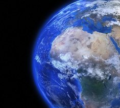
Countries of the World with a Borderless Map
All borders between countries have been completely removed. Despite the difficulty, can you name all 196?
Rate:
Featured Quiz
Last updated: January 18, 2020
You have not attempted this quiz yet.
More quiz info >>
| First submitted | November 26, 2016 |
| Times taken | 54,621 |
| Average score | 83.2% |
| Rating | 4.99 |
12:00
Enter country here:
0
/ 196 guessed
Time Used
00:00
Best Time
00:00
The quiz is paused. You have remaining.
Scoring
You scored / = %
This beats or equals
% of test takers
also scored 100%
The average score is
Your high score is
Your fastest time is
Keep scrolling down for answers and more stats ...
|
|
|
|
|
New and Popular
Save Your Progress
Borderless Map
Quiz series by Quizzer6794
...
Copyright H Brothers Inc, 2008–2024
Contact Us | Go To Top | View Mobile Site

Also, Bir Tawil is unclaimed and not part of Sudan
My best time also happens to be 4:14 in the original Countries of the World quiz.
I think that's my ultimate form so I'll stop trying to achieve a time under 4mins
Not that I'm perfect or should be in the top 0.01%, but I think that this clearly demonstrates that there are quite a few cheaters at the top.
Although I do plan on rising a few more levels without cheating.
Would also help if I wasn't monolingual.
I always do it in this order. Oceania, S America, N America, Africa, Asia, Europe.
I don't think anyone cheats on this one; almost everybody on Jetpunk can do this literally blindfolded.