Featured Quizzes
User Quizzes
Create Quiz
Data and Charts
Badges and Games
About JetPunk
JetPunk Shop
Dark Mode
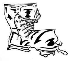
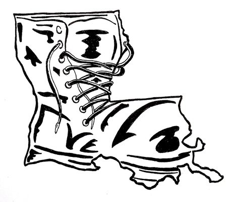
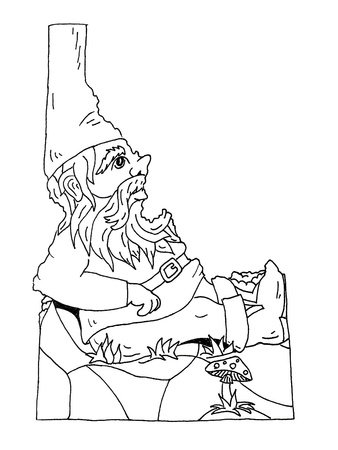
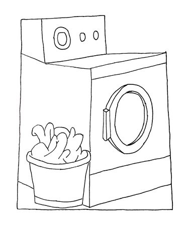
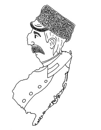
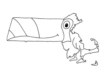
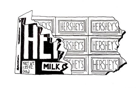
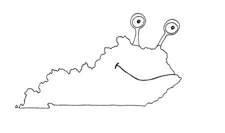
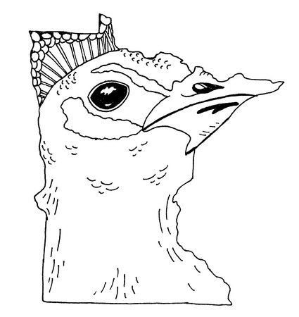
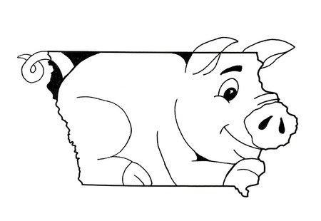
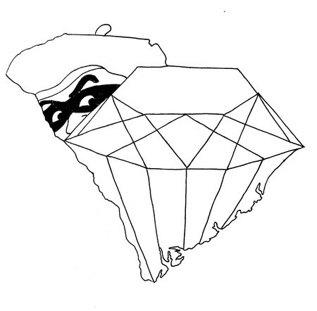
Cartoon Versions of U.S. States
If you look very closely and use lots of imagination, some U.S. states look like something. Using the drawings below, identify each state that has been transformed into a cartoon.
All drawings are original. In some cases, a few embellishments have been added to the state's border.
Answer must correspond to the yellow box.
Also try Countries.
Rate:
Featured Quiz
Last updated: March 16, 2020
You have not attempted this quiz yet.
More quiz info >>
| First submitted | March 1, 2020 |
| Times taken | 42,596 |
| Average score | 83.3% |
| Rating | 4.78 |
2:00
Enter answer here
0
/ 12 guessed
Time Used
00:00
Best Time
00:00
The quiz is paused. You have remaining.
Scoring
You scored / = %
This beats or equals
% of test takers
also scored 100%
The average score is
Your high score is
Your fastest time is
Keep scrolling down for answers and more stats ...
|
|
|
|
|
|
|
|
|
|
|
|
New and Popular
Save Your Progress
Copyright H Brothers Inc, 2008–2024
Contact Us | Go To Top | View Mobile Site
They are shaped differently, incidentally.
Anyway, great quiz!
Do you wanna to do the second version?
1. I though Massachusetts was a lobster not a toucan!
2. I though Minnesota was a rabid peacock with a lopsided mustache not whatever that is (I STILL can’t figure it out)!
3. I though South Carolina was a robber looking over his shoulder at a sack of gold not a robber sneaking up to a diamond!
whats up with that??
Sincerely, Bob