
Some Wacky Geography
First published: Sunday December 6th, 2020
Report this blog
Does Colorado border Arizona?

And furthermore does Utah border New Mexico? As you may know these are the 'Four Corner States', which form quite a rare geographical phenomenon called a quadripoint. A quadripoint is where four geographic territories form converge on a single point. Tripoints by comparison - where three territories converge- are much more common. There are about 176 tripoints between countries in the world, but no quadripoints. The closest thing to a quadripoint between countries is the Botswana-Zambia border. At a mere 150 metres long it is the shortest international border in the world, and at either end of this stretch are tripoints shared with Namibia and Zimbabwe.

Four countries are visible in this picture.
But there are a few quadripoints between sub-national level territories, such as the one between the Four Corner States.
Canada also has its own Four Corners, where a quadripoint is shared between Manitoba, Saskatchewan, the Northwest Territories and Nunavut.

The point is, though the Corner States share a quadripoint, do the diametrically opposed states share a land border? Even attempting to answer this question actually raises a plethora of profound philosophical questions and debates about the impermanence, test validity, and ontological ramifications of the entire concept of borders. And if things such as quadripoints weren't confusing enough already, did you know that there are points where even more than four regions converge? In some countries there are convergence points between 5, 6, 7, even 8 different regions.
The summit of the highly active Sicilian volcano Mount Etna is a point were ten different municipalities converge, and one of them touches the convergence point in two places, so really it is an undecipoint.

A map of the municipalities that converge atop Mount Etna. ('m not naming them all, you can look them up).
And finally we have the supremo of complex geography; where in the world does Australia border Norway and France? Why Antarctica, of course!
And not only that, the South Pole is the convergence point for 11 different territories claimed by six countries, as well as a huge region of land not claimed by anyone (why has nobody claimed it? Who wants to move to Antarctica and start our own country?)

So the South Pole is arguably the convergence point for twelve different territories, including the soon to be dubbed Penguinland (Chilly was already taken).
The most important question is, what do you think is the right answer?
More confusing borders-
As discussed in a previous blogpost, the presence of water complicates things when it comes to borders. It's hard to pin down whether Sri Lanka borders India via Adam's Bridge, but there are other examples of countries that share land borders when in fact the entire length of those borders are made up of water.
The abovementioned 150m Botswana-Zambia border is formed by the Zambezi River. We don't really count maritime borders between countries, but what about borders formed by rivers? It may be considered a 'land-border', but it's not, strictly speaking, a border on land.
Tanzania-Democratic Republic of Congo:
The border between these countries is made up entirely of the enormous Lake Tanganyika.
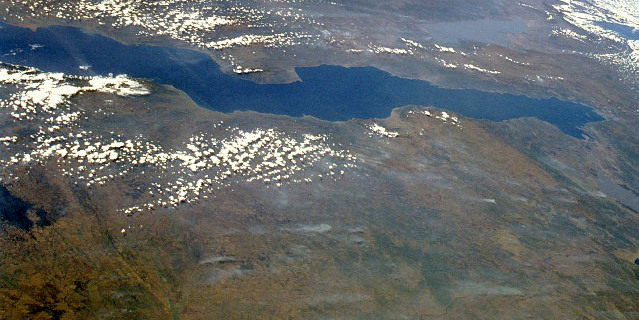
There are no bridges, tunnels, or stepping stones adjoining the two countries. The only way to cross is in a boat, take a reeeaallly long running jump, or start swimming.
What if there were a bridge, then?
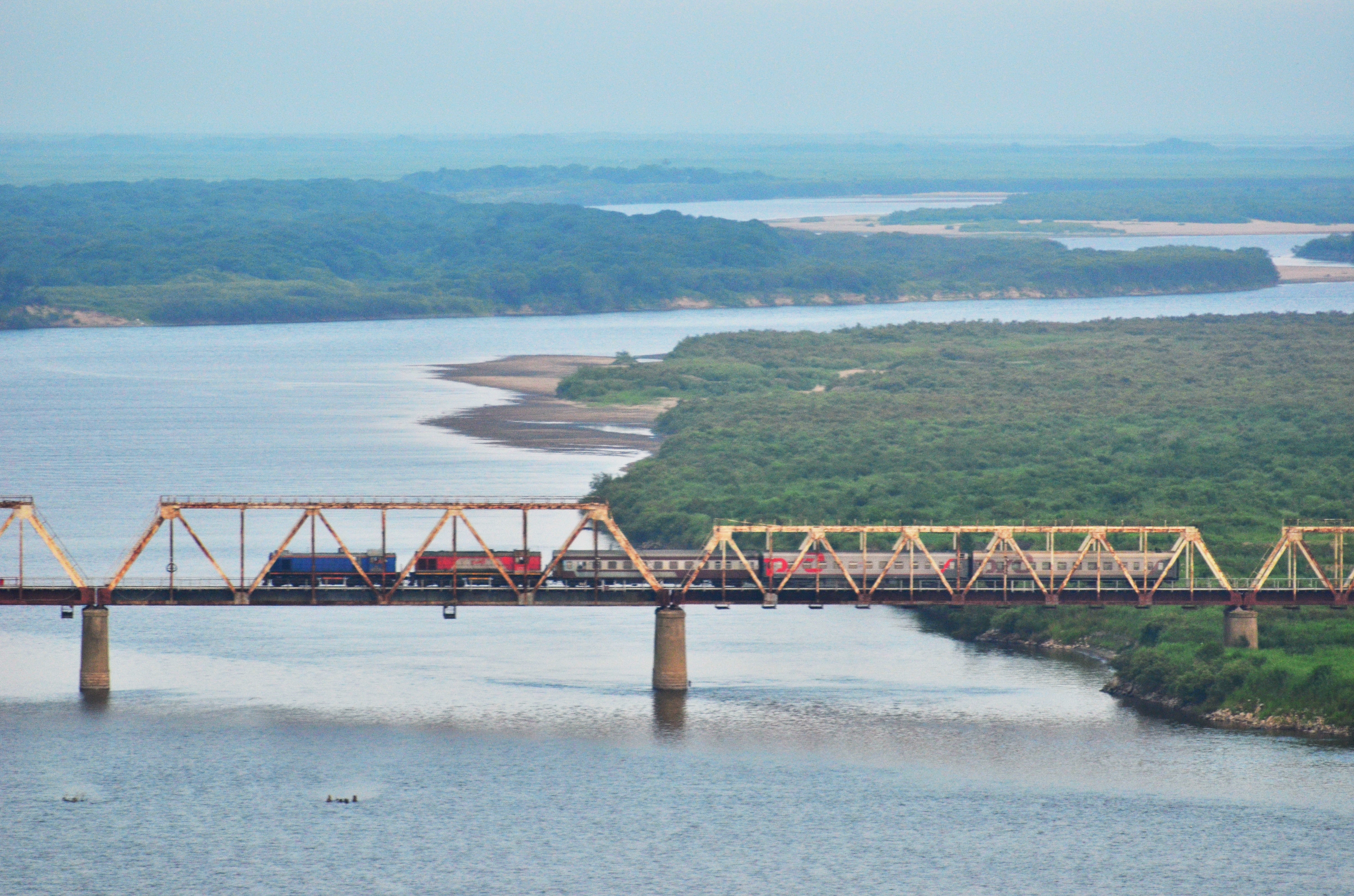
Laos-Burma/Myanmar:

The Laos and Burma/Myanmar border is formed by the mighty Mekong River, and there are only two or three bridges that span it there. Similarly;
North Korea-Russia:
The border between these countries is made up by the last 19km of the Tumen River before it flows into the sea, and only one railway bridge spans it.
The average width of Lake Tanganyika is about 33 miles, and about 45 miles at its widest part. That means the distance between Tanzania and DRC is even longer than the distance between United Kingdom and France across the English Channel (about 22 miles), and deep underneath there is a tunnel that actually lets you travel between the two countries. So why don't we consider the UK to border France in that case? The same applies to Denmark-Sweden, separated by only 9 miles of water, and still connected by a bridge/tunnel.
And if THAT weren't enough to contend with, where do we stand on the Caspian Sea? Similar to Lake Tanganyika, 125 miles of Caspian Sea separate Azerbaijan and Turkmenistan. Do we hold lakes, rivers, and seas to different standards? But then DO WE EVEN COUNT THE CASPIAN SEA AS A SEA?? It's got the word 'sea' in its name, and is made of saltwater, and it is huge, but it also isn't connected to the oceans.
(If this is giving you a headache please take a break before continuing).
The battle of the rivers-
Most rivers are actually made up of several rivers. Rivers that flow into other rivers are called tributaries.
The Strahler stream order is a system used to denote the hierarchy of sections of tributaries in a river system. First level river sections are those that originate at a source, and have no tributaries flowing into them (and are labelled with a Number One). Then subsequent sections of tributaries are labelled Two, Three, and so on.
It works rather like a tree, where the sources are the 'leaves', and the main river is the 'trunk'. It's best explained by this diagram:

The section of river between the last tributary and the sea is the highest Strahler number in that river system.
In the United Kingdom the highest Strahler number is four.
The Amazon river has a Strahler number of twelve, making it the highest order river in the world.
Now when a tributary joins another river, i.e. where they confluence, typically the new river keeps the name of the longer of the two tributaries.
For example the Sava and Danube rivers confluence in Belgrade. The Danube is much longer than the Sava up to that point, and so the remainder of the two rivers keeps the name Danube.

The confluence of the Sava and Danube in Belgrade.
All well and good so far...
But wait,
there's a glaring problem.Let's move from Belgrade to St Louis, Missouri. Here we find the confluence of the Missouri and Mississippi rivers. From this point on the new river takes the name of the Mississippi until it reaches the sea. But should it?
From source to mouth the Mississippi runs for 2,320 miles or 3,730 km.
But even from its source to its confluence with the Mississippi in St Louis, the Missouri River is still longer than the entire length of the Mississippi, even if narrowly, at 2,341 miles or 3,767 km.
The entire length of the Missouri from its source in Montana to the sea is whopping 3,895 miles or 6,270 km long, easily making it a rival for even the Amazon, Nile or Yangtze rivers.

The Missouri is by far the longer of the two rivers, so why does it get subsumed by the Mississippi? Perhaps when Miss Ouri and Miss Issippi got married they both preferred to be known as Mrs Ippi. Or perhaps it's because the rivers were named back-to-front (no I don't mean they were named iruossiM and ippississiM).
When French explorers and colonists were surveying and mapping North America in the 17th century, they basically discovered the Mississippi River first, and by the time it was found out that the Missouri was actually longer, the stretch of river from St Louis down to the sea had already become known as the Mississippi, and it was too late to change it to Missouri as it ought to be called. Just imagine if they had, maybe the states of Missouri and Mississippi would have swapped names.
Sadly it's also too much of a hassle to rename it the Missississouriippi. It's very difficult to rename things once its name has been established. I mean it's not like countries do it all the time.
The smallest republic showdown:
San Marino vs. Nauru-


At 61km2 the tiny nation of San Marino is one of the smallest countries in the world. But then as small as San Marino is, the island nation of Nauru is even smaller at a mere 21 km2. But then again.... is it?
Nauru's land area may only be 21 km2, but Nauru claims a 12 nautical mile territorial sea, and a 200 nautical mile exclusive fishing zone, so if you include water territory Nauru potentially is much much larger than it appears, and covers more area than San Marino. That pesky water is causing us problems again.
Kiribati is a country in the Pacific comprised of 33 islands, which collectively are 811 km2. However, these islands are spread out over an area of over 3.5 million km2. By that measure Kiribati is arguably larger than India.
If that weren't complicated enough, did you ever stop to wonder if a country is 2D or actually 3D? How deep underground does a country's territory go; to the Earth's core? And conversely how high up in the sky does a country go; to the Kármán Line? Beyond??
More importantly, what do you think?
What conclusions can be drawn from all this?
Just remember that all of these examples are of artificial geography. That is to say borders and names are all human constructs. They help us understand the world easier, but shouldn't be taken too seriously. The world is an amazing place, appreciate its natural wonders before worrying about the man-made stuff.
It's also important to remember that no two parts of the world are exactly exactly alike, in fact many places are completely different to one other, so it is not really possible to standardise the different countries and regions of the world into the same neat categories.
It's no wonder that so many countries have disputes with each other. But that doesn't mean we should follow their example. If you have a different opinion to someone, just voice it politely.

One thing: on the San Marino vs. Nauru, you mentioned Nauru's territorial waters and exclusive fishing zone. The UN allows countries with coastlines a certain radius around their coastlines for natural resources (i.e. fishing, boating, oil, and natural gas). However, these do not count as part of a countries' area.
Once again, great blog!
'm not naming them all