Brazilian National Parks - Pictures and Info! #Part 3
First published: Friday April 23rd, 2021
Report this blog
- Jericoacoara National Park
- Juruena National Park
- Lagoa do Peixe National Park
- Lençóis Maranhenses National Park
- Mapinguari National Park
- Fernando de Noronha Marine National Park
- Ilha dos Currais Marine National Park
- Abrolhos Marine National Park
- Montanhas do Tumucumaque National Park
- Monte Pascoal National Park
- Monte Roraima National Park
- Nascentes do Lago Jari National Park
- Nascentes do Rio Parnaíba National Park
- Pacaás Novos National Park
- Pantanal Matogrossense National Park
- Pau Brasil National Park
Let's see more parks today? Hope you like it!
Jericoacoara National Park
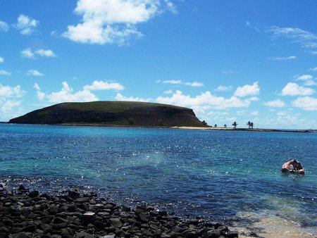
The Jericoacoara National Park is located in the municipalities of Jijoca de Jericoacoara, Cruz and Camocim, on the west coast of the state of Ceará, in Brazil. It has an area of 8 850 hectares. It is administered by the Chico Mendes Institute for Biodiversity Conservation (ICMBio). It is located 300 km west of the state capital, Fortaleza. It houses the internationally known Jericoacoara Beach. The objectives are to protect and preserve samples of coastal ecosystems, ensure the preservation of their natural resources and provide scientific research, environmental education and ecological tourism. Until 1985, Jericoaquara was just a small fishing village, lost among dunes and isolated, until its discovery by the tourism industry, which made it rise to international fame. It has been the subject of several major television programs and publications around the world. The American newspaper The Washington Post chose its beach of the same name as one of the ten most beautiful beaches on the planet in 1994. Jericoaquara was also the setting for the Brazilian film A Ostra e o Vento (The Oyster and the Wind) (1997).
The climate of the region is characterized as hot and humid, with rains from summer to autumn, with average temperatures oscillating between 35 ° C and 22 ° C and with the drought period varying from five to six months. The annual rainfall average is 1,364 mm. The coastal environment is extremely vulnerable and consists of different landscapes: saw, sandbank, dunes, lagoons, board, mangrove, halophytic lawns and beaches. It has a coastal biome. The vegetation is characterized by several phytophysiognomies, such as cerrado, caatinga. Herbaceous vegetation and grasses. The fauna of this region is mainly represented by avifauna, ichthyofauna and cetaceans, however, there is evidence of small and medium-sized mammals. There are 38 bird families at the site, and several species are rare or threatened with extinction. The reserve has numerous attractions, many of which are only accessible by means of traction vehicles, among which the following stand out:
- Barra of Guriú River: located 10 km away from the main town of Jericoacoara, following the west coast. It gave its name to a small fishing village in its surroundings. It determines the western limit of the Jericoacoara National Park.
- Lighthouse: one of the most visited places to watch the moon and the sun rise. It is powered by solar energy.
- Lagoa Azul (Blue Lagoon): fresh and crystalline lagoon surrounded by native vegetation, it has the popular nickname of Caribbean of Northeast.
- Lagoa do Paraíso (Paradise Lagoon): located at the seat of the municipality of Jijoca. There are 15 km² of fresh and transparent water, surrounded by large dunes. It is also called Lagoa de Jijoca and is very popular for sailing.
- Mangue Seco: is a small town located to the west of the village, in the middle of the dunes. Its main attraction is a lagoon that is in the middle of them, bordered by a small strip of mangrove that was occupied by the sea.
- Nova Tatajuba: located 25 km from the main town, following the west coast, already close to the neighboring municipality of Camocim. It is a small town, still primitive. Some of its dunes are in the process of crystallization, that is, they are compressing and forming hills called dead dunes. It is called Nova (New) because the old one was buried by the dunes.
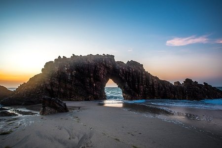
- Pedra Furada: is the icon of Jericoacoara. It is located in the rocky region of Jericoacoara called Serrote, which is almost 2km long. It consists of an enormous rock formation in the shape of an arch / portal sculpted by the action of the waves of the sea. During the period that extends from July 15th to August 15th, the sun, when setting, fits in the hole of the stone. At low tide, access to the site is done by a walk on the beach of about 30 minutes. The route to it is marked by landscapes of beaches, caves, such as the Poço da Princesa, and peculiar rock formations.
- Duna do Pôr-do-Sol (Sunset Dune): to the west of the fishing village, there is the great dune, the most popular place to see the sunset in Jericoacoara. It is next to Canoas Beach. It is famous for being able to watch the sun rise and set in the ocean, due to its peninsular location.
- Malhada Beach: important beach in the region. It is very popular for surfing.
- Preá Beach: located east of the National Park, its fishing village is one of the gateway to Jericoacoara, 17km away from the headquarters. Fishing is abundant in the region and the cuisine of fish, shrimp and lobsters is traditional. The beach is perfect for kitesurfing.
- Serrote: a small mountain range approximately 100m high that stands out from the fullness of the dunes. It gave rise to the name of the fishing village that resists, even today, just before the surf of the sea. Seen from the high seas, one has the impression that it is shaped like a lying down alligator.
Juruena National Park
The Juruena National Park is a Brazilian conservation unit of integral protection to nature located in the states of Mato Grosso and Amazonas, with territory distributed by the municipalities of Apuí and Maués, in Amazonas, and Apiacás, Colniza, Cotriguaçu and Nova Bandeirantes, in Mato Grosso. The park was created with the objective of protecting the biological diversity of the region of the lower Juruena - Teles Pires and upper Tapajós, their natural landscapes and associated abiotic values. Juruena was created by Decree, issued by the Presidency of the Republic on June 5, 2006. The area of the Creation Decree was 1 957 000 ha, slightly less (approximately 1 220 km²) than Israel. The administration of Juruena is currently the responsibility of the Chico Mendes Institute for Biodiversity Conservation (ICMBio).
The park has an area of 195 752 671 ha, including the islands of the Teles Pires river. 1,181 154 ha (60% of the total area) of the park are in the state of Mato Grosso. The rest of the area (40%) is located in the state of Amazonas, distributed by the municipalities of Apuí and Maués. Juruena is located in an area considered to be one of the main frontiers of deforestation in the Amazon region. In addition to deforestation, the area is the target of constant land grabbing acts and suffers the impacts of livestock enterprises and uncontrolled sport fishing activities, ore extraction through onshore mines and river dredgers. Such initiatives have caused significant environmental impacts for the park, with the need for the inspection and embargo action of such enterprises being extremely necessary.
Lagoa do Peixe National Park
The Lagoa do Peixe National Park is located on the south coast of the state of RS, covering the municipalities of Tavares (80%), Mostardas (17%) and São José do Norte (3%). The unit was created through Decree No. 93,546, issued on November 6, 1986. It has an area of 36 722 ha. It is currently managed by the Chico Mendes Institute for Biodiversity Conservation (ICMBio). Access from the north is made from Porto Alegre, via RS-040 to Capivari (90 km - paved road); from Capivari do Sul, on the RST-101 to Mostardas (120 km - paved road), where the Park's administrative headquarters is located. From there the limits of the unit are another 25 km. The cities closest to the park are Tavares and Mostardas, which are 230 and 200 km away from the state capital, Porto Alegre, respectively.
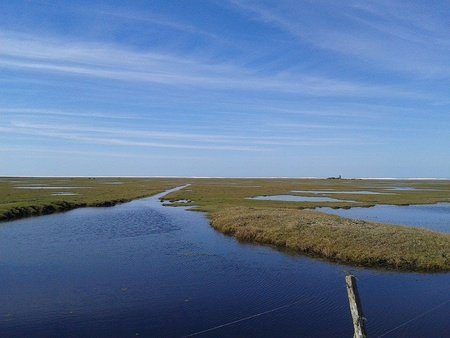
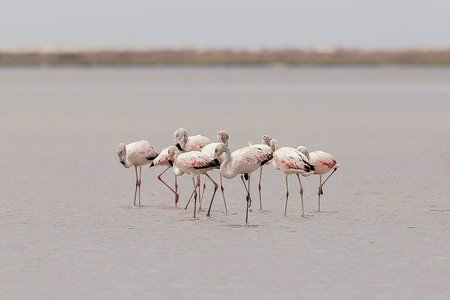
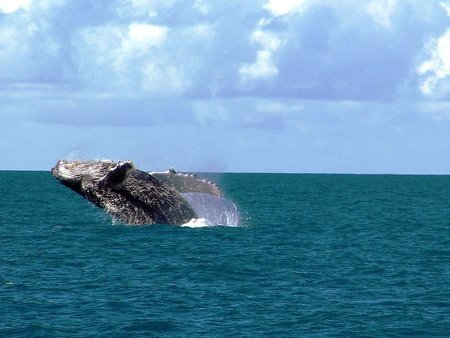
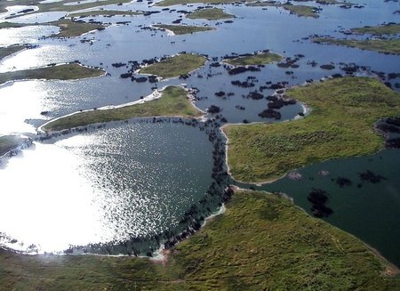
The climate is humid subtropical, with an average temperature of 16.5 ° C and average annual rainfall of 1,186 mm. Peixe Lagoon - technically a lagoon, as it has a communication channel with the sea during most of the year -, located on the isthmus formed by Patos Lagoon and the Atlantic Ocean, is a shelter for large concentrations of migratory birds from the Northern Hemisphere (in summer) and South (in winter), among them coscoroba swans, flamingos, cormorants, red-breasted curlew, seagulls, talha-mares, pirus-pirus, sternas, batuíras and the black-necked swan. Among mammals can be seen graxains, armadillos, small rodents and, between the months of July and October, the right whale migrating to Santa Catarina. Brought by sea currents, it is not uncommon to find sea turtles, penguins and even fur seals on the beach, depending on the time of year. The Mata de Restinga, the wetlands and the dunes complete the attractions of the unit. The park has no visitation infrastructure and it is forbidden to camp in your area. Very interesting is the walk along the sea or Laguna dos Patos, near the park, where traces of several shipwrecks and lighthouses can be found that record the great danger for navigators in this part of Rio Grande do Sul. the Lighthouse of Mostardas and the Lighthouse of Solitude on the edge of the Atlantic, and the Lighthouse Cristóvão Pereira and the Lighthouse Capão da Marca, on the banks of the Patos Lagoon.
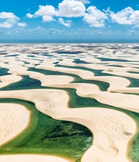
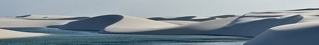
Lençóis Maranhenses National Park
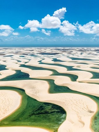
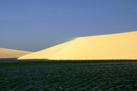
The Lençóis Maranhenses National Park is a Brazilian conservation unit with integral protection to nature located in the northeastern region of the state of Maranhão. The park's territory, with an area of 156,584 ha, is distributed among the municipalities of Barreirinhas, Paulino Neves, Primeira Cruz and Santo Amaro do Maranhão. It is located 335 km from the capital São Luís. The park was created with the primary purpose of protecting the flora, fauna and natural beauty, existing on the site. Public use is only allowed for accredited vehicles, and it is not allowed to travel with motorized vehicles in the dune field. Ecotourism with observation of fauna and flora, observation of the night sky, adventure tourism, long-distance hikes and stand up paddle are allowed. Inserted in the marine coastal biome, the park is an exponent of mangrove, sandbank and dune ecosystems, associating strong winds and regular rains. Its great scenic beauty, combined with walks through the dune fields and the possibility of bathing in the lagoons, attract tourists from all over the world, who visit the park throughout the year. The national park of Lençóis Maranhenses was created in vacant lands belonging to the Union through Decree No. 86.060, issued on June 2, 1981 by the Presidency of the Republic. The area of the park, according to the creation decree, was 155 000 ha. The film The House of Sand was recorded in the park.
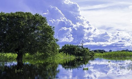
The park is located in the Microregion of Lençóis Maranhenses, in northern Brazil, on the northeast coast of the state of Maranhão. With 156 584 hectares of area, the park is inserted in the marine coastal biome, with mangrove, sandbank and dune ecosystems. Lençóis Maranhenses is home to approximately 90,000 ha of free dunes and freshwater lagoons, as well as large areas of sandbank and ocean coast. The strip of dunes advances, from the coast, from 5 to 25 km towards the interior. In the region is the source of the Preguiças River, which runs through the park to its mouth in the Atlantic Ocean. One of the episodes of Naked and Afraid, a survival reality show aired by the Discovery Channel, was filmed in the region. The Avengers: Infinity War, and Avengers: Endgame films used the location as a backdrop for the planet Vormir. The climate is dry sub-humid, with an average annual temperature of 26 ° C. Despite the desert appearance of the park area, the region's climate has two well-defined seasons: a rainy season, which runs from January to July, and a dry season, from August to December. The rains contribute to the control of the region's humidity and the formation of lakes. Between December and January, and sometimes until the end of February, in the transition period between the rainy and dry seasons, the Lençóis Maranhenses occasionally dry out, causing the bluish or greenish lagoons to disappear. The average annual rainfall is around 1600 mm.
The ponds in the park are often interconnected to one another, as are the rivers that flow through the area. They are home to a number of species of fish and insects, including hoplias, which hide in wet layers of mud and remain asleep during the dry season. In addition to the dunes that form the centerpiece of the park, the ecosystem also includes restinga and mangrove areas. The headquarters of the park is about 260 km from São Luís, on the banks of the Preguiças River. Access to the park is by land, via BR 135, by sea, entering the Preguiças River channel in Atins (fishing village of Barreirinhas), by river, from Barreirinhas, through the Preguiças River, and by air, through the airport of Barreirinhas.
Mapinguari National Park
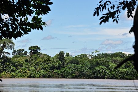
The Mapinguari National Park is a Brazilian national park located between the states of Amazonas and Rondônia. Next to the park are the cities of Canutama, Humaitá and Lábrea, in Amazonas, and Porto Velho, in Rondônia. It has an area of 1,776,914.18 hectares. It was created in 2008, and is managed by ICMBio. Like many parks in the Amazon region, it suffers from unregulated land tenure and illegal deforestation and mining. Still, much of the park is still covered with native vegetation.
Fernando de Noronha Marine National Park
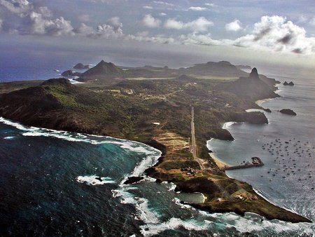
Fernando de Noronha is a Brazilian archipelago in the state of Pernambuco. Formed by 21 islands, islets and rocks of volcanic origin, it occupies a total area of 26 km² - of which 17 km² are from the main island - and is located in the Atlantic Ocean to the northeast of mainland Brazil, 545 km from the Pernambuco capital, Recife, and 360 km of Natal in Rio Grande do Norte. The commercial center of the island is the urban core of Vila dos Remédios. The administration of the National Park is currently in charge of the Chico Mendes Institute for Biodiversity Conservation (ICMBio). Spotted for the first time between 1500 and 1502, its discovery is attributed to an expedition led by explorer Fernão de Loronha, although there are controversies; however, it is true that the first to describe it was Américo Vespúcio, on an expedition carried out between 1503 and 1504. First hereditary captaincy of Brazil, the archipelago suffered constant invasions by the English, French and Dutch between the 16th and 18th centuries. On September 24, 1700, Fernando de Noronha became, by royal letter, a dependency on Pernambuco, captaincy with which he already had a historical connection. In 1736, the island was invaded by the French Company of the East Indies, being called Isle Dauphine, however, in the following year, an expedition sent by Recife expelled the French.
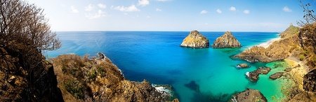
In 1942, with the Second World War, the archipelago became a federal territory, whose acronym was FN, and started to serve as an advanced war base; but it returned to the Pernambuco administration four and a half decades later, in 1988. Currently Fernando de Noronha is a state district of Pernambuco, and is managed by an administrator-general appointed by the state government. After a campaign led by environmentalist José Truda Palazzo Júnior, on October 14, 1988, most of the archipelago was declared a National Park, with approximately 11,270 ha, for the protection of endemic species there and the area of concentration of spinner dolphins (Stenella longirostris), which meet daily in the Bay of Dolphins - the most regular place of observation of the species in the whole planet. In 2001 UNESCO declared Fernando de Noronha a Natural Heritage of Humanity. The islands of this archipelago are the visible parts of a submerged mountain range. Fernando de Noronha is composed of 21 islands, islets and rocks of volcanic origin, and has a total area of 26 km². The main island comprises 91% of the total area of the archipelago, with an area of 17 km2, 10 km long and 3.5 km wide at its maximum point. The base of this huge volcanic formation is about 4,000 meters below sea level. The central plateau of the main island is called "Quixaba". The United Nations Environment Program (UNEP) lists 15 possible plant species endemic to the archipelago. The United Nations Environment Program (UNEP) lists 15 possible plant species endemic to the archipelago. The islands have two endemic birds - Noronha Elaenia and Noronha Vireo. Both are present on the main island.
Although protected by the designation of a national park, much of its terrestrial ecosystem is destroyed. A survey carried out in 2007 by the Ministry of the Environment showed that the island's natural resources were already being depleted and that tourism, which continues to grow, has been very harmful to the environment, producing vast data and some irreversible, among them accumulation of garbage, slums, lack of water, social inequality and loss of habitat for endemic species. The beaches of Fernando de Noronha are promoted for tourism and recreational diving. Due to the South Equatorial Current, which pushes hot water from Africa to the island, diving at depths of 30 to 40 meters does not require a diving suit. Underwater visibility can reach up to 50 meters. The island's climate is tropical (As' type in the Köppen-Geiger climate classification, hot all year round, with an average annual temperature of 26 ° C and concentrated rains between February and July, with April being the wettest month (290 mm) The thermal amplitude is very small, characteristic of the Equator region, throughout the year the temperature of the sea water varies between 26 ° C and 28 ° C.
Ilha dos Currais Marine National Park
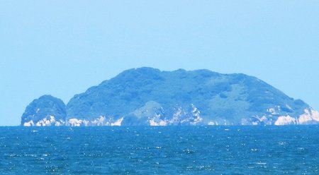
The Ilha dos Currais Marine National Park is a Brazilian protected area of the national park type. Created by federal law No. 12,829 of June 20, 2013, it is formed by a small archipelago 6.2 miles off the coast, in front of Praia de Leste, in the municipality of Pontal do Paraná, in Paraná. Formed by three small islands and some nearby reefs covering an area of 1359.69 hectares. The islands do not have a beach, they are constituted only by rocks and stones formations. More than 8,000 birds live on these islands, in addition to fish, which take shelter on the reefs near the islands. In addition to its ecological importance, the archipelago is widely used by small fishermen of the coast of Paraná, being one of the main fishing hubs in the state.
Abrolhos Marine National Park
Abrolhos is a coastal archipelago located in the Atlantic Ocean, about 65 kilometers from the southern coast of the Brazilian state of Bahia. It consists of five islands, thirty-six nautical miles off the coast of the municipality of Caravelas. The five islands of the archipelago are: Santa Bárbara Island (under the control of the Brazilian Navy, where the lighthouse is located and also the only inhabited one), Siriba Island, Redonda Island, Sueste Island and Guarita Island. Three of them are intangible areas (Redonda, Guarita and Sueste), that is, landing on these islands is prohibited. Only Siriba and Santa Bárbara Islands are open to visitation and in a fully programmed, monitored and supervised manner by ICMBio and the Brazilian Navy.
The islands are spread over a total area of 913 square kilometers, an area that belongs to the Abrolhos National Marine Park, controlled by the Chico Mendes Institute for Biodiversity Conservation (ICMBio) with support from the Brazilian Navy. The archipelago was the first area in Brazil that received the title of "National Marine Park", by decree No. 88.218, of April 6, 1983. The origin of its name comes from the Portuguese language, having first been recorded on several maps as a warning to navigators for frequent accidents and shipwrecks caused by the formation of corals and which made navigation difficult: "Abre Olhos (Open your eyes)". In this region, there is the famous season of humpback whales, which choose the warm waters of the Bahian sea for the reproduction and breastfeeding of young, and provide the practice of whale watching or whale watching tourism, being an important tourist destination of the kind in the world. considered the largest reproductive nursery of the species in the entire Western South Atlantic. A small number of southern right whales also started to return to Abrolhos after many years endangered.
Montanhas do Tumucumaque National Park
The Montanhas do Tumucumaque National Park is a Brazilian Conservation Unit with integral protection of nature located in the states of Amapá and Pará, with territory distributed by the municipalities of Almeirim, in Pará, and Calçoene, Laranjal do Jari, Oiapoque, Pedra Branca do Amapari and Serra do Navio, in Amapá. The park is limited to the north with French Guiana and the Republic of Suriname, being connected, through the French overseas territory of French Guiana, to the European Union. In this way, Tumucumaque Mountains integrates, along with the national parks of Serra do Divisor, Cabo Orange, Pico da Neblina and Monte Roraima, the set of National Parks bordering the Brazilian Amazon. With an area of 3 846 429.40 ha, Montanhas do Tumucumaque is the largest national park in Brazil and the largest in tropical forests in the world.
The park's territory covers an area of 38,464 km², slightly smaller than that of Switzerland. Tumucumaque is the largest national park in Brazil and also the largest rainforest park in the world. The park, which occupies 26.5% of the total area of the state of Amapá, is inserted in the region known as Escudo das Guianas, north of the Amazonian plain. The Brazilian portion of the Escudo das Guianas has an area of approximately 1 million km², distributed across the states of Amapá, Pará, Amazonas and Roraima. Tumucumaque Mountains, with a protected area covering almost 4% of the total of this region, contributes significantly to its preservation. The region in which the park is inserted has extreme biological importance, as it contains the portion of tropical forest that is considered the least impacted that exists, thus being one of the few places in the world where conservation and sustainable development strategies can be adopted without need to remedy impacts caused by previous inappropriate activities. The climate is hot and humid equatorial, with annual rainfall greater than 2500 mm, average annual temperatures oscillating between 25 and 30ºC. A dry season occurs between August and November, with a reduction in the rainfall index to less than 50 mm per month.
Monte Pascoal National Park
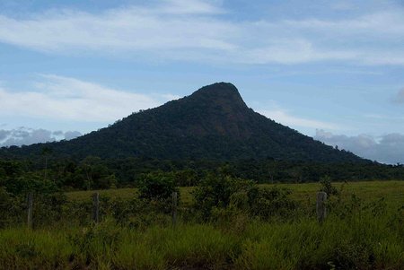
The Monte Pascoal National and Historical Park is one of the most important integral conservation units in southern Bahia, created in 1961. It's next to the cities of Porto Seguro and Prado. In this national park is located Mount Pascoal, which was the first portion of land spotted by Pedro Álvares Cabral in 1500. It has lands with groups of the Pataxó ethnicity, which also means that the park is managed by the Fundação Nacional do Índio (Funai) and also resident groups in the area. The presence of these indigenous groups in the park caused an impasse on how to conserve the area. The park's management plan is still being drafted.
The vegetation of the park is the dense lowland rain forest, with large trees, and in the coastal part are restingas and mangroves. It is a region of great rainfall, with 1,500 to 1,700 mm annually. The relief is flat, with the elevation of Mount Pascoal standing out in the landscape. The fauna of the park draws attention due to the presence of large predators such as the jaguar and cougar in addition to other large mammals, such as the South American-tapir, which are highly threatened in the forests of southern Bahia. The area of the park was demarcated where traditionally it was Pataxó territory, which since 1861 occupied the region. An impasse arises between indigenous leaders and Funai and conservationist interests. Approximately 8,000 ha has been ceded for the formation of indigenous land.
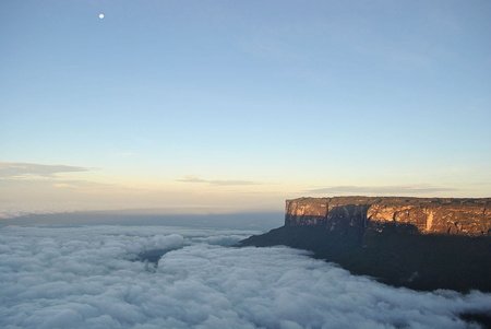
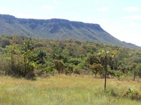
Monte Roraima National Park
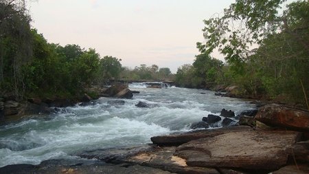
Monte Roraima National Park was created on June 28, 1989 by the then President of the Republic of Brazil José Sarney, through Decree nº 97.887. In the park are savannas, forests of altitude and rivers of strong current. Also located in the park are some of the oldest mountains on earth, notably Mount Roraima, in addition to the Raposa Serra do Sol Indigenous Land. The Monte Roraima National Park is located in the municipality of Uiramutã, in the state of Roraima. It has an area of 116,747.80 hectares. The park includes part of the Cotingo River basin, where plans were made for a hydroelectric plant. The area has high potential for mining, agriculture, livestock and ecotourism, which results in tension between the indigenous population and farmers and settlers.
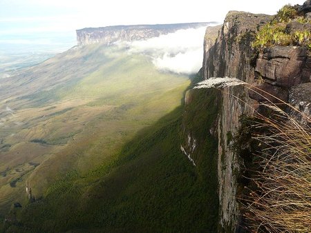
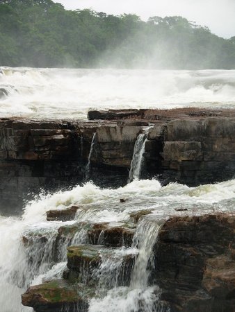
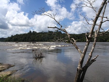
The park includes part of the Serra de Pacaraima, which separates Brazil from Venezuela and Guyana. It is named after Monte Roraima, the highest of the tepui mountains, with almost 3,000 meters of altitude, being one of the highest in the Pacaraima chain. The mountain has a flat top that contains a monument, the Marco de la Triplice Fronteira, the border of Venezuela, Guyana and Brazil. The altitudes in the park vary from 920 to 2780 meters. The mountains are generally flat and bordered by steep and partially denuded cliffs, which are surrounded by wide pediments cut by ravines that merge into the lower dissected reliefs of the Pacaraima mountain range. The Sol Mountains, to the southeast, have altitudes of up to 2,400 meters. The park contains the sources of the northernmost rivers that flow south in the basin of the Branco river. These include the Cotingo River, with its sources at the foot of Mount Roraima, the Panari River in the extreme north to the south of the Caburaí mountain range, the Maú River, which forms the border between Brazil and Guyana, and the Uailan River. The Cotingo and Maú rivers have continuous stretches of rapids and waterfalls, including the Garã Garã waterfall in Maú. The Monte Roraima National Park is in the Amazon biome. Temperatures range from 2 to 18 ° C with an average of 10 ° C. The average annual rainfall is 1,900 mm. The region has several landscapes that help to conserve biodiversity, although it lacks space. It contains an area of 9,900 hectares of savanna, 8.7% of the total area. This area includes forests and pastures. The forest includes plateau and mountainous ecosystems. There are several endemic species adapted to the severe mountain climate, where temperatures can vary from 4 to 25 ° C over a 24-hour period.
Nascentes do Lago Jari National Park
The Nascentes do Lago Jari National Park is a Brazilian national park located in Amazonas, close to the municipalities of Beruri, Manicoré and Tapauá. It was founded in 2008 and has 812 745.18 hectares. Like many parks in the Amazon region, it suffers from unregulated land tenure and illegal deforestation and mining. Still, much of the park is still covered with native vegetation. Is administred by ICMBio.
Nascentes do Rio Parnaíba National Park
The Nascentes do Rio Parnaíba National Park is a Brazilian national park created by Decree of July 16, 2002 and expanded by Decree on January 12, 2015, with an area of 749,848 ha. It is located on the border of the states of Piauí, Maranhão, Bahia and Tocantins. It aims to ensure the preservation of natural resources and biological diversity, as well as providing scientific research and the development of educational, recreational and ecological tourism activities. It is administered by the Chico Mendes Institute for Biodiversity Conservation (ICMBio). The Park is located at the divider of three large basins: the Parnaíba River Basin, the São Francisco River Basin and the Tocantins River Basin. The hydrographic network is, with numerous springs and water courses, especially the springs of the Água Quente River and Curriola River, which, when they come together, form the Parnaíba River (which functions as a border between Piauí and Maranhão). Also located in, there are the river springs of Uruçuí-Vermelho, Gurguéia, Riozinho, Parnaibinha, among others, which supply the Parnaíba River Basin.
The park's vegetation is complex and diversified, belonging to the Cerrado (savana) biome, with different aspects, with trees that can reach 12 meters. Some of the species found are: pequi, golden trumpet tree, blackberry, mangaba and Bahia rosewood. The fauna has more than 60 species of mammals and approximately 211 species of birds. Among the rare and / or endangered species, the peasant deer, the ocelot, the jaguar, the otter, and the giant armadillo stand out. Among the birdlife representatives, there are the hawk-eagle, the macaw and the white-tailed hummingbird. The climate of the region is of the semi-humid Tropical type, with two well-defined seasons: the dry period (between May and November) and the other rainy (between December and April). From August to October, the most critical period occurs in relation to drought and fires. The annual rainfall totals vary between 750 and 1400 mm, with an average annual temperature of 26 ° C. Due to the predominant wind in the dry period being in the east-west direction, the Unit's eastern limit is the most prone to being hit by fires. The relief of the park is composed of Chapadões Tropicais, with vast planing surfaces, with portions typical of the relief of the sedimentary plateau of the São Francisco, of the sedimentary depression of the mid-north and of the plateaus of the São Francisco - Tocantins. Two major segments are distinguished in the park: a higher part, Chapada das Mangabeiras; and a lower one, Serra da Tabatinga.
Pacaás Novos National Park
The Pacaás Novos National Park was created by Federal Decree No. 84,019 in 1979. The accelerated occupation of the new agricultural frontier represented by the state of Rondônia, which began in the 1970s, made it essential to protect part of its natural resources. It is located in the central region of the state, extending through the municipalities of Guajará-Mirim, Nova Mamoré, Campo Novo de Rondônia, São Miguel do Guaporé, Monte Negro, Governor Jorge Teixeira, Alvorada d'Oeste and Mirante da Serra, on site where the Serra dos Pacaás Novos is developed. Access can be by land and river, although the precarious conditions of the BR-421 and BR-429 roads recommend that ICMBio be consulted before any visit. About two thirds of the Park coincides with areas occupied by the Uru-eu-wau-wau and Uru-pa-in indigenous nations.
The climate is hot and humid, of the equatorial type, with two to three dry months. The rainy season runs from November to March, when 70% of the annual rainfall is concentrated, which ranges from 2,000 to 2,500 mm. Winter (June, July, August) corresponds to the dry season. The average temperature is 25 ºC. The vegetation is a large mosaic. In the higher parts, extensive areas of cerrado are observed and, in the valleys and slopes, areas of forest formations typically Amazonian. There are also large areas of contact between the cerrado and the forest. The Park brings together a drainage network that has a dendritic and, locally, radial pattern. Rivers and streams that are born in the Pacaás Novos and Uopiane Mountains, form rapids and waterfalls of great beauty, strongly influenced by lithological control. This network encompasses the three main hydrographic basins in the state: Guaporé, Mamoré and Madeira.
Pantanal Matogrossense National Park
The Pantanal Matogrossense National Park is a Brazilian national park located between the states of Mato Grosso do Sul and Mato Grosso. With 135 606.71 ha, it aims to protect and preserve part of the Pantanal biome, as well as its biodiversity, maintaining the dynamic balance and ecological integrity of the ecosystems contained in the Park. It is administered by the Chico Mendes Institute for Biodiversity Conservation (ICMBio). Considered by UNESCO as a World Natural Heritage Site.
The creation of the National Park met the demands of society and the scientific community, for the creation of a conservation unit that would protect significant samples of the Pantanal ecosystem. The National Park incorporated the former Caracará Biological Reserve, created in the 70s, added to an old cattle farm that had its area permanently flooded as a result of environmental changes in the wetland after the great flood of 1974. In the 1980s the park served as the base of operations in the fight against alligator hunters. The park had its Management Plan approved in 2004. It covers parts of the municipalities of Corumbá, in Mato Grosso do Sul, and Cáceres and Poconé, in Mato Grosso. It is next to the Guirá State Park, to the north. The Cuiabá River runs through the park, which is part of the Pantanal Biosphere Reserve and also includes the national parks of Chapada dos Guimarães, Emas and Serra da Bodoquena, in addition to the state parks of Serra de Santa Bárbara, Nascentes do Rio Taquari and Pantanal of the Negro River. The Pantanal as a whole is characterized by an enormous accumulation surface, with a very flat topography and often subject to flooding, being the drainage network commanded by the Paraguay River. The Pantanal Matogrossense is one of the most productive ecosystems in Brazil. Environmental conditions favor the establishment of a wide variety of fauna. You can observe terrestrial fauna (capybara, maned wolf, marsh deer, ocelot, otter, agouti, south-american-tapir, jaguar, puma, pampas deer, great rhea, etc...), birds (heron, macaw, toucan, jabiru) and reptiles (snakes, alligators), etc.
Pau Brasil National Park
Pau Brasil National Park is one of the most important integral conservation units in southern Bahia. The park was created on April 20, 1999, a year before the 500 years of Europeans' arrival in Brazil. It was expanded in 2010, when its area reached just under 19 thousand hectares, and is part of the Atlantic Forest biome. It is located entirely in the municipality of Porto Seguro.
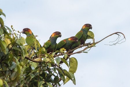
The park has several attractions within easy reach even for some people with some difficulty in locomotion, such as the Tapir Trail, quite flat, the Ibirapitanga Trail, suspended, and the Sede Lookout. There are also medium difficulty trails such as the Vera Cruz Trail, where tourists can bathe in Barra River, and the Patatiba Trail, which culminates in the Jacuba Waterfall, where you can also swim. It is also possible to observe birds: more than 200 species have already been spotted in the park, including the harpy, extinct in other regions, but capable of reproducing in this fragment of ombrophilous forest. According to ICMBio, the park can be visited throughout the year, between 8:30 am and 4:00 pm, with prior appointment.
Well, we finished the part 3. From Jericoacoara to Pau Brasil, we saw amazing parks and places. Sorry because the alphabetical order was not fulfilled on this blog. The Wikipedia page that I access the parks is in Portuguese, and because the order there is being considered with M because of the "Marine" thing in three parks, the literal translation would not match the initial planning. I'll make sure to not do this again! And the part 4? Maybe will be the last one, or we will have a part 5. I need to make some calculations for have sure. What surprises we will see? Just seeing for discover! Liked? So stay open to the news here on my blog! Thank you very much for that minute of attention, and until the next post!
The name of the state was taken from Mount Roraima, whose name comes from the Pemon words "roroi" ("cyan") and "ma" ("large"). One of the main archaeological sites is the Pedra Pintada, Roraima, with ancient rock art and engravings.
Lençóis Maranhenses looks really drawn. So gorgeous!