Geography of the Netherlands
Last updated: Monday April 5th, 2021
Report this blog
The Netherlands has been an influential nation for hundreds of years. Unfortunately for them, they've been cursed by their annoying but impressive geography, which has haunted them and has spared thousands of lives throughout its history.
Intro
Despite the Netherlands' land consisting of a fraction of which existed just fifty years ago, it still has some overseas territories, most notably Bonaire, Curaçao, Saba, Sint Eustatius, and Sint Maarten (not to be confused by France's overseas territory known as Saint Martin, which covers half of the island Sint Maarten is located on.)
The country follows a multiple-nation
setup similar to that of the United Kingdom. These are known as landen and the Netherlands consists of four of them, three of which are overseas territories:
- Mainland Netherlands
- Aruba
- Curaçao
- Sint Maarten
The map down below pictures a few of the Netherlands' overseas territories:

Circled in green are known as special municipalities of the Netherlands (Bonaire, Sint Eustatius, & Saba)
Going back to the administrative divisions of the Netherlands, the country contains 12 provinces (provincies) and a whopping 355 municipalities (gemeenten).
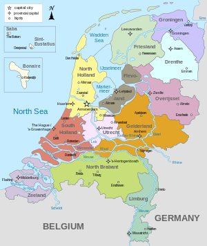
Dutch provinces
Languages
The languages of the Netherlands may seem unmistakably Dutch at first glance, but it's actually more complicated than that.
There are 453,000 people in the Netherlands who speak West Frisian, mainly in the Friesland province. English is the official language in Saba and the BES islands (more Dutch overseas territories).
Papiamento is spoken in the special municipality of Bonaire. Dutch Low Saxon is spoken in many municipalities also, and Limburgish is spoken by ~825,000 people in the province of Limburg.
Despite there being so many languages, many of these languages have origins from Dutch.
The geographic coordinates of the centre of the Netherlands are 52°22′N 4°53′E.
The total area of the European Netherlands is 41,545 km² (16,041 sq. mi), the land area is 33,481 km² (12,927 sq. mi), and the water area is 8,064 km² (3,114 sq. mi). The country borders Belgium with a border length of 450 km (280 mi) and Germany with a border length of 577 km (359 mi). In total, the Dutch border length in Europe is 1,027 km (638 mi). However, this excludes the very short Sint Maarten & Saint Martin border with France. It also borders the Atlantic Ocean, which flows into the smaller North Sea. The coastline is 451 km (280 mi) long.
The Netherlands has cool summers with mild winters, while the overseas territories have tropical temperatures.
The lowest point is Zuidplaspolder, which is 7 meters (23 ft) below sea level. The highest point on the mainland is Vaalserberg, which is 322 meters (1,059 ft) above sea level, while the highest point when including overseas territories is Mount Scenery (on Saba), which is 887 meters (2,910 ft) above sea level.
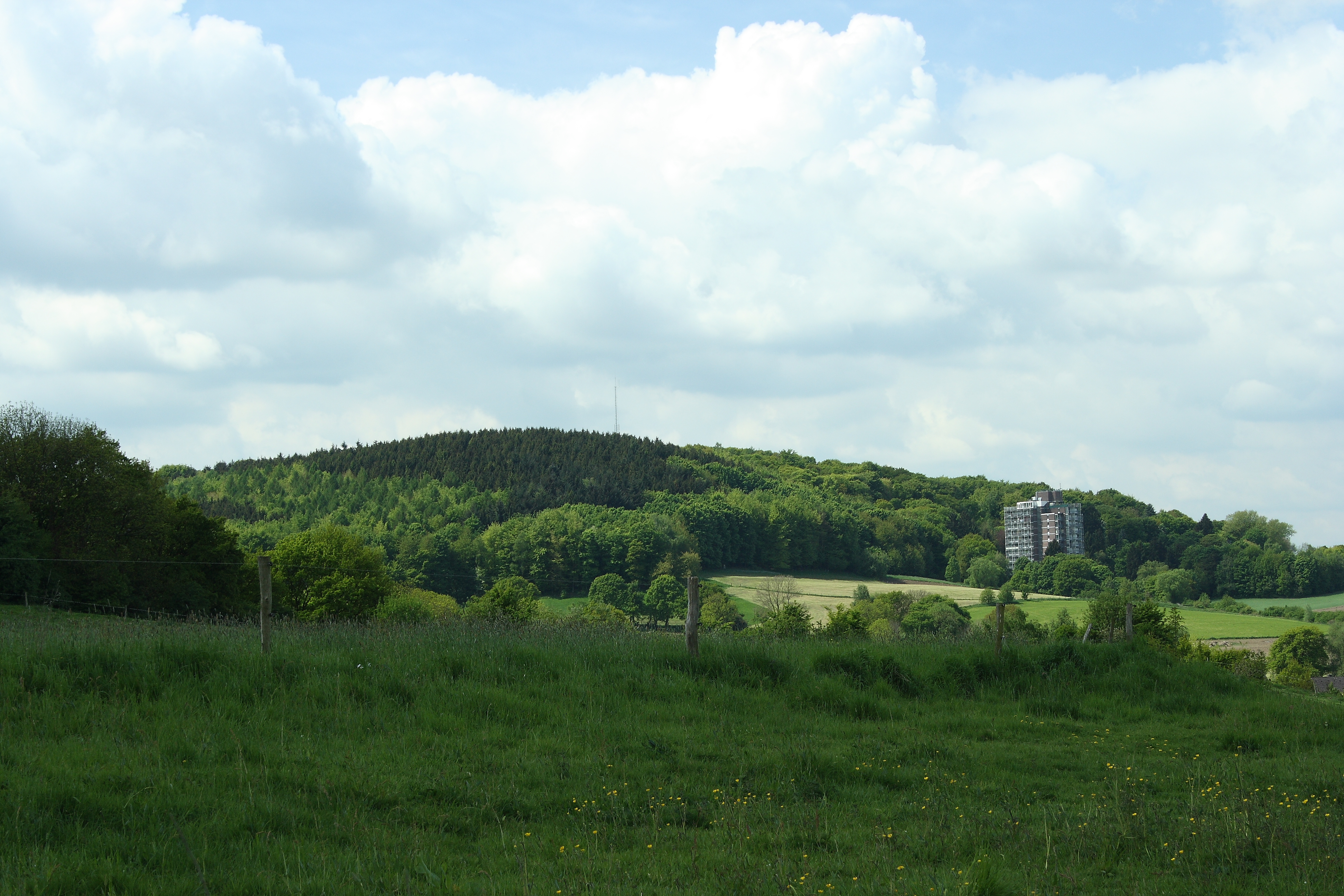
Vaalserberg, the highest point in the European Netherlands
Water
The longest river in the Netherlands is the Rhine River, which begins in Switzerland and flows through the Netherlands. The longest rivers are as follows:
- Rhine - 1229.53 km (764 mi)
- Meuse - 925.37 km (575 mi)
- Eems - 362.1 km (225 mi)
Because of the Netherlands having a long coastline and many rivers, it houses the busiest port in all of Europe - located in Rotterdam, Netherlands.

The Rotterdam port at night
The Netherlands also has many lakes, with the biggest being the IJsselmeer Lake. Down below is a list of the longest Dutch lakes.
- IJsselmeer - 683.49 km² (424.7 mi²)
- Markermeer - 435.01 km² (270.3 mi²)
- Veluwemeer - 18.64 km² (11.58 mi²)
Landscape
Generally seaside marsh and the land recovered from ocean (polders); low and level; about portion of the outside of the Netherlands is under 1 m above ocean level, and enormous pieces of it (24%) are really underneath ocean level.
25.08% of the land in the [European] Netherlands is arable, crops take up 0.88% of its land, and 74.04% of it is used for other purposes.
The country's landscape can be divided into two. The flat and low lands lie up North and West while higher areas are in the East and South of the country.
Demographics
As of April 30th, 2020, the Dutch population is 17,418,465 (64th place worldwide), with a population density of 421 people per square kilometre (16th place worldwide).
The Dutch population was 5.1 million in 1900 and 10.0 million in 1950 - meaning it had doubled in a span of half a century. This boost ratio slowed down a bit, but the amount increased stayed constant, as the population increased to 15.9 million people in 2000, ~17 million less people than the current Dutch population.
Down below is a map of the Netherlands showing the population density in each province.

The growth rate is 0.39% (189th place), and the life expectancy is 79.55 years (35th place), with women having a life expectancy of 82.30 years and men with 76.94 years. 17.4% of the population is aged 0-14 years, 67.7% is aged between 15-64 years, and 65 and olders take up 14.9% of the population.
79.3% of the people in the Netherlands are Dutch, 4.9% are Indos, 2.4% are Turks, 2.2% are Moroccans, 2.1% are Surinamese, 0.9% are Carribeans, 0.3% are Chinese, 0.3% are Iraqis, and 3.9% fall under the other
category.
The largest cities in the Netherlands are as follows:
- Amsterdam - 1,114,745
- Rotterdam - 829,875
- 's-Gravenhage - 803,835
- Utrecht - 382,520
- Eindhoven - 298,795
- Leiden - 270,225
- Dordrecht - 221,235
- Groningen - 213,705
- Tilburg - 213,055
- Haarlem - 204,570

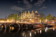
Amsterdam, the most populous city
Tourism
Unlike many countries, tourism does not play a big role in the country's economy. Most tourists overall visit Amsterdam, the capital city. It however accounts for 5.4% of the country's GDP and gives 9.6% of the population jobs.
The total number of tourists in 2017 was 17,924,000, 13% more than in 2016 (15,829,000)
Some of the tourism goes into seeing the country's fascinating canals such as the Jordaan Canal, and visitng some historical sites such as Rijksmuseum in Amsterdam.
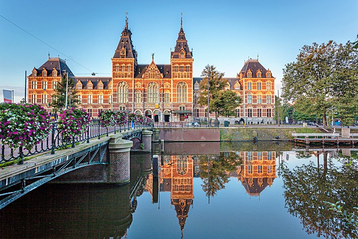
Rijksmuseum, a historical site in Amsterdam
Back to Top
Thanks for reading!