Featured Quizzes
User Quizzes
Create Quiz
Data and Charts
Badges and Games
About JetPunk
JetPunk Shop
Dark Mode
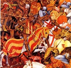
Countries of Iberia in History with a Map
Can you name the countries which had territory on the Iberian Peninsula in the selected six years?
Map sources in the comments (Warning contains spoilers)
Rate:
Featured Quiz
Last updated: July 30, 2023
You have not attempted this quiz yet.
More quiz info >>
| First submitted | November 21, 2020 |
| Times taken | 27,878 |
| Average score | 51.6% |
| Rating | 4.74 |
8:00
Enter country here
0
/ 31 guessed
Time Used
00:00
Best Time
00:00
The quiz is paused. You have remaining.
Scoring
You scored / = %
This beats or equals
% of test takers
also scored 100%
The average score is
Your high score is
Your fastest time is
Keep scrolling down for answers and more stats ...
|
|
|
||||||||||||||||||||||||||||||||||||||||||||||||||||||||||||||||||||||||||||||||||
New and Popular
Save Your Progress
Historical Map Quizzes
Quiz series by Nathaniel
...
Copyright H Brothers Inc, 2008–2024
Contact Us | Go To Top | View Mobile Site
100
418
750
1000
1400:
Crown of Aragon
Crown of Castile
Duchy of Gascony, Emirate of Granada and Kingdom of Navarre
I thought it was referring to the moment when the territory got the shape shown on the map.
But actually, that would have meant at least 2 countries had the same dates: the one which gained possessions and the one which lost them