Featured Quizzes
User Quizzes
Create Quiz
Data and Charts
Badges and Games
About JetPunk
JetPunk Shop
Random Quiz
Dark Mode
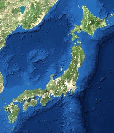
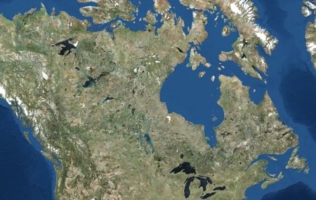
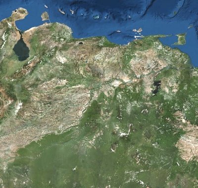
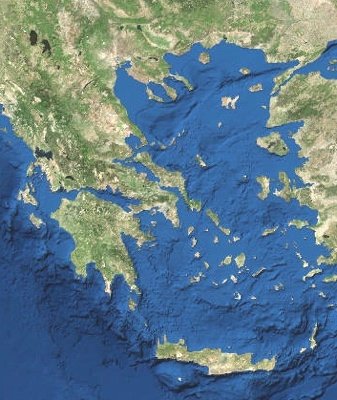
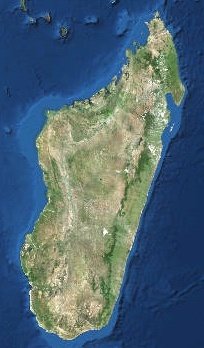
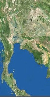
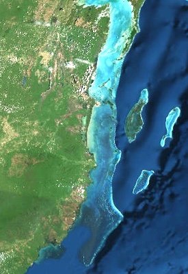
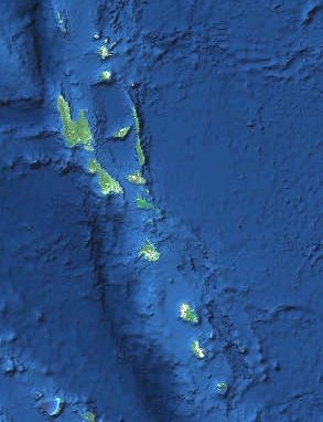
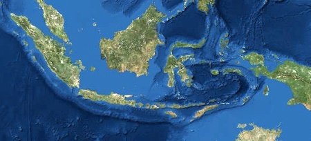
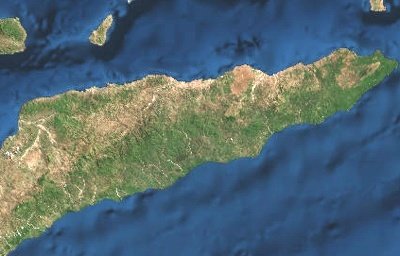
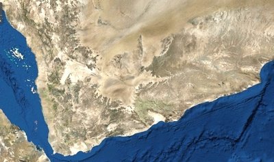
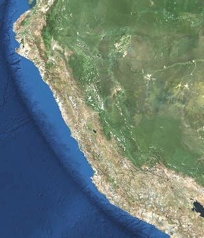
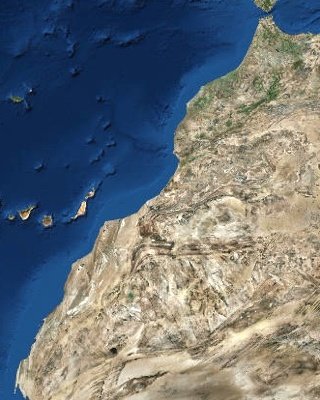
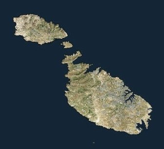
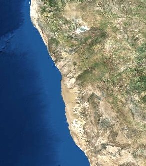
Countries by Satellite Image #5
Guess the countries that are pictured in these satellite images.
All images from the Landsat satellite
Dear nitpickers: If multiple countries appear, guess the one that has a greater percentage of the image
Rate:
Featured Quiz
Last updated: April 2, 2018
You have not attempted this quiz yet.
More quiz info >>
| First submitted | June 20, 2017 |
| Times taken | 52,968 |
| Average score | 68.8% |
| Rating | 4.71 |
4:00
Enter answer here
0
/ 16 guessed
Time Used
00:00
Best Time
00:00
The quiz is paused. You have remaining.
Scoring
You scored / = %
This beats or equals
% of test takers
also scored 100%
The average score is
Your high score is
Your fastest time is
Keep scrolling down for answers and more stats ...

New and Popular
Save Your Progress
Countries by Satellite Image
Quiz series by Quizmaster
Copyright H Brothers Inc, 2008–2024
Contact Us | Go To Top | View Desktop Site
Nice quiz, I was struggling but just got Malta in the last few seconds, after trying possibly every other island country on Earth first...
Peru was a wild guess, but correct first time, and Belize was a gut feeling. For the island group, I just rattled off all that I could think of and got a hit at the fourth (fifth try).