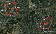
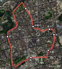
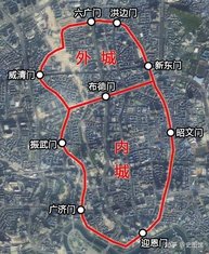
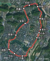
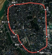
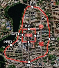
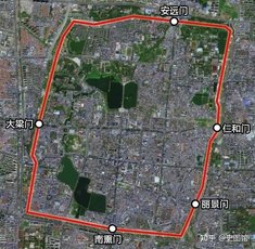
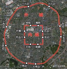
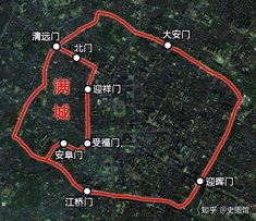
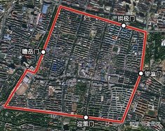
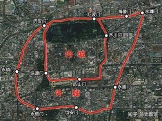
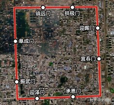
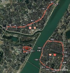
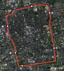
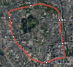
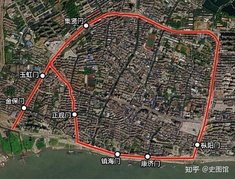
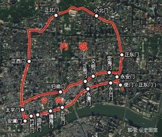
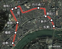
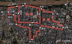
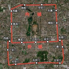
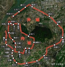
根据城墙地图写出清代各省城 Name the Qing Dynasty provincial cities based on map
请根据考证的城墙地图写出对应的清代省城(不完全严谨含所有省城)。
【重要提示 备填的省城包括:安庆、保定、北京、成都、长沙、迪化、福州、桂林、贵阳、广州、合肥、开封、杭州、吉林、济南、昆明、兰州、南昌、南京、齐齐哈尔、沈阳、苏州、台北、太原、武汉、乌里雅苏台、西安】
图片来源:知乎https://zhuanlan.zhihu.com/p/420592561
方向均为正上北下南,比例尺不完全一致。
注意时间,不鼓励穷举。
Rate:
Last updated: February 19, 2024
You have not attempted this quiz yet.
More quiz info >>
| First submitted | February 19, 2024 |
| Times taken | 36 |
| Average score | 40.7% | Report this quiz | Report |
6:00
Enter answer here
0
/ 27 guessed
Time Used
00:00
Best Time
00:00
The quiz is paused. You have remaining.
Scoring
You scored / = %
This beats or equals
% of test takers
also scored 100%
The average score is
Your high score is
Your fastest time is
Keep scrolling down for answers and more stats ...
|

|
|
|
|

|

|
|

|
|
|
|
|
|
|
|

|

|
|
|
|
|
|
|
|
|
|
1 Comments
Show comments >
Mly1014
+2
Level 40
Feb 20, 2024
民国城市地图大部分和城墙范围差不太多
New and Popular
Save Your Progress
中国人文地理 Chinese cultural geography
Quiz series by uoiu
...
Copyright H Brothers Inc, 2008–2024
Contact Us | Go To Top | View Mobile Site