thumbnail

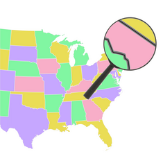
Closest States that Don't Share a Land Border

Some states are have land very close to each other, but do not share a land border. How many pairs of states can you name that are less than 100 miles (161 km) apart?
"Land border" includes a border over land, a river, or a manmade lake.
State abbreviations are acceptable. So, for example, if Alaska and Hawaii are less than 100 miles apart (they're not), then you can type "AKHI", "HIAK", "Alaska Hawaii", or "Hawaii Alaska" ("Alaska HI", "AK Hawaii" and similar formats are also acceptable).
Quiz by DelcoDaisy
Rate:
Last updated: February 4, 2024
You have not attempted this quiz yet.
First submittedFebruary 3, 2024
Times taken11
Average score53.7%
Report this quizReport
15:00
Enter pairs of states here:
0
 / 54 guessed
The quiz is paused. You have remaining.
Scoring
You scored / = %
This beats or equals % of test takers also scored 100%
The average score is
Your high score is
Your fastest time is
Keep scrolling down for answers and more stats ...
Distance
State Pair
Closest Locations
(mi)
(km)
1.64
2.64
New York
Rhode Island
Wicopesset Island
Napatree Point
11.5
18.5
Connecticut
New Jersey
Greenwich
Alpine
12.1
19.5
Maryland
New Jersey
Elkton
Finns Point
12.7
20.5
Maine
Massachusetts
Appledore Island, Isles of Shoals
Salisbury Beach
13.4
22.4
Michigan
Minnesota
Johns Island, Isle Royale
Pigeon Point
17.7
28.4
Pennsylvania
Virginia
SE of Inglesmith
NW of Reynolds Store
19.9
32.0
Maine
Vermont
East of PIttsburg, NH
Caanan
29.3
47.1
Delaware
Virginia
Selbyville
Assateague Island
29.9
48.1
Arkansas
Kentucky
East of Piggott
Madrid Bar
32.3
52.0
Illinois
Tennessee
Angelo Towhead
South of Hickman, KY
33.8
54.4
Alabama
Louisiana
Sandy Point, Dauphin Island
Chandeleur Islands
34.0
54.7
Colorado
Texas
CO-KS-OK tripoint
North of Stratford
34.0
54.7
Kansas
Texas
CO-KS-OK tripoint
North of Stratford
34.4
55.4
Arkansas
Kansas
AR-MO-OK tripoint
KS-MO-OK tripoint
36.2
58.3
Illinois
Michigan
East Side, Chicago
Michiana
36.7
59.0
New Hampshire
New York
East of Brattleboro, VT
East of Hoosick
39.0
62.8
New York
Ohio
East of Wattsburg, PA
Conneaut
40.0
64.4
Iowa
Kansas
IA-KS-MO tripoint
South of Northboro
40.7
65.4
Tennessee
West Virginia
NE of Laurel Bloomery
South of Berwind
42.3
68.1
North Carolina
West Virginia
NC-TN-VA tripoint
South of Berwind
44.5
71.7
South Carolina
Tennessee
GA-NC-SC tripoint
Clingmans Dome
44.7
72.0
Montana
Washington
ID-WA-Canada tripoint
East of Eastport, ID
46.5
74.9
Florida
Mississippi
West of Walnut Hill
NE of Agricola
46.9
75.5
New Hampshire
Rhode Island
Pelham
Cumberland
47.3
76.1
Connecticut
New Hampshire
Thompson
Mason
47.8
76.9
Connecticut
Vermont
Somers
MA-NH-VT tripoint
49.2
79.1
Louisiana
Oklahoma
AR-LA-TX tripoint
East of New Lake
Distance
State Pair
Closest Locations
(mi)
(km)
53.1
85.5
Kansas
New Mexico
West of Elkhart
CO-NM-OK tripoint
53.3
85.8
Connecticut
Pennsylvania
Greenwich
Matamoras
54.2
87.2
Kentucky
North Carolina
SE of Cranks
NE of Howard's Rock
55.9
90.0
Indiana
Wisconsin
Hammond
Pleasant Prairie
57.1
91.9
Arkansas
Illinois
West of Campbell, MO
SW of Willard
57.6
92.7
Minnesota
Nebraska
IA-MN-SD tripoint
North of Maskell
60.0
96.6
Rhode Island
Vermont
CT-MA-RI tripoint
MA-NH-VT tripoint
64.2
103.3
New Jersey
Virginia
Cape May Point
Assateague Island
65.5
105.4
North Dakota
Wyoming
MT-ND-SD tripoint
MT-SD-WY tripoint
65.6
105.5
Ohio
Virginia
East of Proctorville
KY-VA-WV tripoint
69.0
111.1
Missouri
Mississippi
South of Cardwell
AR-MS-TN tripoint
69.4
111.6
Maryland
Ohio
MD-PA-WV tripoint
West of Moundsville, WV
72.1
116.1
Alabama
North Carolina
SE of Higdon
GA-NC-TN tripoint
73.2
117.9
Massachusetts
New Jersey
Mount Washington
Mahwah
74.6
120.0
Illinois
Minnesota
East Dubuque
IA-MN-WI tripoint
75.6
121.7
Indiana
Tennessee
West of Uniontown, KY
South of Golden Pond, KY
77.1
124.0
Maine
Rhode Island
Cedar Island, Isles of Shoals
Cumberland
77.1
124.1
Massachusetts
Pennsylvania
Mount Washington
North of MIllrift
77.5
124.8
Indiana
Missouri
East of Ridgeway, IL
SE of Grand Tower, IL
78.3
126.0
Delaware
New York
Claymont
Tottenville, Staten Island
81.3
130.8
Florida
Louisiana
Perdido Key
Chandeleur Islands
89.7
144.3
Connecticut
Maine
Thompson
Cedar Island, Isles of Shoals
92.1
148.2
Montana
Oregon
West of Alta
East of Imnaha
93.9
151.1
Maryland
North Carolina
Assateague Island
Carova Beach
95.1
153.1
South Carolina
Virginia
SE of Tuxedo, NC
SE of Bruno
97.1
156.3
Florida
South Carolina
Ferdandina Beach
SW of Bloody Point
97.5
156.8
Maryland
New York
DE-MD-PA tripoint
Tottenville, Staten Island
Comments
No comments yet