Featured Quizzes
User Quizzes
Create Quiz
Data and Charts
Badges and Games
About JetPunk
JetPunk Shop
Dark Mode
Graphical Map of the U.S. Quiz
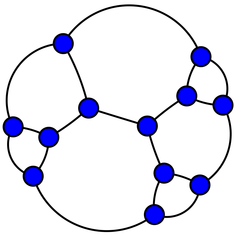
A graph is a mathematical structure that shows the connections between points, but does not include details like distance or direction. This graph is a map of the United States; each node represents one state, and a line between two nodes indicates that those two states share a border. Fill in the map by correctly guessing each highlighted state.
Dashed lines indicate water boundaries
Alaska and Hawaii are not included
If this map seems too difficult, I recommend starting with the Americas quiz, which has a much less complex map
Save time by using Keyboard Shortcuts
Rate:
Last updated: August 19, 2021
You have not attempted this quiz yet.
More quiz info >>
| First submitted | August 19, 2021 |
| Times taken | 50 |
| Average score | 72.9% | Report this quiz | Report |
9:00
0
guessed
48 remaining
The quiz is paused. You have remaining.
Scoring
You scored / = %
This beats or equals
% of test takers
also scored 100%
The average score is
Your high score is
Your fastest time is
Keep scrolling down for answers and more stats ...
Select State
Alabama
Arizona
Arkansas
California
Colorado
Connecticut
Delaware
Florida
Georgia
Idaho
Illinois
Indiana
Iowa
Kansas
Kentucky
Louisiana
Maine
Maryland
Massachusetts
Michigan
Minnesota
Mississippi
Missouri
Montana
Nebraska
Nevada
New Hampshire
New Jersey
New Mexcio
New York
North Carolina
North Dakota
Ohio
Oklahoma
Oregon
Pennsylvania
Rhode Island
South Carolina
South Dakota
Tennessee
Texas
Utah
Vermont
Virginia
Washington
West Virginia
Wisconsin
Wyoming
This State is:
Comments
No comments yet
New and Popular
Save Your Progress
Copyright H Brothers Inc, 2008–2024
Contact Us | Go To Top | View Mobile Site