Featured Quizzes
User Quizzes
Create Quiz
Data and Charts
Badges and Games
About JetPunk
JetPunk Shop
Dark Mode
Singapore Airlines Destinations on a Map
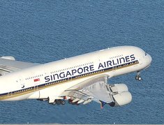
Singapore Airlines is Singapore's flag carrier, and possibly the most luxurious airline in the world. It also currently holds the record for the longest non-stop commercial flight. Can you guess all the places this airline flies to?
If you're looking for a challenge, try guessing the individual airports; IATA and ICAO codes are also both accepted (when not interfering with the full name of the city or airport)!
If you're looking for a challenge, try guessing the individual airports; IATA and ICAO codes are also both accepted (when not interfering with the full name of the city or airport)!
As you guess, the route lines will disappear. Remember to click to zoom in!
Currently available destinations only. Terminated or suspended flights are not included. Seasonal destinations are included
Source is flightconnections
If you liked this quiz, you can find the rest of the series here!
Rate:
Last updated: October 16, 2020
You have not attempted this quiz yet.
More quiz info >>
| First submitted | October 16, 2020 |
| Times taken | 2,085 |
| Average score | 80.6% |
| Rating | 5.00 | Report this quiz | Report |
8:00
Enter answer here
0
/ 62 guessed
Time Used
00:00
Best Time
00:00
The quiz is paused. You have remaining.
Scoring
You scored / = %
This beats or equals
% of test takers
also scored 100%
The average score is
Your high score is
Your fastest time is
Keep scrolling down for answers and more stats ...
|
|
|
|
||||||||||||||||||||||||||||||||||||||||||||||||||||||||||||||||||||||
New and Popular
Save Your Progress
Crem's Airlines Destinations on a Map
Quiz series by Crem
Copyright H Brothers Inc, 2008–2024
Contact Us | Go To Top | View Mobile Site
I'll look into the two carriers you mentioned!
Long answer: I create a map in Cartopy with the equirectangular projection (which is the closest to the default JetPunk map projection) and add the lines with a geodetic transformation so that they connect any two points using the shortest path on a globe, not on a flat map. Cartopy exports this to an SVG file, which I then clean up (remove colours, simplify the lines' paths so that they are curves, and so on). In the meantime I use JetPunk's Place Dots on a Map tool to make an SVG with the airports' coordinates. I then combine the two SVGs (which is actually not that easy, since the JetPunk map projection is not exactly equirectangular). For this map in particular, I also had to cut the JetPunk-made SVG to have it centered on Singapore.
Hope that answers your question! :)
Guangzhou and Moscow are suspended.
Madrid is terminated.
Cairns, Darwin, Vancouver, Chennai, Kochi, Pune, and Kathmandu had been reopened.
Medan, Penang and Phuket are missing.
Some new routes are Phnom Penh, Siem Reap, Chengdu, Chongqing, Shenzhen, Xiamen, Cebu, Davao, Newark and Da Nang.