thumbnail

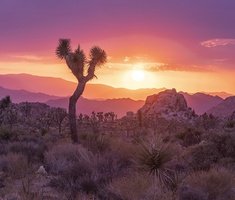
Wilderness Areas of California on a Map

With the help of a map, can you guess all 154 federally designated wilderness areas in the state of California?
source: https://umontana.maps.arcgis.com/apps/webappviewer/index.html?id=a415bca07f0a4bee9f0e894b0db5c3b6
Quiz by Werifesteria
Rate:
Last updated: February 20, 2022
You have not attempted this quiz yet.
First submittedJanuary 8, 2022
Times taken135
Average score7.1%
Report this quizReport
20:00
Enter answer here
0
 / 169 guessed
The quiz is paused. You have remaining.
Scoring
You scored / = %
This beats or equals % of test takers also scored 100%
The average score is
Your high score is
Your fastest time is
Keep scrolling down for answers and more stats ...
 
Bureau of Land Management
Agua Tibia
Argus Range
Avawatz Mountains
Beauty Mountain
Big Maria Mountains
Bigelow Cholla Garden
Bighorn Mountain
Black Mountain
Bright Star
Bristol Mountains
Buzzards Peak
Cache Creek
Cadiz Dunes
Cahuilla Mountain
Carrizo Gorge
Cedar Roughs
Chemehuevi Mountains
Chimney Peak
Chuckwalla Mountains
Cleghorn Lakes
Clipper Mountain
Coso Range
Coyote Mountains
Darwin Falls
Dead Mountains
Domeland
El Paso Mountains
Elkhorn Ridge
Fish Creek Mountains
Funeral Mountains
Golden Valley
Granite Mountain
Grass Valley
Great Falls Basin
Hollow Hills
Ibex
Indian Pass
Inyo Mountains
Ishi
Jacumba
Kelso Dunes
Kiavah
King Range
Kingston Range
Little Chuckwalla Mountains
Little Picacho
Machesna Mountain
Malpais Mesa
Manly Peak
Rocks and Islands
Mecca Hills
Mesquite
Milpitas Wash
Newberry Mountains
Nopah Range
North Algodones Dunes
North Mesquite Mountains
Old Woman Mountains
Orocopia Mountains
Otay Mountain
Owens Peak
Pahrump Valley
Palen-McCoy
Palo Verde Mountains
Picacho Peak
Pinto Mountains
Piper Mountain
Piute Mountains
Resting Spring Range
Rice Valley
Riverside Mountains
Rodman Mountains
Sacatar Trail
Saddle Peak Hills
San Gorgonio
Santa Lucia
Santa Rosa
Sawtooth Mountains
Sheephole Valley
Snow Mountain
Soda Mountains
South Fork Eel River
South Nopah Range
Stateline
Stepladder Mountains
Surprise Canyon
Sylvania Mountains
Trilobite
Turtle Mountains
Ventana
Whipple Mountains
White Mountains
Yolla Bolly–Middle Eel
Yuki
Fish and Wildlife Service
Farallon
Havasu
Imperial Refuge
National Park Service
Ansel Adams
Death Valley
Hain
John Krebs
Joshua Tree
Lassen Volcanic
Lava Beds
Mojave
Phillip Burton
Sequoia-Kings Canyon
Yosemite
U.S. Forest Service
Agua Tibia
Ansel Adams
Bighorn Mountain
Bucks Lake
Caribou
Carson-Iceberg
Castle Crags
Chanchelulla
Chumash
Cucamonga
Desolation
Dick Smith
Dinkey Lakes
Domeland
Emigrant
Garcia
Golden Trout
Granite Chief
Hauser
Hoover
Inyo Mountains
Ishi
Jennie Lakes
John Muir
Kaiser
Kiavah
Machesna Mountain
Magic Mountain
Matilija
Mokelumne
Monarch
Mount Lassic
Mt. Shasta
North Fork
Owens River Headwaters
Pine Creek
Pleasant View Ridge
Marble Mountain
Red Buttes
Russian
San Gabriel
San Gorgonio
San Jacinto
San Mateo Canyon
San Rafael
Sanhedrin
Santa Lucia
Santa Rosa
Sespe
Sheep Mountain
Silver Peak
Siskiyou
South Fork San Jacinto
South Sierra
South Warner
Thousand Lakes
Trinity Alps
Ventana
White Mountains
Yolla Bolly–Middle Eel
Yuki
+1
Level 79
Feb 27, 2022
Great Quiz. I look forward to seeing all Wilderness areas in the U.S. If I had the time, I'd do it. We desperately need more designated wilderness nationwide and worldwide.
+1
Level 65
Feb 28, 2022
I agree! Hope to edit this quiz a lot I also made one for the entire US, but there are probably a lot of imperfections. https://www.jetpunk.com/user-quizzes/1245682/all-wilderness-areas-of-the-united-states-on-a-map
+1
Level 79
Feb 27, 2022
You might consider adding California State Wilderness areas to this. http://www.150.parks.ca.gov/?page_id=27567
+1
Level 65
Feb 28, 2022
good idea