Featured Quizzes
User Quizzes
Create Quiz
Data and Charts
Badges and Games
About JetPunk
JetPunk Shop
Dark Mode
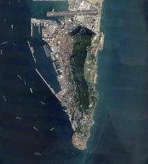
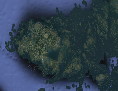
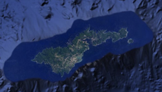
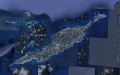
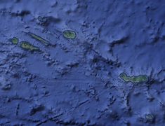
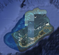
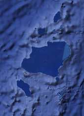
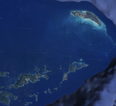
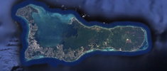
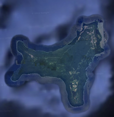
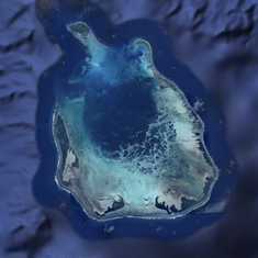
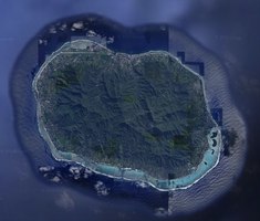
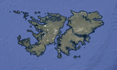
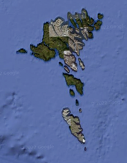
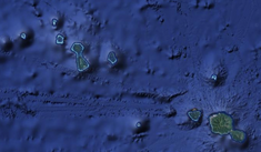
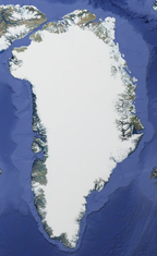
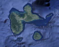
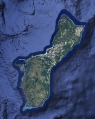
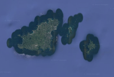
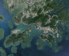
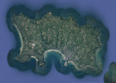
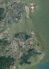
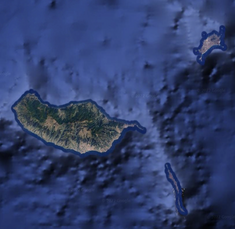
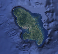
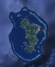
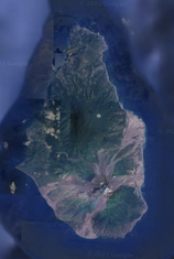
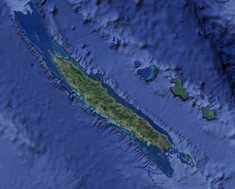
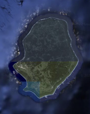
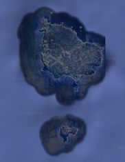
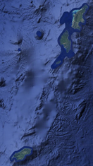
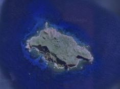
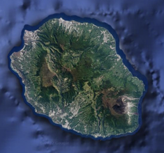
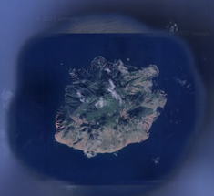
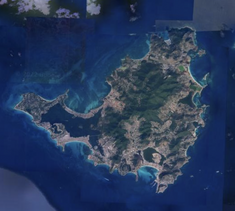
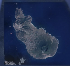
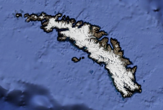
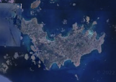
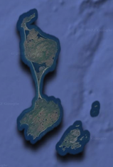
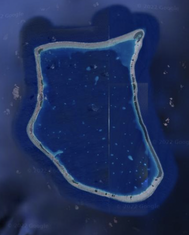
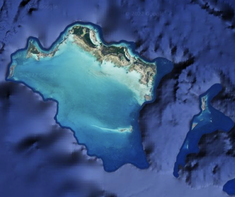
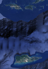
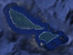
Territories By Satellite Image
Identify the territories by their satellite image.
Includes territories, overseas regions, overseas collectivities, and crown dependencies.
For territories with many islands, the main island(s) are pictured.
Rate:
Last updated: January 7, 2023
You have not attempted this quiz yet.
More quiz info >>
| First submitted | December 23, 2022 |
| Times taken | 9 |
| Average score | 27.3% | Report this quiz | Report |
3:30
Enter answer here
0
/ 44 guessed
Time Used
00:00
Best Time
00:00
The quiz is paused. You have remaining.
Scoring
You scored / = %
This beats or equals
% of test takers
also scored 100%
The average score is
Your high score is
Your fastest time is
Keep scrolling down for answers and more stats ...
|
|
|
|
|
|
|
|
|
|
|
|
|
|
|
|
|
|
|
|

|
|
|
|
|
|
|
|
|
|
|
|

|
|
|
|
|
|
|
|
|
|
|
|
No comments yet
New and Popular
Save Your Progress
Copyright H Brothers Inc, 2008–2024
Contact Us | Go To Top | View Mobile Site