Featured Quizzes
User Quizzes
Create Quiz
Data and Charts
Badges and Games
About JetPunk
JetPunk Shop
Dark Mode
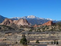
US Elevation Ladder from East to West
Each of these hills/mountains is higher than all US points east of it. For each elevation, name the high point
This was less a strict attempt at finding the easternmost high points using, and more an excuse to play around with Openstreetmap. May not be completely accurate in Maine
There are multiple peaks with the same name in this list
Includes subpeaks, given that there is no prominence requirements to be on this list. Subpeaks are given parenthesis.
Rate:
Last updated: July 20, 2023
You have not attempted this quiz yet.
More quiz info >>
| First submitted | July 20, 2023 |
| Times taken | 9 |
| Average score | 25.6% | Report this quiz | Report |
10:00
Enter answer here
0
/ 43 guessed
Time Used
00:00
Best Time
00:00
The quiz is paused. You have remaining.
Scoring
You scored / = %
This beats or equals
% of test takers
also scored 100%
The average score is
Your high score is
Your fastest time is
Keep scrolling down for answers and more stats ...
|
|
Kearsarge
+1
Level 68
Jul 20, 2023
As I said above, this was just an excuse to screw around with Openstreetmap for an hour or two. This is about as unscientific a quiz as imaginable, and while I am pretty certain on anything in NH and westward, everything to the east of Mars Hill was determined manually by eyeballing elevations and comparing coordinates of locations I thought were likely higher. If I really wanted to be completely accurate here. I would have grabbed a bunch of heightmaps of eastern Maine, fed them into QGIS, and then tried to create something that would determine a series of points that were higher than anything east of it. I did not do that, so there might be some errors here.
New and Popular
Save Your Progress
Copyright H Brothers Inc, 2008–2024
Contact Us | Go To Top | View Mobile Site