The Countries Iceberg - Part V
First published: Monday January 15th, 2024
Report this blog
By FreeStater and Nickelz.
Once again, welcome back to the Countries Iceberg.

In today's blog we will cover tiers 9 and 10.
After a short hiatus, we are back and ready for action. This will be the last segment to contain any current sovereign states in it. Therefore, this will be the extent of knowledge for probably about 95% of JetPunkers. We will be covering some very obscure countries and world regions, and some, even we didn't know. Most will not be able to locate these entries on a map.
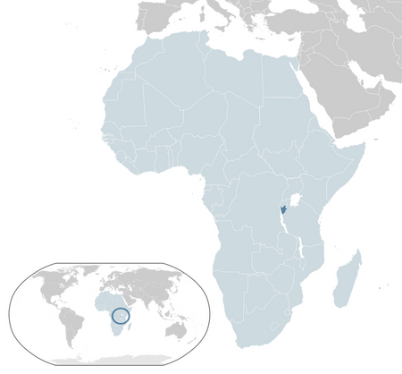
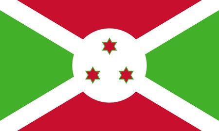
Tier 9 - Republic of Burundi
Burundi
(boo-roon-dee)
Burundi is a densely populated and landlocked country located in the Great Rift Valley. It is also the poorest country in the world by GDP per capita. In this surprisingly coastline-abundant landlocked nation that is home to a notorious man-eating crocodile, jogging without permission from the government is strictly prohibited as a prevention method for political subversion. Despite its characteristics, Burundi is surprisingly progressive when it comes to women's rights—it's the only country in the world where the average woman makes more money than the average man.
Capital: Gitega
Burkina Faso
(burr-keen-uh-FAH-so)
Burkina Faso is a landlocked country located in West Africa. Burkina Faso is the hottest country in the world on average, so you think it'd be quite attractive, eh? Wrong. Burkina Faso is known for constant political turmoil and war, as well as crushing poverty, and has recently been involved diplomatically with a coup in Niger. People from Burkina Faso are called Burkinabè, which is pretty cool, but not as cool as the country's old name—Upper Volta.
Capital: Ouagadougou


Guinea
(ghin-nee)
It's not a rodent, it's a country that's located in West Africa. A majority Muslim nation (90%), Guinea is known for its high production of bauxite and also for an exceedingly corrupt government; in fact, there were no democratic elections until 2010. In 2021, however, a military coup overthrew the president, and the junta remains in power. Situated on the western coast of Africa, Guinea is a country known for its rich natural resources and diverse cultural heritage. Also, it's larger than you think, even bigger than the United Kingdom.
Capital: Conakry


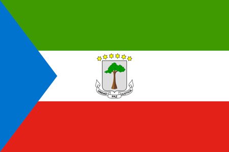
Equatorial Guinea
Equatorial Guinea is a small country located in Central Africa. It is unique in that its capital is situated on an island off the coast of the continent, however a new capital on the mainland, Ciudad de la Paz, is currently under construction. Equatorial Guinea is infamous for its extremely corrupt government, suspiciously high GDP per capita, and even higher poverty rate. Its high GDP per capita can be attributed to high oil sales as the least populous and second smallest member of OPEC. It is also the only sovereign state on the African continent with Spanish as an official language.
Capital: Malabo

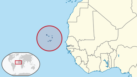
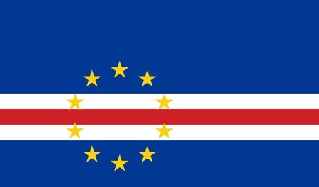
Cape Verde
(caype-vurd)
Cape Verde, officially known as Cabo Verde, is an archipelago situated off the coast of West Africa in the Atlantic Ocean. It is composed of ten main islands and numerous smaller islets, all of which were completely uninhabited until the arrival of Portuguese explorers in the 15th century. Cape Verdean culture is a vibrant fusion of African, European, and Brazilian influences, and the country is celebrated for its rich musical traditions. It generally ranks high on economic and social indicators compared to other African countries.
Capital: Praia
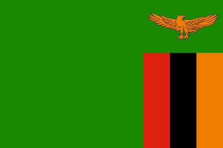
Zambia
(zahm-bee-uh)
Zambia is a landlocked nation located at the crossroads of South, East, and Central Africa. Formerly known as Northern Rhodesia and later becoming a crisis-struck socialist dictatorship, Zambia is known for possessing the shortest international border in the world, just barely touching Botswana in the south. Victoria Falls is located in the country, and is a major tourist attraction. Additionally, the musical genre Zamrock, a mix of traditional Zambian music and western guitar riffs, has gained somewhat of a cult following—why not give it a listen?
Capital: Lusaka

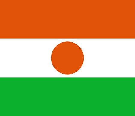
Niger
(nai-jer or nee-jer)
Niger, or sometimes the Niger, is a landlocked country located in West Africa along the Sahara Desert. Niger is known for its widespread political instability, hosting five coups since its independence in 1960, the currently ruling military junta, and crippling poverty. It was consistently the worst ranking country on the Human Development Index until recently. Agriculture is subsistence-based, given that most of the country is desert, and most calories comes from livestock. The country's economy is driven by gold, however, with it comprising 53.7% of all exports.
Capital: Niamey

Seychelles
(say-shells)
Seychelles is an archipelago of around 155 islands, located in the Indian Ocean off the coast of East Africa. It boasts one of the strongest economies in Africa, having grown rapidly with the advent of tourism, and is generally one of the better-off countries in Africa, with low corruption, progressive legislation, and a high HDI score. It is also the least populous and smallest country in Africa.
Capital: Victoria


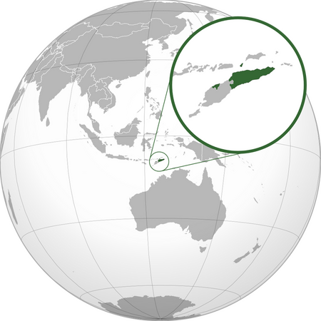
East Timor
(eest-tee-more)
East Timor, officially known as Timor-Leste, is a country located in Southeast Asia on the island of Timor, which it shares with Indonesia. It gained independence from Indonesia in just 2002, making it one of the newest countries, after a long war and related genocide. It is now one of the poorest and least developed nations in the world, relying mostly on foreign aid and oil to maintain itself. Despite this, it is ranked highly for freedom and government, so perhaps they're doing something right.
Capital: Dili

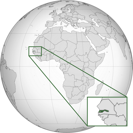
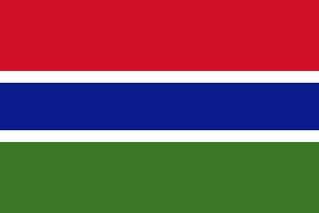
The Gambia
(thuh-gamm-bee-uh)
The Gambia, often just Gambia, is a small country in West Africa, the smallest by area on the mainland continent. It is majority Muslim, much like its neighbor Senegal, which almost entirely surrounds its path along the Gambia River, save for a small coast on the west. Like many other countries in the region, it is extremely poor, with just under half its population living in poverty, and it's also had coup attempts in 1981, 1994, and 2022, with only the 1994 one succeeding, and actually managing to usher in (mostly) free and fair elections.
Capital: Banjul
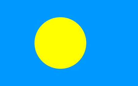
Palau
(puh-laao)
Palau is an archipelago nation located in the western Pacific Ocean. It gained its independence from U.S. trusteeship in 1994, and today is one of the smallest and least populated countries on Earth, only having about 20,000 residents. It is comprised of more than 340 islands, and is very concerned with the upkeep of its natural beauty, including establishing the world's first shark sanctuary. On the subject of natural beauty, the Rock Islands, a UNESCO World Heritage Site, feature hundreds of thin, hilly islets. Palau also has the world's least populated national capital, Ngerulmud, which has zero permanent residents. In fact, the entire state has only 318 people.
Capital: Ngerulmud

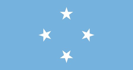
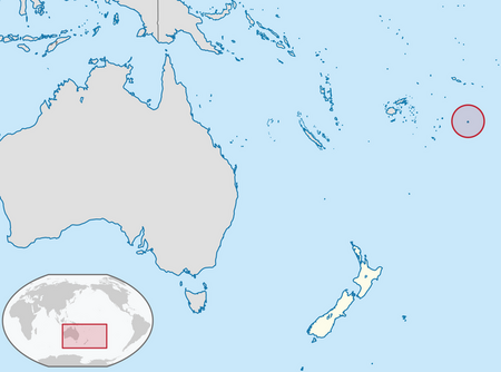
Federated States of Micronesia
(feh-duh-ray-tid-stayts-uhv-my-crow-nee-zhuh)
The Federated States of Micronesia, better known as just Micronesia, is a small country in the Pacific Ocean that is made up of four states: Yap, Chuuk, Kosrae, and Pohnpei, where the capital of Palikir is located. It is a chain of atolls and islands, around 600 in total, that nonetheless manages to hold a unique Micronesian culture, most famously the Rai stones found on Yap, large round plates used as money by the natives. Like Palau, it gained independence from United States trusteeship in 1986.
Capital: Palikir

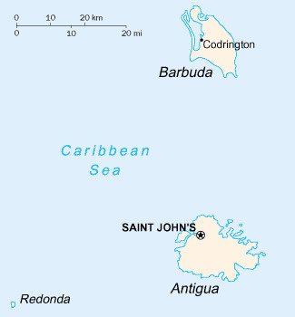
Antigua and Barbuda
(ahn-tee-gwuh-and-bahr-boo-da)
Antigua and Barbuda is a country located in the eastern Caribbean, consisting of two main islands, Antigua and Barbuda, as well as several other minor islands. It was first spotted by Christopher Columbus, who named it after the church of Santa Maria la Antigua (Saint Mary the Ancient). It was eventually colonized by the British and gained independence in 1981, though Charles III is still the official monarch. Economically, the country is highly dependent on tourism, which accounts for 80% of its GDP.
Capital: Saint John's


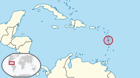
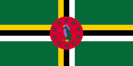
Dominica
(doh-min-nuh-kuh)
Not to be confused with the Dominican Republic, Dominica is a much smaller country located in the Lesser Antilles of the Caribbean Sea, sandwiched between the French regions of Guadeloupe and Martinique. It is one of the newest islands in the Caribbean, and geothermic activity still exists today—in fact, the country hosts the world's second-largest hot spring, Boiling Lake (only beaten by Frying Pan Lake in New Zealand). The national bird, the Sisserou parrot, is only found on the island, and is famous for giving the flag one of only two showings of purple worldwide.
Capital: Roseau
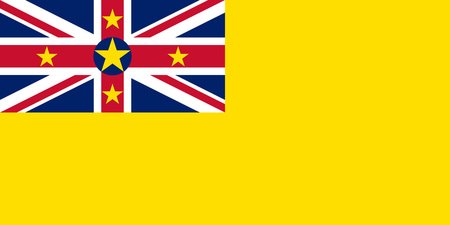
Niue
(NEE-ooh-ay)
Niue is, like the Cook Islands from Tier 8, a self-governing island in free association with New Zealand, who manages defense and foreign affairs but leaves most other things to the local government. In fact, many countries recognize it as independent, but it is not a UN member nor a JetPunk-recognized country. Not that it's too big a deal anyways, as the population is just below 2,000 people, and only shrinking.
Capital: Alofi
American Samoa
(uh-mair-ick-an-suh-mow-ah)
American Samoa is an unincorporated territory of the United States, located in the southern Pacific next to the sovereign country of Samoa. It is the southernmost stretch of American territory, and the only populated possession below the equator. Given this strategic position, it is heavily militarized, boasting the highest enlistment rate of any U.S. state or territory. It is also unique in that its residents are not granted U.S. citizenship on birth, as it is a unorganized, unincorporated territory—meaning that it is directly administered by the federal government (although there is some degree of autonomy), but is not subject to the federal constitution.
Capital: Pago Pago


New Caledonia
(noo-cahl-eh-doh-nee-uh)
New Caledonia is a small French sui generis dependency—a status unique to it, granting it some autonomy and dual French-New Caledonian citizenship—in the south Pacific, near Australia. Its largest island is Grand Terre, though there are more than 140 in total. The island is mostly autonomous, however it clearly wishes to remain in France—three referendums, held in 2018, 2020, and 2021, all rejected independence.
Capital: Nouméa


Guam
(gwahm)
Guam is an unincorporated territory of the United States located in the western Pacific Ocean, and is approximately equidistant to Japan, the Philippines, and Papua New Guinea. As a territory of the United States, Guam is governed by a locally elected governor and a legislature, but Guamanians do not have the right to participate in federal elections. A bit smaller than the city of Huntsville, Alabama, Guam offers a rich history and culture, as it was captured by the U.S. during the Spanish-American War, briefly occupied by Japan during WWII, and then recaptured soon after.
Capital: Hagåtña


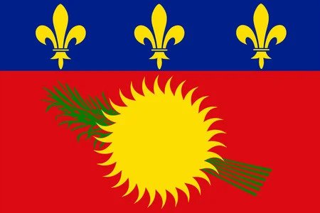
Guadeloupe
(gwaa-duh-loop)
Guadeloupe is a fully integrated department of France located in the Caribbean Sea, a situation similar to Hawaii within the United States. Despite being an integral part of France at the same level of Île-de-France or Nouvelle-Aquitaine, Guadeloupe is not part of the Eurozone, nor is it protected by NATO's Article 5. It was given its name by Christopher Columbus in 1493.
Capital: Basse-Terre (not to be confused with Basseterre, the capital of Saint Kitts and Nevis)

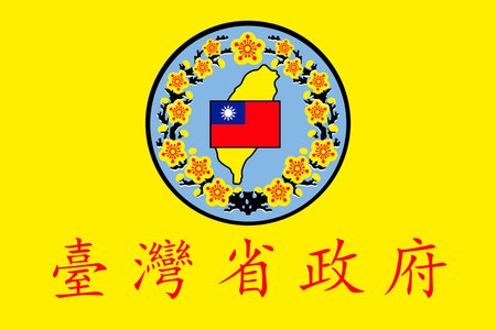
Taiwan Province
(tai-waan-prah-vinss)
Taiwan Province is a nominal province of the People's Republic of China, which claims but does not control the island. The central government recognizes that Taiwan is not under their control, and doesn't even maintain a government-in-exile for the province, however there are thirteen seats reserved for Taiwan in the national legislature. A proposed reunification plan has included annexing Taiwan as a Special Autonomous Region, much like Hong Kong or Macau.
Capital: Taipei (claimed)

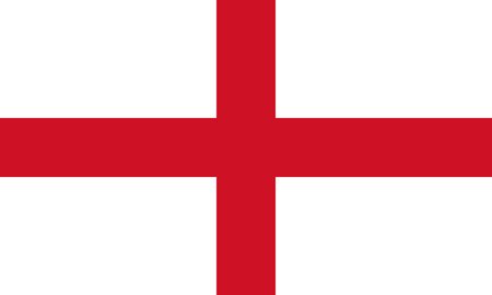
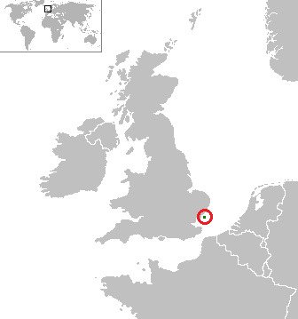
England and Wales
(ing-lind-and-waylz)
England and Wales is one of, along with Scotland and Northern Ireland, the United Kingdom's three judicial regions, each of which has their own legal system and procedures. It is composed of, shockingly, England and Wales, but there have been calls for Wales to split off and form its own judicial system.
Capital: London (central court)


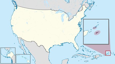
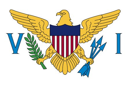
Virgin Islands of the United States
(VUR-jin-EYE-luhndz-uhv-thuh-YOO-nuhy-tid-stayts)
The Virgin Islands of the United States, more commonly known as the U.S. Virgin Islands, is an overseas territory of the United States in the Caribbean, just to the east of Puerto Rico. It is composed of the islands of Saint Croix, Saint John, and Saint Thomas, along with about 50 other minor ones. Its primary income source is tourism and cruise ship-related activities, with a geography similar to most other Caribbean islands. The territory was purchased from Denmark in 1917, and as such they are the only U.S. jurisdiction where people drive on the left side of the road.
Capital: Charlotte Amalie
Sealand
(see-land)
Sealand is a micronational principality off the coast of England. A micronation is a small, unrecognized country supported by just a few people, usually run as a hobby—expect many more in this series. It is located on HM Fort Roughs, a WWII-era naval tower in the North Sea, and is home to just two people. It was founded by Paddy Roy Bates in 1967, who intended to set up a pirate radio station, however he never broadcasted anything and instead declared independence. It gained some semblance of sovereignty in 1968, when a British court declared it was outside of England's territorial waters. Since then, the "country" has seen a civil war, a hostage situation, a fire, and the death of Paddy in 2012, who passed Sealand onto his son, Michael.
Capital: None

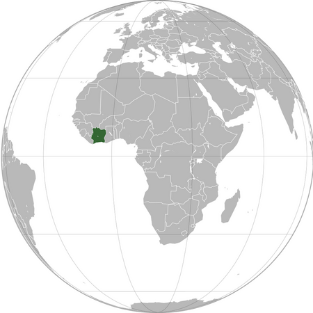
Côte d'Ivoire
(coht-dee-vwahr)
Côte d'Ivoire, more commonly known as the Ivory Coast (a name officially denounced by the government), is a fairly large country in West Africa. It is home to 29 million people, about 6 million of whom live in the largest city and former capital, Abidjan. As the name suggests, it was a large ivory hub during the colonial era, when it was controlled by France. It gained independence in 1960, and though it went through a period of civil wars and instability, it has bounced back and is now one of Africa's best-off countries, being the continent's second-fastest growing economy, as well as the world's largest cocoa producer. Despite this, it is still heavily agricultural, especially since most of the country is savannahland, though there are small rainforests in the south.
Capital: Yamoussoukro

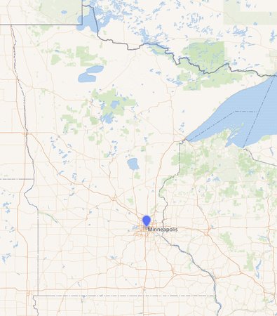
George Floyd Square
(johrj-floeed-skwayr)
George Floyd Square was an occupation protest in Minneapolis that, as of this blog's writing, no longer exists. On May 25, 2020, in what many took as an act of racial violence, George Floyd was killed by a police officer in Minneapolis. Just one day later, angry mobs began to occupy the intersection of East 38th and Chicago streets, the location of the killing, and declared it George Floyd Square. The mobs blocked off vehicular traffic, barred police from entering, and set up an anarchist community with art gatherings and things such as. However, as you'd expect, without police, seven people died by violence during the protest. Traffic resumed as normal over a year later in June 2021, and today the city plans to erect a George Floyd monument in the square.
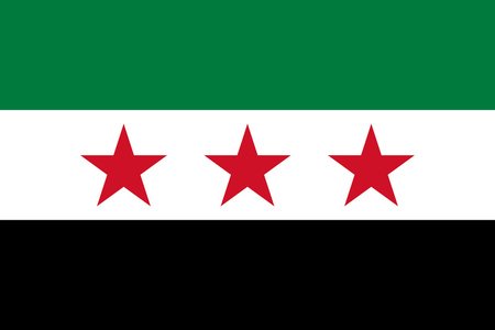
Free Syrian Army
(free-see-ree-an-ahr-mee)
The Free Syrian Army, not to be confused with the Syrian Free Army, is an extremely decentralized and big-tent grouping of Syrian Opposition armies. It was originally founded in 2011 by Colonel Riad al-Assad and had a strong leadership, but it fell apart in 2016 and it is now mostly just a term used by otherwise unrelated groups. For example, it is so unorganized that some groups under its banner fight for Turkey, and some who fight under it are Turkey's enemies. It's all very confusing, as is the case with the war in general.
Capital: Azaz / Qamishli / others

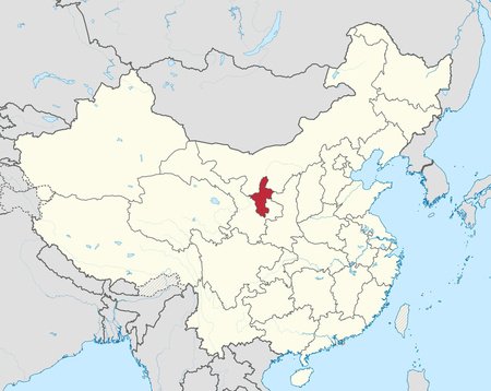
Ningxia
(NING-shah)
Ningxia, officially Ningxia Hui, is an autonomous region in the center of China. In 1958, it was designated as an autonomous region for the Hui people, and today about a fifth of China's Hui population lives in it. Though it is mostly desert, canal and irrigation projects—some stretching as far back as the Qin dynasty—have made agriculture possible, and the region has recently become a hotspot for winemaking, producing as much as a quarter of the country's wine.
Capital: Yinchuan
Federal Capital Territory
(feh-deh-ruhl-cah-piht-uhl-teh-rih-tohr-ree)
The Federal Capital Territory is, well, a federal capital territory hosting the capital of Nigeria, Abuja. Similar to the United States' District of Columbia, it has a unique status from the rest of the country's states. For example it is not led by a governor, but rather a minister who is appointed by the president. It was formed in 1976 in order to give the government greater control over the new capital's construction zone, and Abuja was finally declared the seat of government in late 1991.
Capital: Abuja


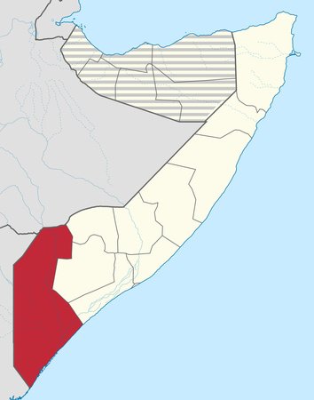
Jubaland
(joo-buh-lihnd)
Jubaland is a federal member state of Somalia located in the country's southeast, upon the Kenyan border. It has a population of 2.5 million, most of whom are members of the Darod clan. As is the case in most of Somalia, it is very unstable, falling to al-Shabaab in 2006, backing a failed independence movement called Azania in 2011, and is now seemingly an autonomous region within Somalia. In 2013, delegates from the region elected Ahmed Mohamed Islam as president, with votes in 2015 and 2019 reaffirming that, though they have been contested. There were elections planned for 2023, however I can't find any report of the results or if they even happened. Geography-wise, the region is mostly steppe, however there are deserts in the far northern and western parts.
Capital: Bu'ale (de jure), Kismayo (de facto)

South West
(saooth-wehst)
South West, or Koofur Orsi in Somali, is another federal member state of Somalia, located between the Jubaland and Hirshabelle states. Like most other regions of Somalia, it is unstable and prone to violence and corruption. Abdiaziz Laftagareen was elected president in a 2018 sham election, mostly backed by Qatar, though his actual power is negligible.
Capital: Barawa (de jure), Baidoa (de facto)


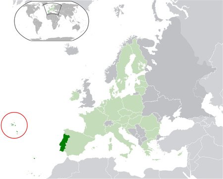
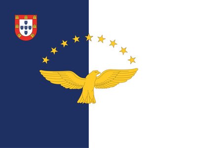
Azores
(uh-zawrz)
The Azores is an autonomous overseas region of Portugal, consisting of nine islands in the middle Atlantic Ocean. Because the islands are so sparse, they developed very differently, and as a result they each have distinct cultures. However, they are generally dependent on agriculture and livestock, as well as tourism more recently. The islands are very interesting from a geological standpoint, since they were all formed from volcanic activity. In fact, Portugal's tallest peak, Mount Pico, is a stratovolcano on the island of Pico. Politically, the islands are autonomous within Portugal, but still receive representation on the federal level.
Capital: Ponta Delgada / Angro do Heroismo / Horta
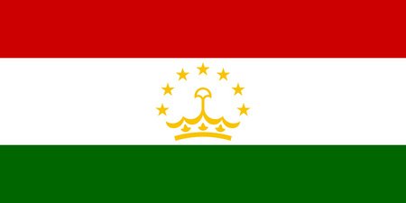
Tier 10 - Kyrgyz Republic
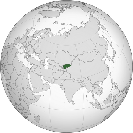
Kyrgyzstan
(keerg-uh-staan)
Kyrgyzstan is a country in Central Asia that holds the record for being the furthest country from the ocean. It is located near the center of the continent, and is mostly mountainous, with its most prominent ranges being the Tien Shan and Pamir-Alai. Its strange alien claw-like shape can be traced back to the Soviet era, which attempted to draw its borders along ethnic lines.
Also, it recently "changed" its flag—that is, the rays around the sun were straightened.
Capital: Bishkek

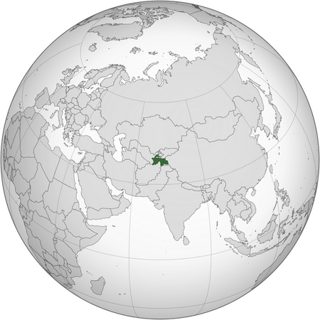
Tajikistan
(tuh-jee-kuh-staan)
Tajikistan is another Central Asian republic located just to the south of Kyrgyzstan. Like its neighbors, it is dominated by mountains—in fact, it is the world's second-most mountainous country, just after Bhutan. Speaking of world records, it also has the world's highest remittance rate (people working in other countries sending money back home), with a whopping 42% of the GDP being remittances. Besides that, its main economic drive is from cotton and aluminum, as well as in the Afghan drug market.
Capital: Dushanbe
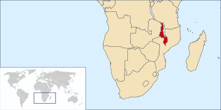
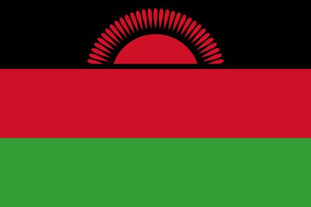
Malawi
(muh-laao-wee)
Malawi is a skinny-looking country along the western shore of Lake Malawi in southern Africa. It is surprisingly democratic, boasting the 6th-highest democracy score in Africa, and the 63rd-highest in the world, beating out countries such as Mexico and Poland. Sadly, however, it remains extremely undeveloped, with 51.5% of the population living below the poverty line. Geographically, it is located in the Great Rift Valley, though the southern regions are home to forested plateaus. It is very culturally diverse, with the tops tribes being the Chewa (25%), Tumbuka (20%), and Lomwe (18%).
Capital: Lilongwe
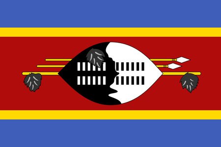
Eswatini
(eh-swah-TEE-nee)
Eswatini, which you may know by its former name, Swaziland, is the only absolute monarchy in Africa, almost entirely surrounded by South Africa, with a small border with Mozambique to the east. Its current king is Mswati III, who has ruled since 1986. Unlike most other countries in its region, it is very ethnically homogenous, with 84% of its population belonging to the Swazi people. This leads to a strong sense of culture, with August and December reed dances being the nation's most important events. This does not save it from low development, though, since it has a life expectancy of 58 and 28% of adults are HIV-positive.
Capital: Mbabane / Lobamba

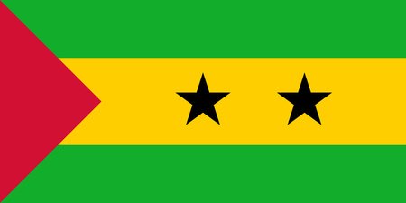
São Tomé and Príncipe
(saao-toh-MEH-and-PREENS-ih-peh)
São Tomé and Príncipe is a small island country in the Gulf of Guinea, off the coast of central Africa. Despite its size, it actually crosses the equator at Ilhéu das Rolas, a tiny islet off the coast of its main island, São Tomé (take a guess as to what the second most important island is). As far as countries go, it's been inhabited only very recently, as its first settlement was established in 1485 by the Portuguese. And it makes sense—the islands are mostly mountainous rainforest. Still, about 220 thousand people live there today, and it has a pretty decent Human Development Index, so it seems to be doing okay.
Capital: São Tomé

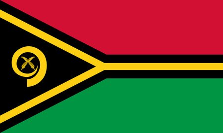
Vanuatu
(vah-noo-ah-too)
Vanuatu is a decently-sized island country (about the size of the Falkland Islands) in the Melanesia region of Oceania, about 1,090 miles east of Australia. In the 19th century, parts of the archipelago were claimed by both France and the United Kingdom, leading to its unique rule as the New Hebrides Condominium until its independence in 1980. Interestingly, the country is highly prone to earthquakes, with three occurring since 2018, though these very rarely result in any deaths.
Capital: Port Vila

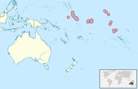
Kiribati
(keer-eh-bahs)
Kiribati is a Pacific island country, located in the Micronesia region, that is composed of 32 tiny atolls spread across about 2,400 miles (for reference, that's nearly the distance from New York City to Los Angeles), though the majority of its 121,388 residents live on the capital atoll of Tarawa. Given its large span, it is perhaps most famous for crossing the International Date Line, making it the first country to celebrate the New Year. Sadly, it is one of the world's least developed countries, with 69% of the country living on less than seven dollars a day. It was once rich from phosphate mining, but after it was depleted most industry has now turned to fishing.
Capital: South Tarawa

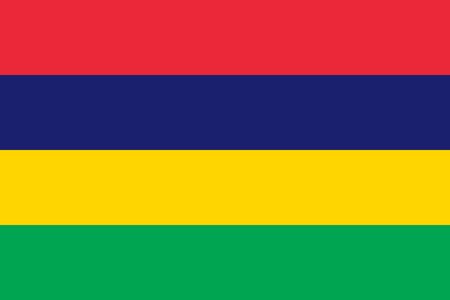
Mauritius
(moor-ish-us)
Mauritius is a small island nation located in the Indian Ocean, off the southeast coast of the African continent. It includes Mauritius, the main island, as well as the smaller islands of Rodrigues, Agaléga, and St. Brandon. Mauritius was utilized by the British Empire as a sugar plantation until independence in 1968. Mauritius boasts its status as the most developed and peaceful country in the entire continent, and is the only country outside Asia to have Hinduism as the most practiced religion, owing that to Indian workers brought during the colonial period.
Not to be confused with Mauritania.
Capital: Port Louis
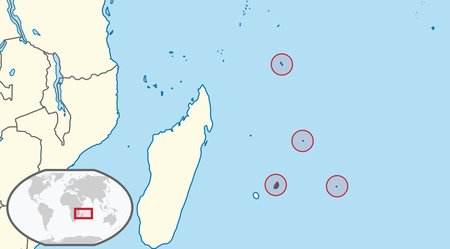
Comoros
(kuh-mohr-ohs)
Comoros is an archipelago nation located off the eastern coast of Africa, in the Indian Ocean. It consists of three major islands: Grande Comore, Mohéli, and Anjouan—Mayotte, despite being in the Comoro Islands, is owned by France, though Comoros does lay claim to it. The third smallest country in Africa, it has a population of about 850,000. Comoros is the southernmost Muslim majority nation and the only country in the Arab world to be entirely south of the equator. It is known for extreme income inequality.
Capital: Moroni


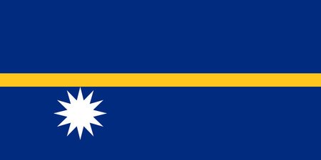
Nauru
(nah-roo)
Nauru is a small island nation located in the Central Pacific. It is the third smallest country in the world by land area, narrowly beaten by Monaco and Vatican City. It is a grassy island with a coastline surrounded by coral reef. Nauru has a history shaped by its phosphate reserves, which were extensively mined in the past, though they are mostly gone now. This mining activity has had a significant impact on the island's environment, leaving distinct formations and also uninhabitable areas. It is also famous for being the fattest country in the world, with 61% of its 11,000 residents being obese.
Also, fun fact: Nauruan is a palindrome.
Capital: Yaren (de facto)

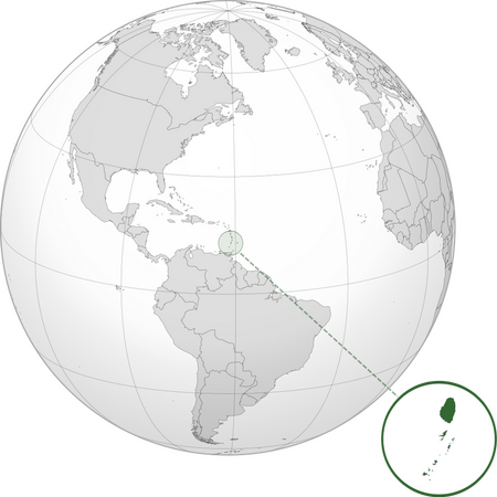
Saint Vincent and the Grenadines
Saint Vincent and the Grenadines is a small island country located in the Windward Islands (essentially everything south of Dominica) of the Caribbean Sea. It is composed of, you guessed it, the main island of Saint Vincent, as well as the Grenadines archipelago, whose main island is Bequia. It was colonized by the British until 1979, though it still recognized the British monarch (currently Charles III) as its head of state. Recently, it has fallen on hard times, as the eruption of the La Soufrière volcano in 2021 prompted the evacuation of over 16 thousand citizens. It is also well-known as the filming site for the Pirates of the Caribbean movies.
Capital: Kingstown

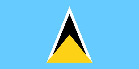
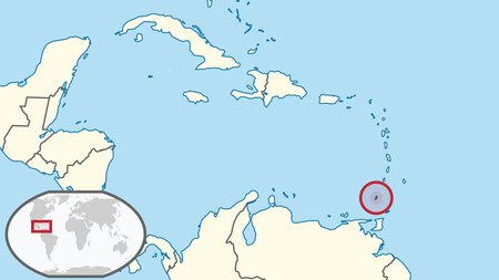
Saint Lucia
(saynt-lou-sha)
Saint Lucia is another small Caribbean island nation, located north of Saint Vincent and south of Martinique. Like many of its fellow Caribbean countries, it was colonized by the British, but was also held by France at times. This can be seen in the language—95% of the islands speaks the French-based Saint Lucia Creole. It also has an unusually high amount of Nobel Prize winners, with two (Arthur Lewis and Derek Walcott) hailing from the island of about 180 thousand, a higher per-capita rate than any other country.
Capital: Castries
Tuvalu
(too-vah-loo)
Tuvalu, formerly known as the Ellice Islands, is an island country located in the Polynesian region of Oceania. Comprised of three reef islands and six atolls, Tuvalu is the least populous member of the United Nations, and second least populous JetPunk-recognized nation (behind Vatican City), with a population of just over 10,000. It was first inhabited by Polynesians seeking refuge from scarcity of resources, and was colonized by the British from 1892 to 1978. Heavily reliant on imports, Tuvalu has a very small and concentrated economy mostly based in fishing. Given its small size and low-lying islands, it is highly at risk of sea level rise, and is a big promoter of the fight against global warming.
Capital: Funafuti


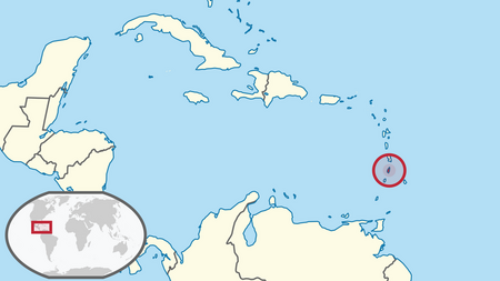
Grenada
(greh-NAH-duh)
Grenada is a small island nation located in the eastern Caribbean Sea, just below Saint Vincent and the Grenadines. Most of its population and area is concentrated on the main island of Grenada, though it also holds two populated Grenadine islands, Carriacou and Petite Martinique, as well as several other minor ones. It is perhaps most well-known for the 1983 American invasion, triggered by unrest following a communist coup. It is known as the "Island of Spice" for its nutmeg production, which can be seen on the flag.
Capital: St. George's

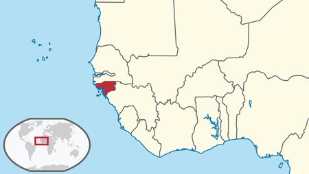
Guinea-Bissau
(ghi-nee-bis-SAO)
Guinea-Bissau is a small country at the tip of western Africa. Its most noticeable geographical feature are the Bissagos Islands, a group of around 90 islands off the coast. It has changed hands several times through history, going from the Mali Empire to Portugal to finally independence in 1973. Its main ethnic groups are Balanta and Fula, each comprising about 30% of the population. It is also very unstable, with low GDP per capita and an attempted coup as recently as 2022.
And with that, we've finished off every JetPunk-recognized sovereign state. Are you ready? Let's move onto the next entry.
Capital: Bissau

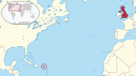
Virgin Islands
(vurr-jin-ai-lends)
The Virgin Islands, better known as the U.K. or British Virgin Islands, is an overseas territory of the United Kingdom located in the Caribbean Sea. The majority of its population lives on the island of Tortola, though there are over 50 other islands. Its beaches are a major tourist attractor, and tourism is the second-largest industry, after financial services. While it is self-governing, all citizens are also citizens of the United Kingdom as a whole.
Capital: Road Town

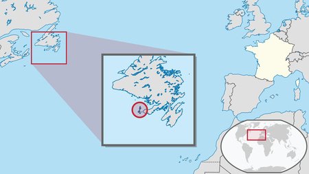
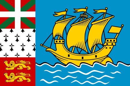
Saint-Pierre and Miquelon
(saan-pee-ehr-uhn-mi-kuh-laan)
Saint-Pierre and Miquelon is an overseas collectivity of France located in the northwest Atlantic Ocean, right off the coast of Newfoundland and Labrador in Canada. It is comprised of two main islands, Saint-Pierre, the more populated one, and Miquelon, the larger one, though there are also six smaller islands. The island group was originally named the "Eleven Thousand Virgins", which is funny considering that the total population today is only 5,827 and decreasing. That name came from a Portuguese explorer, but when France annexed the islands in 1670, they acquired their current name.
Capital: Saint-Pierre
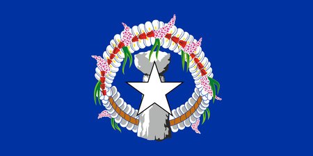
Northern Mariana Islands
(norr-thurn-meh-ree-ah-nah-ai-lends)
The Northern Mariana Islands are a territory of the United States in the Pacific Ocean, just north of Guam. However, unlike Guam, it was not won in the Spanish-American War, but was rather annexed from Japan following WWII. Despite their small size, the islands are very mountainous and well-forested, but are also often the victim of typhoons and volcanic eruptions. The economy is highly dependent on tourism, mostly from China and South Korea, with textiles, farming, and ranching also being highly important.
Capital: Saipan

Sahrawi Arab Democratic Republic
(sah-rah-wee-ah-rahb-deh-moh-kraah-tick-reh-puh-blick)
The Sahrawi Arab Democratic Republic (also known as the SADR or, inaccurately, the Western Sahara) is a partially recognized state located in the western Maghreb region. A former Spanish colony, it is recognized by 46 UN members, with the majority being fellow African nations. While the SADR claims the entirety of the Western Sahara as its territory, it only controls a relatively small sliver of that, as Morocco controls the vast majority of the region and calls it Southern Provinces. The government of the SADR is, ironically, located among refugee camps in Algeria.
Capital: El Aaiún (de jure), Tifariti (de facto)


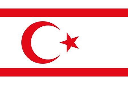
Northern Cyprus
(nohr-thurn-sai-pruss)
Northern Cyprus is an (mostly) unrecognized country located on the northern part of the island of Cyprus. It is internationally recognized as a part of the Republic of Cyprus under Turkish occupation, but has established itself as the Turkish Republic of Northern Cyprus, which only Turkey recognizes. The conflict stretches back many centuries, and essentially boils down to the struggle between Greek (supporting Cyprus) and Turkish (supporting Northern Cyprus) islanders. Pakistan and Bangladesh also used to recognize it, but it was withdrawn due to western pressure.
Capital: Nicosia (de jure), Northern Nicosia (de facto)

Réunion
(RAY-yoon-yon)
Réunion is an overseas department of France (not a territory, but akin to Hawaii and the United States) located east of Madagascar and west of Mauritius. It was uninhabited until the French arrived in the 17th century, establishing a sugar-based economy and importing large numbers of Asian and African workers. As a full-fledged part of France, it uses the Euro, and is also the furthest inhabited reach of the European Union. The island is also very mountainous, with its highest point, Piton des Neiges, being the highest point of the entire Indian Ocean.
Capital: Saint-Denis


Caribbean Netherlands
The Caribbean Netherlands are a collection of three islands—Sint Eustatius, Bonaire, and Saba—located within the Netherlands (again, think of Hawaii and the United States), itself a subdivision of the greater Kingdom of the Netherlands, which consists of the (European) Netherlands and three other Caribbean islands, themselves distinct from the Caribbean Netherlands. They used to be their own country within the Kingdom, but were annexed into the (European) Netherlands in 2010. Confusing, I know.
Despite being integral parts of the (European) Netherlands, they are not part of the European Union, and are officially known as "public bodies" or "special municipalities."
Capital: Kralendijk (Bonaire) / Oranjestad (Sint Eustatius) / The Bottom (Saba)


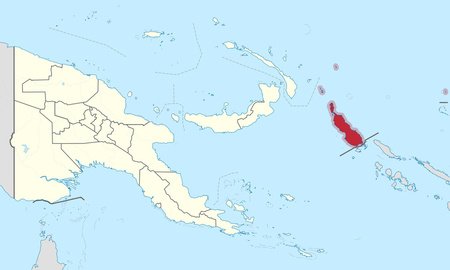
Bougainville
(boo-gehn-vill)
Bougainville is an autonomous region in the eastern part of Papua New Guinea. Its largest and most populated island is, well, Bougainville, but somewhat strangely the capital city of Buka is located on the much smaller Buka Island. This can be attributed to the former capital, Arawa, being destroyed during the Bougainville Civil War, a secessionist war that resulted in the current status quo. It seems they still wanted independence, though, as in 2019, 98% of the population voted in favor of independence. If everything goes smoothly, they are set to gain it in 2027, which will make it the world's newest country.
Capital: Buka
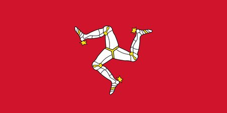
Isle of Man
(ail-uv-mann)
The Isle of Man is a British Crown Dependency located in the Irish Sea between England and Northern Ireland. The island is self-governing, though the United Kingdom represents it in military and foreign affairs. It is probably most famous for being the site of the annual Tourist Trophy motorcycle race, though more elite circles probably enjoy its tax haven status more.
Capital: Douglas

Libya (GNS)
(lih-bee-yah)
The Government of National Stability is a Libyan provisional government headquartered in Sirte, and it controls most of eastern Libya. It is supported by the House of Representatives, the Libyan legislature elected in 2014 with 18% turnout. Its main opponent is the more Islamist-focused Government of National Unity, which is based in Tripoli, and since 2022 they have both claimed sovereignty over Libya. The situation began during the Arab Spring, and since then two civil wars have passed. Currently, both sides are locked in a low-intensity string of clashes, with an August 2023 battle in Tripoli leaving at least 55 dead.
Capital: Sirte

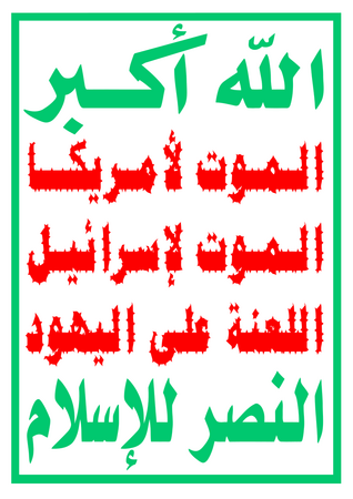
Yemen (SPC)
(yeh-men)
The Supreme Political Council is a splinter Yemeni government, recognized only by Iran, created by the rebel Houthis (a group that have historically had ties to Iran) during the country's ongoing civil war. It controls much of western Yemen, including the capital, Sana'a, which is the location of their headquarters. It was established in 2016 and seeks to unite Yemen under an anti-Israeli, American, and Saudi banner.
By the way, in case you're wondering what the flag says, it is "God is the Greatest, Death to America, Death to Israel, A Curse Upon the Jews, Victory to Islam." No joke.
Capital: Sana'a

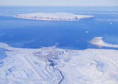
Pituffik Space Base
(pih-tuf-fick-spayce-bays)
The Pituffik Space Base, formerly the Thule Air Base, is an American space / air base in northern Greenland, and the northernmost U.S. military base in the world. It is instrumental in NORAD, ICBM detection, and space surveillance programs. Outside of military topics, its surroundings include the Wolstenholme Fjord, the only point in the world where four glaciers meet.
You've got to feel for the people stationed here—the yearly average high is 18°F, or −7.8°C.
Pheasant Island
(feh-sent-ai-lend)
Pheasant Island is a small, uninhabited river island located near the Bay of Biscay on the Franco-Spanish border. It is unique in that it switches jurisdiction every six months, with France getting it between August 1 and January 31, and Spain getting it between February 1 and July 31. It is significant for being the location of the signing of the Treaty of the Pyrenees, which ended the Franco-Spanish War and under whose terms the island would be a psuedo-condominium.

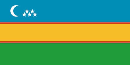
Karakalpakstan
(kah-rah-kahl-pahk-stahn)
Karakalpakstan is an autonomous republic of about 2 million residents located in northwest Uzbekistan. As you might've guessed by the name, it is an autonomous region for the Karakalpak people, who are more closely related to Kazakhs than Uzbeks. These days, however, Uzbeks are the largest group (40%), with ethnic Karakalpaks making up "just" 37% of the population. It is also one of the poorest regions of Uzbekistan, as the drying of the Aral Sea has led to water shortages.
Capital: Nukus

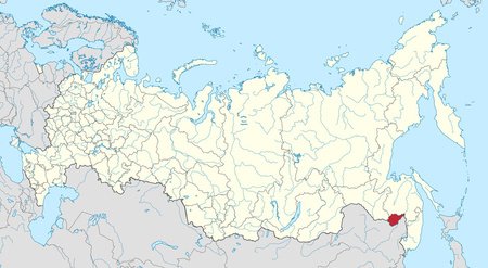
Jewish Autonomous Oblast
(joo-ish-ah-tah-nuh-muhs-oh-blahst)
The Jewish Autonomous Oblast is an autonomous oblast (the only one in the country) in far eastern Russia. It was establish under Stalin's Soviet government in 1928, and at its peak it was home to about 50,000 Jews. However, after Soviet emigration restrictions were lifted in 1989, most Jews moved to Israel, and today the entire territory has less than 1,000 Jews, making up just 0.6% of its population. Despite this, the region still has a strong Jewish heritage, with kosher meats being promoted and the Yiddish language being taught in schools.
Capital: Birobidzhan

Barbuda
(bahr-boo-dah)
Barbuda is a semi-autonomous island within Antigua and Barbuda. While it does send representatives to the national parliament, it also elects its own local council with special powers such as land management and roadwork. Its most significant power, however, is the ability to formally request the separation of Barbuda from Antigua. The island has a very low population of around 1,800, the overwhelming majority of which live in the only town of Codrington. In 2017, Hurricane Irma devastated the island, destroying up to 90% of infrastructure, however it seems most of the evacuated population has returned.
Capital: Codrington
Tobago
(toh-bay-goh)
Tobago is an island and ward within Trinidad and Tobago, located 22 miles northeast of the much larger Trinidad. Much like Barbuda, it is a semi-autonomous island, though again it still sends representatives to the national legislature. It has a history of self-government dating back to at least the 18th century, though it was cut when the British consolidated it into Trinidad in 1889. After Trinidad and Tobago gained independence in 1962, provisions were made for self-government, and the local legislature was finally restored in 1980. Outside of politics, the island is tropical and mountainous, with a record low of 65.7°F, or 18.7°C. Economically, the island is based on tourism and fishing, although the aforementioned local assembly employs 62% of the workforce.
Capital: Scarborough

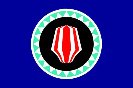
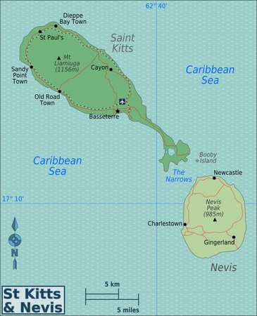
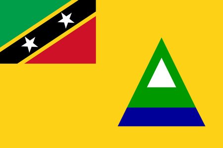
Nevis
(nee-viss)
Nevis is, you guessed it, a semi-autonomous island within Saint Kitts and Nevis. Its 12,000 citizens elect their own legislature and send three representatives back to the national parliament on Saint Kitts. It is fairly well-off, with a 98% literacy rate and a GDP per capita ten times as high as Saint Kitts'. However, it is also a hub for offshore banking schemes; at one point, an estimated 17,500 banking companies were registered on the island. Looking at the flag, you may notice a multicolored triangle—this represents Nevis Peak, an inactive volcano that is one of the highest points in the Caribbean.
Capital: Charlestown
Príncipe
(PREEN-see-peh)
We really can't get enough of these autonomous regions within a two-island country, can we?
Príncipe is autonomous province in the north of São Tomé and Príncipe. It elects its own legislature and president, and has a population of about 8,420. Though it was a plantation center during Portuguese colonial rule, it has mostly reverted to forest now. Probably the most significant thing to ever occur on the island was an experiment with Einstein's theory of relativity—Sir Arthur Eddington proved it with photos of the Príncipe solar eclipse in 1919.
Capital: Santo António

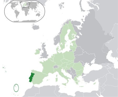
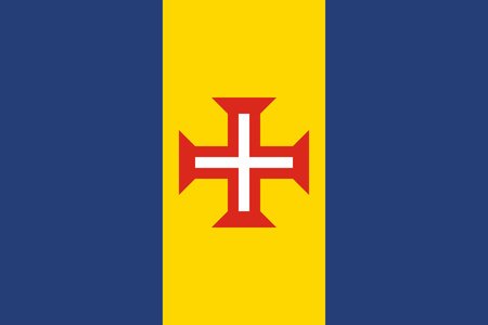
Madeira
(muh-dair-uh)
Madeira is an autonomous region of Portugal in the Atlantic Ocean, geologically located on the African continent but culturally and geopolitically European. Its main island is Madeira itself, with other islands including Porto Santo and the Savage Islands chain. It was uninhabited until its exploration by Portuguese explorers in 1419, and in fact its discovery is considered the start of the Age of Discovery. It is a major tourist destination, notable for its mountainous Mediterranean climate and especially its sweet wine production.
Capital: Funchal
Looking forward to the next edition whenever that will be!
actually, a lot of those random islands in the pacific and caribbean have cool flags
fun fact: Women in Burundi are 55% the work force, and are in Agriculture, Burundi's biggest sector