Five Islands of Maritime Southeast Asia
Last updated: Sunday May 28th, 2023
Report this blog
Introduction
Well, here we are again, I get an intense feeling of deja vu whenever I start the title of a blog with "Five Islands of...". I don't know if I'm over half way, at half way, or before half way. I suppose that depends on how I lump countries together. I could do USA, Canada and Brazil as separate blogs with five each, or I could just stick to North, Central and South America. I know what MG would say. I'll have to see how I feel at the time I suppose. Can you tell I'm getting bored with islands and want to carry on with the songs blogs?
Anyhoo, let's carry on with this episode for now, then I may have another short hiatus from the islands. (Or I may not, does anyone care? Nah thought not!)
Sorry, I'm just a little tired this week, had some early starts and long days, nothing to worry about from your point of view, just need a long weekend off and some much needed R&R.
Ok, rant over, back to the blog with our first country in Maritime Southeast Asia...

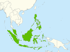
This region, as I described in the last islands blog, comprises of Malaysia, Singapore, Indonesia, Brunei, The Philippines, and East Timor. It has been hard to pick the islands in this blog, all of the nations are island nations and there is thousands to choose from. I think I have chosen the interesting ones.
We have already covered Malaysia previously, so we will start with Singapore...
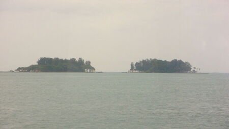
Sister's Islands (Singapore)
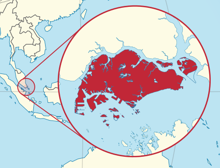
We all know, well hopefully we do, that Singapore is an island nation. However you may not know that it is made up of one main island and sixty-four smaller islets. As you can see from the map below, many of them are concentrated around the main island.
Unusually, this entry has two islands rather than one, a sort of bonus for you to make up for the rant earlier. They are separated by a narrow, dangerous channel. The islands are known individually as Big Sister's Island and Little Sister's Island, in Malay they are called Pulau Subar Laut and Pulau Subar Darat respectively.
There are three legends about the islands.
One tells of two orphaned sisters living with their uncle. One was captured by pirates and tried to escape by jumping overboard, her sister tried to save her but both sadly drowned. The islands sprang up the day after at the spot where the sisters were last seen.
The second tale describes two sisters being blown away in a storm and each landing on one of the islands.
The third is similar to the first, but instead of pirates, the sisters just drowned. God thought that their love was so strong that he turned them into islands, so they could be next to each other forever.
In 2014, the islands, surrounding waters and parts of two other nearby islands were designated as a Marine Protected Area by the Singapore government. The area was also made into a Marine Park.
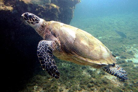
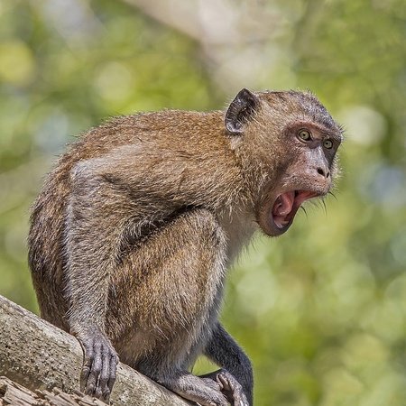
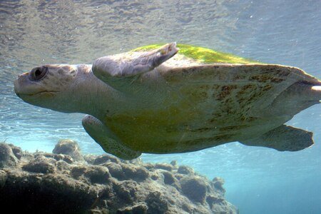
There are several endangered species in the area, including sponges, turtles, and corals. Big Sister's Island is also home to the Crab Eating Macaque.
Little Sister's Island currently cannot be visited due to being the egg laying and hatching habitat of the endangered hawksbill sea turtle.
The Big Sister's Island can however be visited. There are guided walks and a visitor centre with viewing platforms on the island. It can be reached by boat from either Marina South Pier or West Coast Pier on the main island.
The Islands have their own webpage on the Singapore National Parks website.
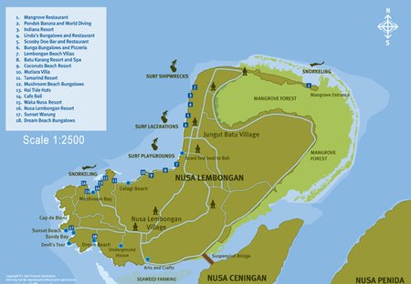
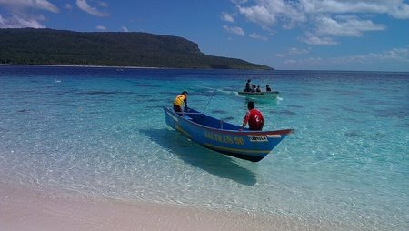
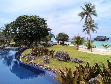
Nusa Lembongan (Indonesia)
Nusa Lembongan is part of a three island archipelago known as the Nusa Islands. These islands are approximately midway between the larger islands of Bali and Lembok.
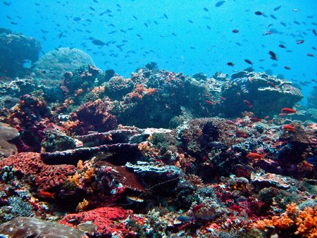
The island has a permanent population of around 5000 people, most of whom are employed in the tourism industry. There are several resorts and the island is renowned for surfing and diving due to the surrounding coral reefs. There is an ongoing conservation programme and significant releases of locally endangered Olive Ridley Turtles.
There is subsistence farming and fishing. There was a small seaweed harvesting industry but following the tourism boom in 2015, this became unprofitable.
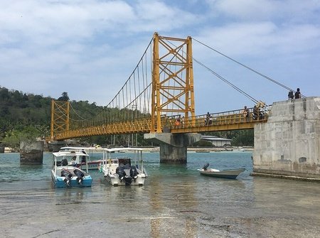
There is a footbridge connecting the smaller neighbouring island of Ceningan. The bridge was rebuilt after it collapsed in 2016.
To the east of the much larger island in the group, Penida, is the Wallace Line that marks the division between the biogeographic areas of Indomalaya and Australasia. The difference in the fauna of these areas was first reported and detailed by Alfred Wallace after whom the Line is named.
The island can be accessed by boat from the resort of Sanur on Bali. The journey takes around 30 minutes. Larger cargo ships ply their trade between the port of Padang, also on Bali.
This blog has a detailed list of things to see and do on the island as well as photographs.
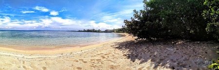
Pelumpong Spit (Brunei)
Despite it's name, Pelumpong Spit isn't a spit. It used to be until the 50m Muara Cut was constructed close to the mainland to provide easier access to Muara Port. It has been proposed to widen the channel in order to increase the capacity of the port.
The island is situated in the northern extreme of Brunei in Brunei Bay, at the edge of the South China Sea.

Pelumpong was one of the places where Australian forces started the liberation of Brunei from the occupying Japanese during World War II. At this time, the island was still connected to the mainland, the channel was not dug until the 1960's
The island has several fish farms, and is often used by locals for fishing. There are pristine beaches which are popular for picnics and recreation. The beaches are protected from erosion on the northern side of the island and the interior is forested with pine trees.
It is known that due to the relative remoteness of the island, a certain amount of illegal activity happens occasionally. Smuggling has been a problem at times.
The island is only accessible by chartered boat from Muara on the mainland. The journey is quite short.
This Youtube video has some scenes of the island and the sort of activities the locals enjoy there.
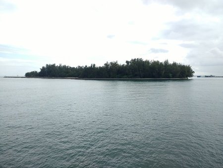
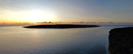
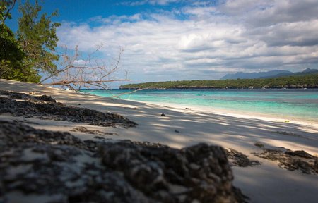
Jaco Island (East Timor)
There are only a few islands in the territory of Timor L'Este, Jaco is the smallest. It is located at the eastern tip of the island of Timor, just off Cape Cutcha, separated from the "mainland" by the Jaco Strait.
The island is uninhabited and is considered sacred by the locals who believe it is the meeting point of two seas, the Timor Sea (Tasi Mane, the men's sea) and Banda Sea (Tasi Feto, the women's sea), however according to the International Hydrographic Organisation the only point these seas meet is slightly further north.
There are at least three sites of ancient remains of fortifications on the island, possibly dating back prior to the Portuguese occupation in the 16th century. Apart from this the only evidence of habitation was a lighthouse tower, demolished in 2010.
The island is technically off limits due to it's sacred position, however local fishermen are increasingly ferrying tourists from the mainland. Overnight stays are completely forbidden though.
The island is a haven for wildlife and is classified as an Important Bird Area. There are many different species of birds that nest on the island. There are also small deer that are able to survive on salt water. Sea turtles lay their eggs on the beaches and coral reefs surround the island.
To visit the island you must first find a fisherman that will take you from Valu Beach 600 meters across the channel. The journey takes around 5 to 10 minutes. It cost a few dollars and the boat will wait a couple of hours or return later in the day for you. Although the channel is only about 600 meters wide it has strong currents and is dangerous to swim across.
The East Timor Tourist Office has a website describing the island.
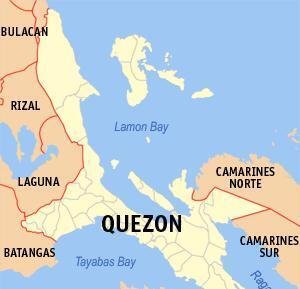
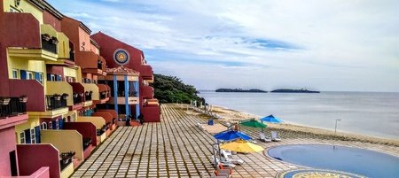
Balesin Island (Philippines)
Balesin is located just off the east coast of Luzon in Lamon Bay. The land below the wide bay is slowly rising, enabling people to walk up to 500 meters from land at low tide.
Due to the trade winds, the island only experiences two seasons. From November to June it is dry with moderate temperatures and an east wind, whereas the rest of the year is hot and humid with heavy, frequent rainfall and wind from the opposite direction. There are occasionally severe tropical storms.
During World War II and the Japanese occupation of the Philippines, between 1942 and 1945, a group of seven soldiers resided on the island, apparently quite peacefully with the local fishermen and their families.
The island nowadays is owned by a corporation that has developed around 10% of it's total area into a luxury resort. The resort was planned with ecology and sustainability in mind. The new airport has a system for collecting rainwater, that is then filtered and used to supply fresh water to the whole of the island. The runway provides over 100 million litres annually.
Used water is then recycled to be put to use on the landscape.
The surrounding coral reefs are managed to sustain wildlife including parrotfish, yellow fin tuna, deep sea crabs, and butterfly fish.
Getting to the island is by air via E.L. Tordesillas Airport, a private facility owned by Alphaland Corporation, the islands current owners.
Unfortunately the resort is for members or their guests only, but just in case you want to book, the resort has it's own website, with pictures of each village within the resort.
Summary
"That's that then" as my grandmother used to say. Maritime SE Asia done and dusted, so to speak. Next on our global journey we shall be visiting the islands of East Asia. Another region that conveniently has six countries with one that isn't compatible with these blogs. They are China, Taiwan, North Korea, South Korea, Marilyn Monroe (sorry can't help saying that from Billy Joels hit song) Japan and Mongolia.
The last one on the list will probably prove very difficult seeing as it is landlocked. although there must be lakes. Looking on the satellite view on Google, there are some islands on Uvs Lake in northern Mongolia, but no information about them, I tried.
So in the words of Bill Haley, "See ya later, alligator"
Although if I'm honest I'm not sure what the reference to ice cream means nickelz ?