The Countries Iceberg - Part VI
First published: Friday March 29th, 2024
Report this blog
By FreeStater and Nickelz.
Welcome back to the Countries Iceberg.

In today's blog we will cover tiers 11 and 12.
This is where things start to get obscure. These two tiers are mostly dependent territories, major unrecognized states, and temporary warzone entities. There are no more sovereign states, and definitely nothing more that would be known to the average person on the street.
Abandon all hope, ye who enter here.
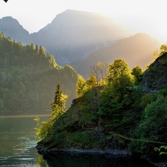
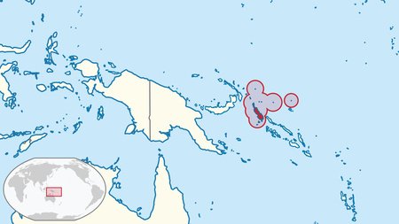
Tier 11 - Republic of Bougainville
Republic of Bougainville
(reh-puh-blick-of-boo-gehn-vill)
The Republic of Bougainville is a planned sovereign state that is set to gain independence by 2027. In late 2019, a non-binding independence referendum was held in Bougainville, with more than 98% of the population voting for independence, rather than remaining an autonomous region within Papua New Guinea. It's still unknown exactly when they'll gain independence, but high-ranking officials have expressed support for it being soon.
Capital: Arawa (planned)
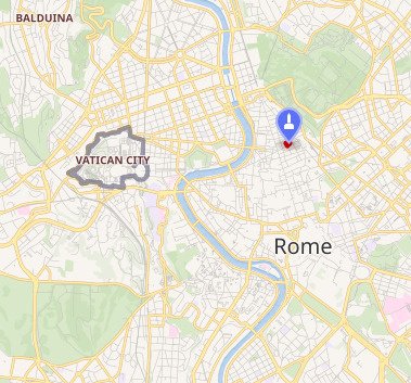
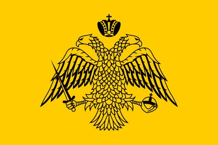
Sovereign Military Order of Malta
(sahv-vehr-rehn-ohr-duhr-of-mahl-tah)
The Sovereign Military Order of Malta, officially known as the Sovereign Military Hospitaller Order of Saint John of Jerusalem, of Rhodes and of Malta, is a Catholic religious order operated out of Rome, Italy. Under international law, it is generally considered a sovereign entity, despite it possessing no actual territory. Even still, it maintains embassies, issues passports, and even mints it own currency. This is because it traces itself back to the medieval Knights Hospitaller, who at one point did control territory.
The Order's modern-day role is focused on providing humanitarian assistance, for which purpose it has had observer status in the United Nations General Assembly since 1994. The Order employs about 52,000 doctors, nurses, and paramedics, and many more volunteers, who help the homeless, old, children, sick, and disabled in more than 100 countries.
Capital: Rome (headquarters)
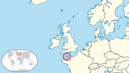
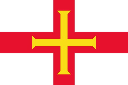
Guernsey
(GURN-zee)
Guernsey is the second largest island in the England Channel, and the largest and most populated jurisdiction of the Bailiwick of Guernsey. It is an autonomous dependency of the United Kingdom, but not technically a part of it—instead, the Kingdom merely provides defense and manages foreign relations. It has been tied with England / the United Kingdom since the middle ages, when the English-controlled Duchy of Normandy fell into French hands, but the island remained loyal to the crown. However, it was occupied by Nazi Germany for five years during WWII.
Capital: St. Peter Port

Jersey
(JUR-zee)
Jersey is another self-governing dependency of the United Kingdom that is not technically a part of it, located to the southeast of Guernsey. Much like Guernsey, it is managed in defense and foreign relations by the British, but is independent when it comes to law. Also, as you might have guessed, the island is where New Jersey takes it name from.
Capital: St Helier
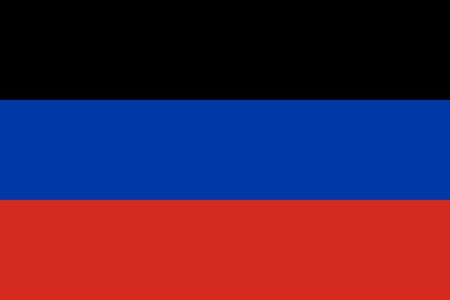
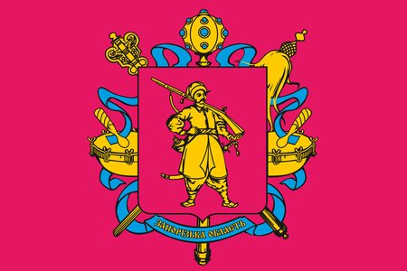
Donetsk People's Republic
(dow-net-suhk-pee-pulls-rə-puh-blick)
The Donetsk People's Republic is an internationally unrecognized republic of Russia. It broke off from Ukraine as an independent "country" in 2014, propped up by Russian militias. In 2022, Russia recognized it as a sovereign state for three days before their full-scale invasion of Ukraine (which partially occurred under the pretext of "protecting" these republics). Later that year, it was annexed into Russia as a federal subject. It and the Luhansk People's Republic are viewed as terrorist organizations by the Ukrainian government.
Capital: Donetsk
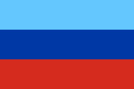
Luhansk People's Republic
(loo-haansk-pee-pulls-rə-puh-blick)
The Luhansk People's Republic is an internationally unrecognized republic of Russia. Its situation is nearly identical to that of the Donetsk People's Republic—a Ukrainian breakaway state, formed by Russian militias in 2014, that was later recognized and eventually annexed by Russia in 2022.
Capital: Luhansk

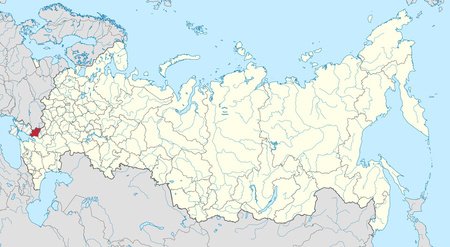
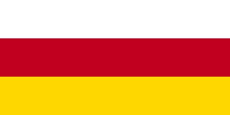
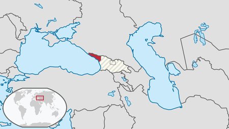
South Ossetia
(souwth-oh-setya)
South Ossetia, or the State of Alania, is a partially recognized state, broken off from Georgia, in the south Caucasus region. Only Russia, Venezuela, Nicaragua, Nauru, and Syria recognize it as independent. The Georgian government, as well as all other UN member states, regard South Ossetia as the sovereign territory of Georgia occupied by Russia. South Ossetia relies heavily on military, political, and financial aid from Russia, and have even expressed interest in being annexed into the Federation.
Capital: Tskhinvali
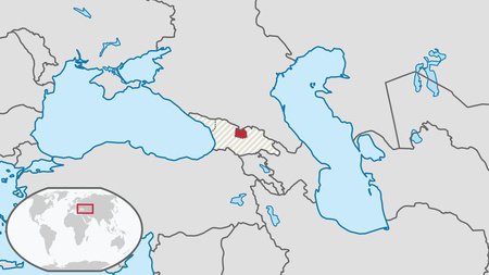
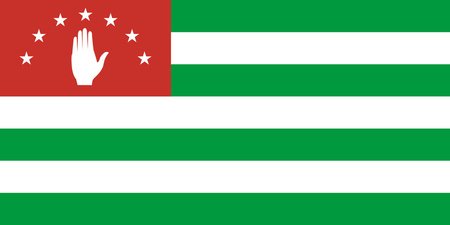
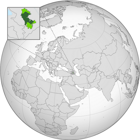
Abkhazia
(ab-KAH-zee-ə)
Abkhazia is a partially recognized state in the south Caucasus, located on the Black Sea. Abkhazia has been recognized as an independent state by Russia, Venezuela, Nicaragua, Nauru, and Syria; however, the Georgian government and nearly all UN member states consider Abkhazia to be the sovereign territory of Georgia. Georgia does not actually control the territory, though, and instead maintains a government-in-exile for the region (which we'll explore in tier 14). Following the collapse of the Soviet Union and the independence of Georgia, the Abkhaz fought against ethnic Georgians for their independence, resulting in Georgians being ethnically cleansed from Abkhazia—known elsewhere in the country as a genocide.
Capital: Sukhumi
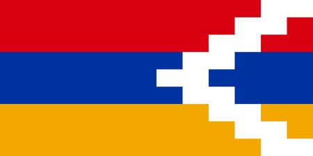
Artsakh
(ART-sa(h)kh)
Artsakh, also known as Nagorno-Karabakh, no longer exists as of the creation of this blog. It was a breakaway state, populated by ethnic Armenians, in the south Caucasus internationally recognized as part of Azerbaijan. Between 1991 and 2023, Artsakh controlled parts of the former Nagorno-Karabakh Autonomous Oblast of the Azerbaijani Soviet Socialist Republic. It was an enclave within Azerbaijan from the 2020 Nagorno-Karabakh War, between Armenia and Azerbaijan, until the 2023 Azerbaijani offensive, when the Azerbaijani military took control over much of the republic's remaining land. Almost the entire population has fled to Armenia, most cities are now abandoned, and all of the republic's institutions were dissolved on January 1, 2024.
Capital: Stepanakert (formerly)
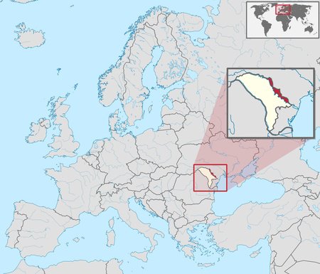
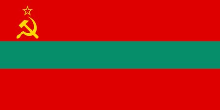
Pridnestrovie
(prid-nehs-troh-vee)
Pridnestrovie, more commonly known as Transnistria, is an internationally unrecognized state that is generally recognized as a de jure part of Moldova. It consists of most of the narrow strip of land between the Dniester River and the border between Ukraine and Moldova. Only Abkhazia and South Ossetia, both mostly unrecognized themselves, recognize its existence. The Council of Europe recognizes it as under military occupation by Russia, who supported it in its 1991–92 independence war. Despite this, it is still a very ethnically diverse place, being nearly evenly-split between Russians, Moldovans, and Ukrainians.
Capital: Tiraspol
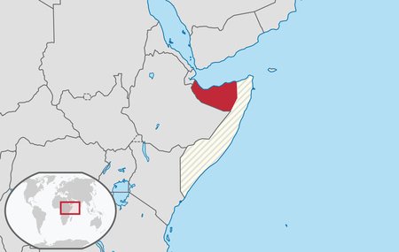
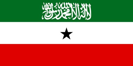
Somaliland
(soh-mahl-lee-land)
Somaliland is an unrecognized state on the Horn of Africa, a de jure part of Somalia. The Government of Somaliland regards itself as the successor state to the British Somaliland colony, which, as the briefly independent State of Somaliland, united in 1960 with the Trust Territory of Somaliland to form the Somali Republic. They re-declared independence in 1991, following the outbreak of the Somali Civil War. Since then, the territory has been ruled by democratically-elected governments who seek international recognition as the Republic of Somaliland... though it has yet to actually gain any of that recognition. It is the largest (major) unrecognized state, slightly larger than the country of Uruguay, and probably one of the most successful.
Capital: Hargeisa
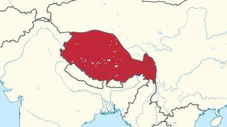
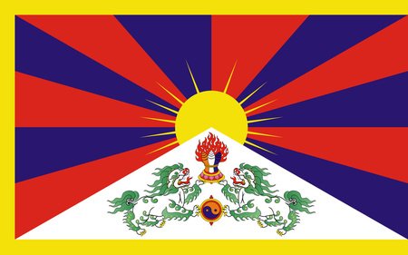
Central Tibetan Administration
(sehn-truhl-tih-beh-ten-add-mihn-niss-tray-shun)
The Central Tibetan Administration is a government-in-exile for the Tibetan people, headquartered in northern India. It was established in 2011, after the Dalai Lama rejected the idea of Tibetan independence. Since then, it has functioned as a quasi-government, with a president, legislature, and court system, even though it has no real power in Tibet itself.
Capital: Dharamshala, India (headquarters)
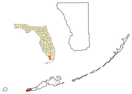
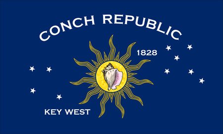
Conch Republic
(conck-reh-puh-blick)
The Conch Republic is a satirical micronation based in Key West, Florida. In 1982, border patrol set up a checkpoint of US-1, the only road connecting it to mainland Florida, in order to check for narcotics and illegal immigrants. In response, the city declared independence—border patrol treated them like a different country, so may as well become one. They quickly declared war on the U.S., ended it after a minute, and asked for a billion dollars in aid. Later in 1995, when a military exercise was conducted off the island's coast, they pretended to go to war, throwing water balloons and bread at the Coast Guard ships. Since then, the Republic has remained active as a tourist attraction.
Capital: Key West
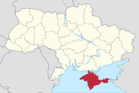
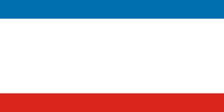
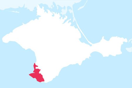
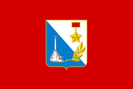
Autonomous Republic of Crimea
(aw-taw-nuh-muhs-re-puh-blick-əf-cry-mee-uh)
The Autonomous Republic of Crimea is an autonomous republic within Ukraine encompassing most of the Crimean Peninsula. It is still legally recognized as a part of Ukraine, though it was annexed by Russia in 2014. The City of Sevastopol, located on the peninsula's southwest, is a separate entity, and has special administrative status. The majority of the population is ethnically Russian, and it is the most Islamic region in Ukraine.
Capital: Simferopol (de jure)
Sevastopol
(se-vah-STAH-pahl)
Sevastopol is the largest city on Crimea and a historic port city on the Black Sea. Sevastopol, along with the rest of Crimea, is internationally recognized as part of Ukraine, and under the Ukrainian government, it is administratively one of two cities with special status, alongside Kyiv. However, Russia has illegally occupied it and the rest of the peninsula since February 27, 2014. Both Ukraine and Russia consider the city administratively separate from the Autonomous Republic of Crimea and the Republic of Crimea, respectively. The majority of Sevastopolians are ethnically Russian.
Capital: Sevastopol
Svalbard
(svahl-bahrd)
Svalbard is a Norwegian archipelago in the Arctic Ocean, to the far north of mainland Europe. While it is ruled under Norwegian law, it holds special status outside of the Schengen Area. Despite this, it is a visa-free zone by treaty (Svalbard was formerly an international mining zone), meaning you could theoretically live there without going through the immigration process.
The largest settlement is Longyearbyen, which also serves as the de facto capital. The entire region is about the size of West Virginia, but only has a population of 2,530. This is due to its Arctic climate, with the average summer temperature fluctuating between 37.4 and 44.6 °F. It is probably most well-known for being the home of the Global Seed Vault, a backup agriculture facility in case of disaster elsewhere.
Capital: Longyearbyen (de facto)

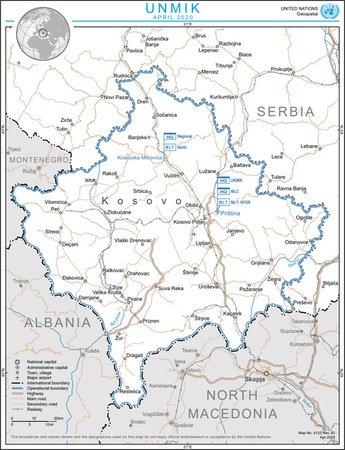
United Nations Interim Administration Mission in Kosovo
(not typing a pronunciation for this)
The United Nations Interim Administration Mission in Kosovo is a mandated mission of the United Nations in Kosovo that was declared during the bloody Kosovo War of 1998–99. Its objective was supposedly to provide peace and stability for citizens of Kosovo. It does technically still exist today, but its function is quite meager, since Kosovo has declared full independence from Serbia. Most of its power has since been transferred to the Kosovan government and a separate European Union mission.
Capital: Pristina (headquarters)
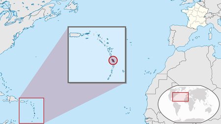
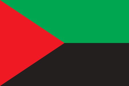
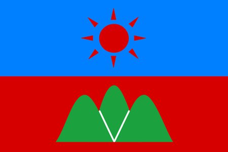
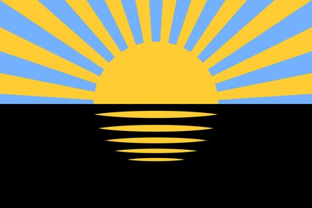
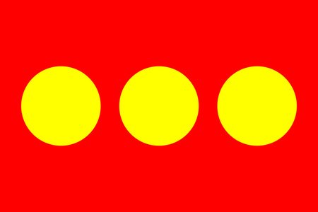
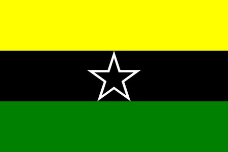
Martinique
(MAR-tin-EEK)
Martinique is an island in the Lesser Antilles that is an overseas department / region of the French Republic. It is also part of the EU as an "outermost region," and uses the Euro as its currency. Despite this, it is not part of the Schengen Area. The island is located in the Windward chain, neighbored by Dominica to the north and St. Lucia to the south. It is slightly larger than Hong Kong and has a population of about 350 thousand people, 26,633 of whom voted for a new flag in 2022. Check out the result on the right!
Capital: Fort-de-France
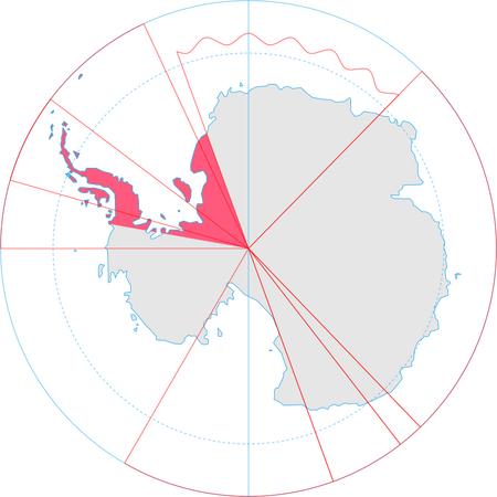
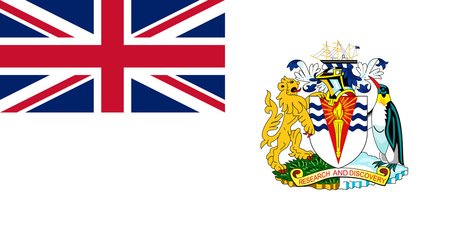
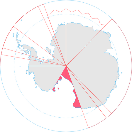
British Antarctic Territory
(brih-tish-ann-tahr-tick-tehr-rih-tor-ree)
The British Antarctic Territory is a portion of Antarctica claimed as a British Overseas Territory by the United Kingdom. A little larger than the country of Iran, it is the largest "British Overseas Territory," even though the claim has been mostly inactive since the Antarctic Treaty came into force in 1961. The treaty did not explicitly dissolve the claim, but it does prevent it, and any other claim, from expanding in the future. It is also overlapped by Chile's and Argentina's claims.
Capital: Rothera Research Station
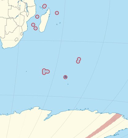
French Southern and Antarctic Lands
(french-suh-thurn-and-ann-tahr-tick-lands)
The French Southern and Antarctic Lands is an overseas territory of France. The entire territory is slightly larger than the country of Iraq, though it has no permanent population, hosting just research stations. It consists of Adélie Land (the Antarctic continental claim), the Crozet Islands (south of Madagascar), the Kerguelen Islands (volcanic islands southeast of Africa), the Saint Paul and Amsterdam Islands (north of Kerguelen Islands), and the Scattered Islands (around the coast of Madagascar).
Capital: Saint-Pierre, Réunion (headquarters, outside geographic area)
Australian Antarctic Territory
(aw-strahl-lee-an-ann-tahr-tick-tehr-ri-tohr-ree)
The Australian Antarctic Territory, by far the largest territorial claim in Antarctica (being 77% the size of Australia itself), is a part of eastern Antarctica claimed as an external territory by Australia. It stemmed from an originally-British claim to a territory known as Enderby Land, which was transferred to Australia in 1933. Only Australia, New Zealand, the United Kingdom, France, and Norway recognize the claim as legitimate. It is noticeably split in two by the French claim to Adélie Land, though most stations are on the larger side.
Capital: Davis Station (headquarters)
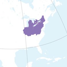
Haudenosaunee Confederacy
(haw-deh-no-saw-nee-con-fed-dur-ah-see)
The Haudenosaunee Confederacy, also known as the Six Nations or the Iroquois Confederacy, are an Iroquoian-speaking confederacy of Native Americans and First Nations peoples in northeast North America. They were known in colonial years by the French as the Iroquois League. The English called them the Five Nations, referring to the Mohawk, Oneida, Onondaga, Cayuga, and Seneca. The Tuscarora were added in 1722, making it the Six Nations.
Though nowhere near the power it held at its peak, the Confederacy still legally exists today on Indian reservations, and the Grand Council even issues passports (unrecognized ones, that is). In 2010 there were 81,000 members in the United States and 45,000 in Canada.
Capital: Various (Grand Council meets in Onondaga, New York)

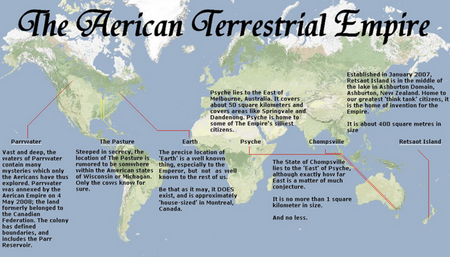
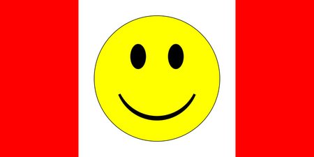
Aerica
(ah-ERR-i-kə)
Aerica, or the Aerican Empire, is a social organization and self-proclaimed micronation. The name is a play on "America," and its motto is "the world is ridiculous; let’s keep it that way." Its flag is similar to the flag of Canada, except with a smiley face as replacement for the maple leaf. As for its location... it consists of a random pond in Alberta, a house in Montreal, a farm somewhere in Wisconsin or Michigan, 50 km2 east of Melbourne, exactly 1 km2 east of that claim with no exact location, and a 0.4 km2 lake island in Ashburton, New Zealand. It also claims three random territories in outer space. If you want a fun way to spend twenty minutes, why not check out their website?
Capital: Montreal
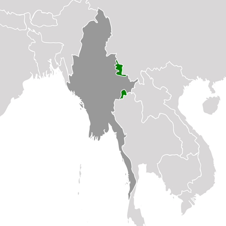
Wa State
(wah-stayt)
The Wa State is an autonomous self-governing region within Myanmar, granted to the Wa people. It has its own political system, divisions, and army, and is de facto independent from Myanmar. While Wa State does not pledge allegiance to any sovereign government, it never formally declared independence and still recognizes Burmese control over its territory. Thus, it is not a breakaway state. A one-party socialist state run by the United Wa State Party, it has strong ties to China. Additionally, the army has come under fire recently for being one of Asia's largest drug pushers, particularly with meth, heroin, and opium.
Capital: Pangkham
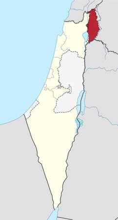
Golan Heights
(goh-lahn-hites)
The Golan Heights is a region internationally recognized as part of Syria, but de facto controlled by the Israeli government since its capture in the Six-Day War of 1967. Control was solidified in 1981, when Israeli law went into affect in the western two-thirds of the territory. Despite this, the eastern third is still under Syrian control—that is, split between the government and rebel forces (thanks to the 2011 civil war), as well as a skinny UN buffer zone.
Capital: Katzrin (de facto)
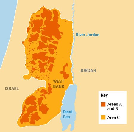
Civil Administration
(sih-vill-add-min-niss-tray-shun)
The Civil Administration is the Israeli governing body that operates in Israeli-controlled Palestine, but since the fall of Gaza in 2005, its authority has been limited to the West Bank. Though formally a separate entity, some observers have called it subordinate to the national military. Nowadays, its function is mostly limited to work, building, and travel permits in the West Bank.
Capital: Beit El (headquarters)
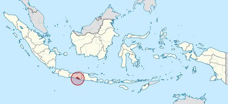
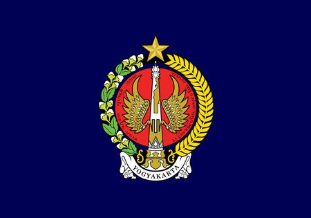
Yogyakarta
(yowg-yuh-kaar-tuh)
Yogyakarta is an autonomous region of Indonesia that is co-ruled by the Yogyakarta Sultanate and the smaller Duchy of Pakualaman. Due to the sultanate's critical support of Indonesian independence, it was awarded its own region within the country. Located on the island of Java, it is home to the country's largest university, Gadjah Mada University. It is also very developed, being one of only two provinces of Indonesia to have a "very high" Human Development Index, ranking just behind Jakarta, the highest.
Capital: Yogyakarta
Kherson Oblast (Russia)
(kehr-saan)
Kherson Oblast is an oblast internationally recognized as a part of Ukraine, though it was officially annexed as a federal subject of Russia in 2022. Despite only controlling the half of the oblast south of the Dnieper River, Russia claims the entire oblast as its own (as well as a small part of neighboring Mykolaiv Oblast, which they do not otherwise claim). The United Nations has condemned the annexations as against international law.
Capital: Kherson (de jure), Henichesk (de facto)
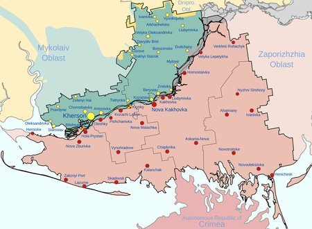
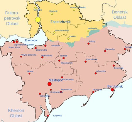
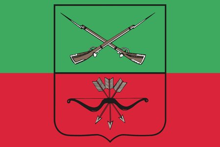
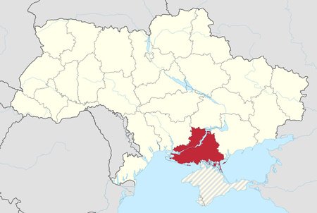
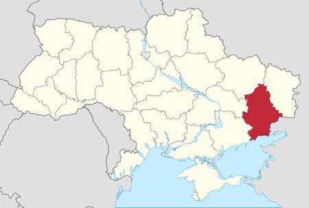
Zaporizhzhia Oblast (Russia)
(zah-pohr-ee-zhah-oh-blast)
Zaporizhzhia Oblast is an oblast illegally annexed by Russia but internationally recognized as part of Ukraine. It shares pretty much the same history as the aforementioned Kherson Oblast: it was invaded by Russia in 2022 and later annexed as an oblast, defying international law. In July, Russia extended the war censorship laws exercised in Russia to the oblast, and threatened to deport those who disobeyed them to Russia (deport them from Russia to Russia?)
Capital: Melitopol
Kherson Oblast (Ukraine)
(kehr-saan-oh-blast)
Kherson Oblast is an oblast in southeastern Ukraine, at the intersection of the Dnipro River and the Black Sea. It is known as the fruit basket of Ukraine due to its heavy agricultural export. Most of the oblast has been under Russian occupation since 2022, with them later annexing it against international law. By mid-November, Ukraine had recaptured all of the area on the west bank of the Dnipro, including Kherson city.
Capital: Kherson
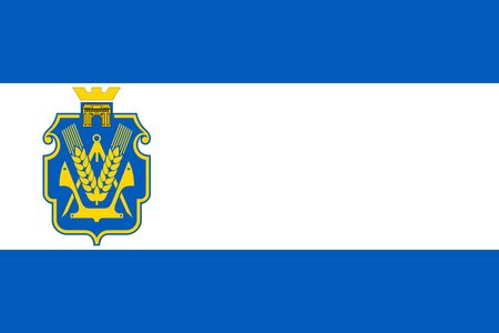
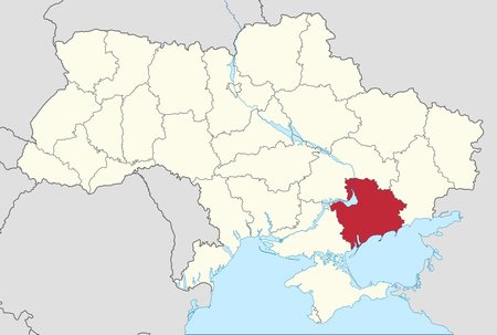
Zaporizhzhia Oblast (Ukraine)
(zah-pohr-ee-zhah-oh-blast)
Zaporizhzhia Oblast is an oblast in southeastern Ukraine. It is vital to Ukraine's industrial and agricultural sectors, especially due to the recent war efforts. Most of the oblast, including its entire coastline, has been under Russian occupation and annexation since 2022, although Ukraine still controls most of the oblast's population and capital.
Capital: Zaporizhzhia
Luhansk Oblast
(loo-haansck-oh-blast)
Luhansk Oblast is the easternmost oblast in Ukraine, located wholly in the Donbas region. Large parts of the oblast, including the capital, Luhansk, were declared to be the Luhansk People's Republic in 2022 by separatists, which was quickly annexed into Russia proper. However, the oblast is still legally considered a part of Ukraine by most countries.
Capital: Luhansk (de jure), Sievierodonetsk (de facto)
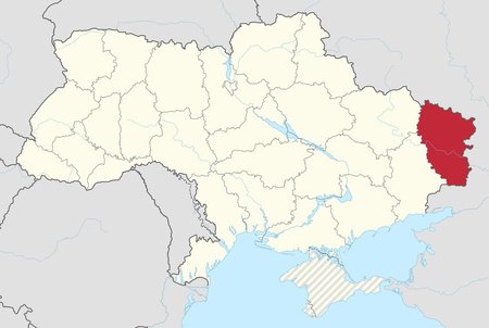
Donetsk Oblast
(don-yetsk-oh-blast)
Donetsk Oblast is an oblast in eastern Ukraine. With over four million residents, it is the most populous oblast in the country. Like Luhansk Oblast, about half of its territory, including Donetsk city, was declared as the Donetsk People's Republic and quickly annexed into Russia. Following this, the capital moved to Kramatorsk.
Capital: Donetsk (de jure), Kramatorsk (de facto)
Tier 12 - Argentine Antarctica
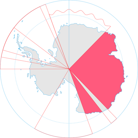
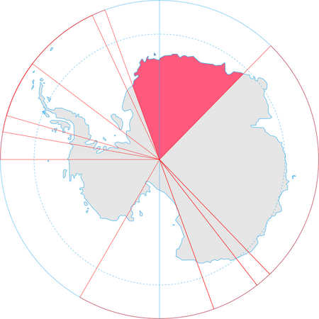
Argentine Antarctica
(aar-jen-teen-ann-tahr-tick-cah)
Argentine Antarctica is the sector of Antarctica claimed by Argentina, and is about the size of Mongolia. Geographically, it is dominated by the Weddell Sea, and is home to Antarctica's second-largest island, Berkner Island. Politically, it overlaps the Chilean and British claims on the continent. Within Argentina, it is a department of Tierra del Fuego, the country's southernmost province.
Capital: Ushuaia (headquarters, outside geographic area)
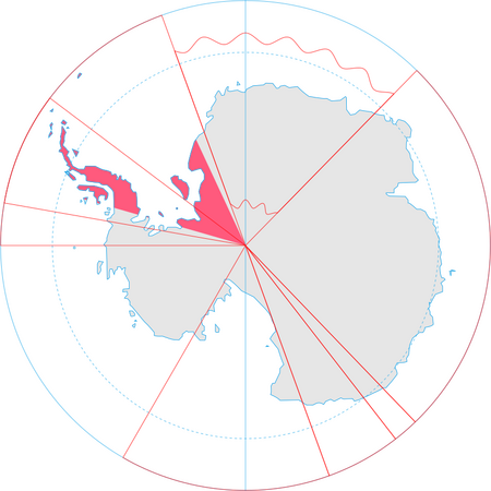
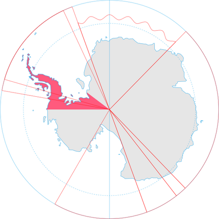
Chilean Antarctic Territory
(chill-lay-en-ann-tahr-tick-tear-rih-tor-ree)
The Chilean Antarctic Territory is a part of west Antarctica, including the Graham Peninsula and nearby islands, claimed by Chile, partially overlapping with Argentinian and British claims. Unlike most other countries, Chile's claim in Antarctica is pretty active, with them establishing several bases and holding jurisdiction over the territory. Also, despite its unique location, it weirdly doesn't have any sort of special status. It is unceremoniously three levels of subdivision down within Chile's Magallanes Region (region, province, commune—basically state, county, township).
Capital: Puerto Williams (headquarters, outside geographic area)
Queen Maud Land
(kween-mod-land)
Queen Maud Land is a Norwegian claim in Antarctica that was annexed in 1939. It takes up roughly a fifth of Antarctica, and is slightly smaller than Kazakhstan, but over seven times the size of mainland Norway. It borders the Australian and British claims. Also, it is notable for being the site of Nazi Germany's historical claim to Antarctica—New Swabia, which only existed from 1939 to 1945.
Capital: Oslo (headquarters, outside geographic area)
Ross Dependency
(ross-dee-PEN-den-see)
The Ross Dependency is a sector of Antarctica claimed by New Zealand that is roughly the size of Uzbekistan. The claim is only recognized by six other countries, all of which have their own claims in Antarctica. It was named after explorer James Clark Ross, who discovered the Ross Sea, the massive bay that splits the territory in three.
Capital: Scott Base (headquarters)
Australian Indian Ocean Territories
(aw-strey-lee-an-in-dee-an-oh-shun-ter-ri-tohr-eez)
The Australian Indian Ocean Territories consists of the Cocos (Keeling) Islands, and Christmas Island, two distinct Australian territories located in, well, the Indian Ocean. This unit is used by the federal government to provide services that a state would provide otherwise.
Capital: Flying Fish Cove (administrator's residence)
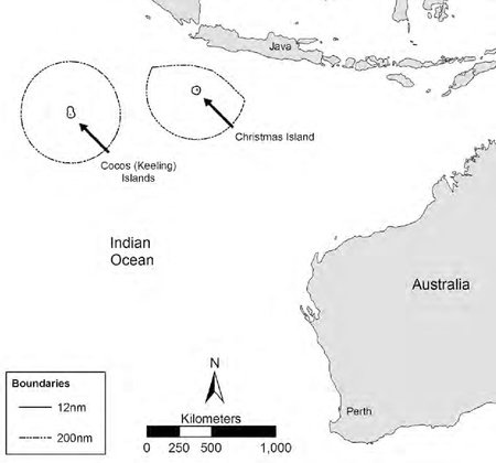
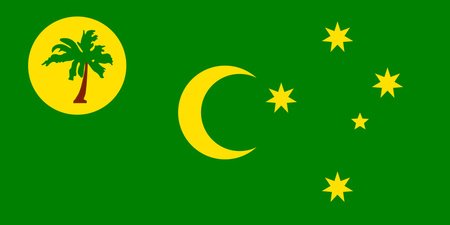
Cocos (Keeling) Islands
(kow-kuhs-kee-luhng-ai-luhndz)
The Cocos (Keeling) Islands are an Australian external territory, consisting of a small archipelago of two atolls that are relatively close to the island of Sumatra in Indonesia. The ~600 people that live there speak Malay and practice Sunni Islam, thanks to colonial practices of foreign labor. It was discovered by the East India Company in 1609 and annexed in 1857, being administered from Singapore and, later, Ceylon. It was given to Australia in 1955.
Capital: West Island

Heard Island and McDonald Islands
(hurd-ai-luhnd-and-muhk-daa-nuhld-ai-luhndz)
Heard Island and McDonald Islands is an external territory of Australia, comprised of mostly barren volcanic islands in the Antarctic Ocean. They contain both of Australia's active volcanoes, as well as the country's highest point outside of Antarctica. It is so remote that the islands had no recorded visitors until 1855. It is uninhabited and can only be reached by boat, which takes about two weeks to arrive.
Capital: Hobart, Tasmania (outside of geographic area)
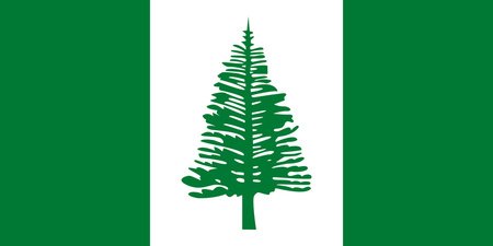
Norfolk Island
(nohr-folk-eye-land)
Norfolk Island is an external territory of Australia. Nearly 900 miles east of Australia, the island served as a convict penal settlement from 1788 to 1855, and was only given to Australia in 1914. It was formerly the only external territory of Australia to be self-governing, but this was revoked in 2015. Nowadays, the island's 2,188 citizens are serviced by the state of New South Wales, but oddly enough represented by the Australian Capital Territory in parliament.
Capital: Kingston
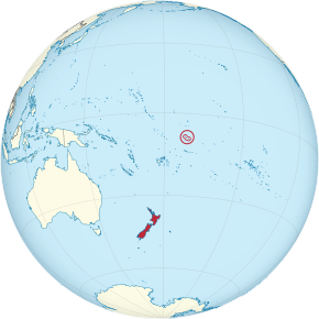
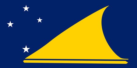
Tokelau
(tow-kuh-lau)
Tokelau is a dependent territory of New Zealand (an actual territory this time, not an associated state like the Cook Islands or Niue), consisting of three small coral atolls. It has a population of about 1,500, and almost half of the population was born overseas, mainly in Samoa or New Zealand. The strange thing is, both the New Zealand and Tokelauan governments refer to Tokelau as a nation, but the people have twice voted against self-determination, making its UN status as a non-self-governing territory controversial.
Capital: None
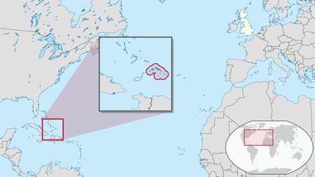
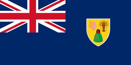
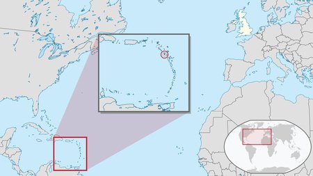
Turks and Caicos Islands
(turks-and-cay-coaz-eye-lands)
A very popular tourist destination for beachgoers and offshore bankers alike, the Turks and Caicos Islands are a British overseas territory located southeast of the Bahamas. They have been passed around by various colonial powers, but were first seen by Christopher Columbus in 1492. Also, its postal system is kind of odd—there's four mailboxes on each of the main islands, and that's it.
Capital: Cockburn Town
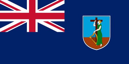
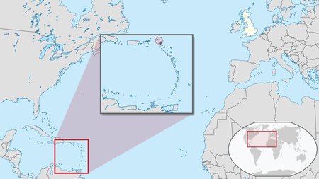
Montserrat
(MONT-sə-RAT)
Montserrat is a British Overseas Territory in the Caribbean Sea. It is nicknamed the "Emerald Isle of the Caribbean" due to the Irish ancestry of the citizens and its resemblance to coastal Ireland. In 1995, a deadly volcanic eruption struck the south of the island, completely destroying the capital, Plymouth, and rendering the south half of the island an uninhabitable exclusion zone. After that, the capital was unofficially moved to Brades, but a new capital, Little Bay, is under construction.
Capital: Plymouth (de jure), Brades (de facto), Little Bay (under construction)
Anguilla
(ang-GWIL-ə)
Anguilla is a British Overseas Territory in the Caribbean Sea. It is east of Puerto Rico and the Virgin Islands, and north of Saint Martin. The name is derived (well, copied exactly) from the Italian word anguilla, meaning eel, as a reference to the island's shape.
Capital: The Valley
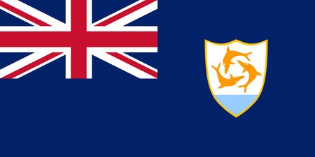
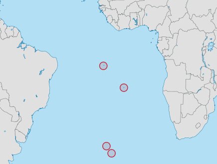
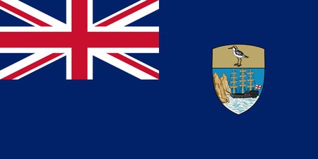
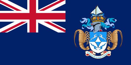
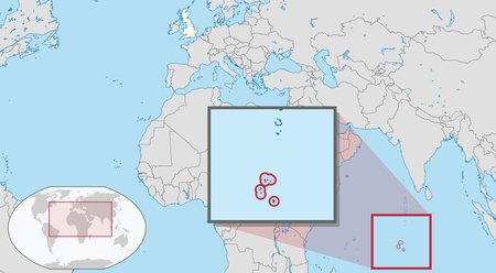
Saint Helena, Ascension and Tristan da Cunha
(saint-heh-leh-na-as-cen-shun-and-triss-tahn-dah-cun-yah)
Saint Helena, Ascension and Tristan da Cunha is a British Overseas Territory located in the southern Atlantic Ocean. The three islands (take a wild guess as to their names) all have separate legislatures and administrators, but are represented by one governor and one court. They are some of the most remote places on earth, and only have 5,633 people between them.
Capital: Jamestown
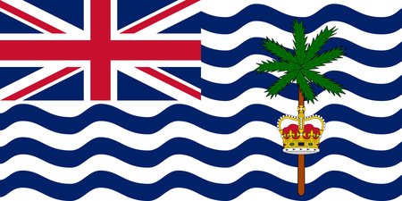
British Indian Ocean Territory
(brit-tish-in-dee-in-o-shin-tear-it-tor-ree)
The British Indian Ocean Territory is... well... exactly what it sounds like. It lies halfway between Indonesia and Tanzania right in the middle of the Indian Ocean. The only inhabitants are British and American military personnel and contractors.
The Government of Mauritius has sought to regain control over the Chagos Archipelago, which was separated from the then-Crown Colony of Mauritius by the UK to form the British Indian Ocean Territory. A February 2019 advisory opinion of the International Court of Justice called for the islands to be given to Mauritius. The United Kingdom and Mauritius began negotiations in 2022, but the future of the islands has yet to be seen.
Capital: None (administered from Diego Garcia)
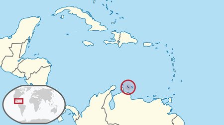
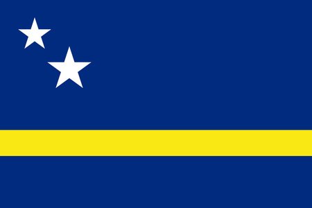
Curaçao
(KURE-ə-soh/KURE-ə-sow)
Curaçao is an island in the southern Caribbean Sea, off the coast of Venezuela. It is a constituent country of the Kingdom of the Netherlands. Along with Aruba (a country within the Kingdom) and Bonaire (a municipality within the Netherlands itself), it forms the ABC Islands. it was formerly a part of the Netherlands Antilles, up until their dissolution in 2010.
Capital: Willemstad
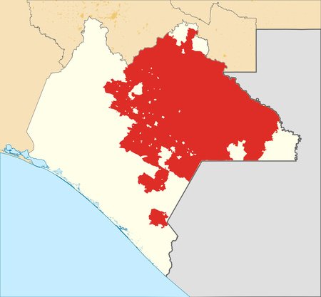
Rebel Zapatista Autonomous Municipalities
(REB-uhl-ZAH-puh-TEES-tuh-aw-TAH-nuh-muhs-myoo-nuh-suh-PAL-uh-teez)
The Rebel Zapatista Autonomous Municipalities were de facto autonomous territories controlled by neo-Zapatista (an anarcho-socialist movement) rebels within the Mexican state of Chiapas, until a major reorganization in 2023.
It was formed in 1994, after the Zapatista uprising and the wider Chiapas conflict (a complex conflict boiling down to tensions between the Mexican government, indigenous peoples, and subsistence farmers of the state of Chiapas). Attempts to negotiate failed in 1996, and the region's autonomy was never recognized by the Mexican Government.
The leading Zapatista Army of National Liberation, despite holding no formal political power, announced the RZAM's dissolution in 2023, to be replaced by a series of "local autonomous collectives."
Capital: Oventik (de facto), none (de jure)
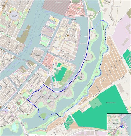
Freetown Christiania
(free-town-kryst-ee-an-ee-ah)
Freetown Christiania is an anarchist commune / micronation in Christianshavn, a neighborhood of Copenhagen, Denmark. It is one of Denmark's biggest tourist attractions, pulling over half a million visitors every year, despite the Danish government having declared it illegal in 2013.
The commune began in 1971, originally as a squatter's settlement. Since then, it has seen lots of violence, especially between gangs. Despite this, about a thousand people still live there today. The commune is probably most infamous for its Pusher Street, where marijuana is freely sold, despite it being illegal in the rest of Denmark. Yet somehow, cars aren't allowed. Go figure.
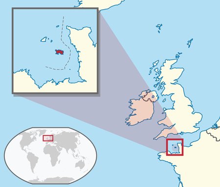
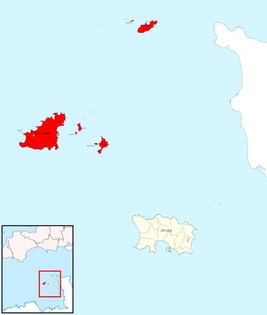
Bailiwick of Guernsey
(bai-lee-wick-of-gurn-sey)
The Bailiwick of Guernsey is a British Crown Dependency in the English Channel, just off the coast of Normandy. It is composed of three major islands: Guernsey, Alderney, and Sark, as well as many other smaller ones. It is self-governing, and technically not a part of the United Kingdom, which only provides defense and international representation.
Most of the Bailiwick's government is led by the island of Guernsey itself, but the two other jurisdictions, Alderney and Sark, also have a high degree of autonomy.
Capital: St. Peter Port
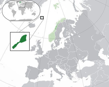
Jan Mayen
(jahn-may-yen)
Jan Mayen is a tiny, isolated Norwegian island and dependency in the Arctic Ocean. It has no population besides non-permanent military personnel and researchers. The island is very mountainous, with the highest summit being Beerenberg, the northernmost active volcano in the world.
Capital: Olonkinbyen (de facto, no permanent residents)
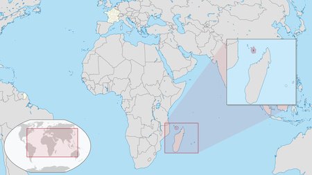
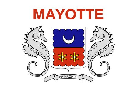
Mayotte
(mai-yout)
Mayotte is an overseas department of France (not a territory, but a situation similar to Hawaii) in the Mozambique Channel. It was formerly a part of the French colony of Comoros, but decided to stay with France instead of joining the newly-decolonized country.
It became an overseas department in 2011 and a part of the EU in 2014. Despite this, Mayotte faces extreme economic challenges, with a poverty rate of 84%, and an unemployment rate of 34%. Additionally, it is extremely Muslim, since Islam was brought to the islands by Arab traders.
Capital: Mamoudzou
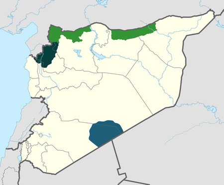
Syria (SSG)
(no pronunciation needed)
Oh boy, more Syria.
The SSG, or Syrian Salvation Government, is a Syrian opposition government based in Idlib Governorate. They are opposed to the Syrian Interim Government, another claimed alternative government in northern Syria, as well as the regular Syrian government.
It was formed by the rebel Hay'at Tahrir al-Sham group in 2017, and today is led by a prime minister and elected body. Happily, they have pushed out a comprehensive school system in their territory, with more than half a million students. They have also financed internet and phone service, so they're doing pretty good by Syrian standards.
Capital: Idlib (headquarters)
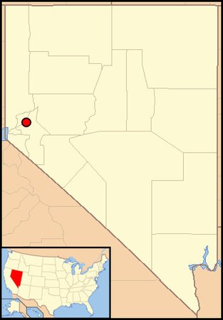
Molossia
(mo-loss-see-a)
Molossia is a micronation claiming sovereignty over 11.3 acres of land near Dayton, Nevada, though no country has recognized it. It was founded by Kevin Baugh in 1998, after whom the capital and only city, Baughston, is named. Some highlights of the micronation include its ongoing war against East Germany, its national drink, the Molossolini (Sprite, grenadine, and pineapple juice), and its currency, the Valora, which is pegged to the value of cookie dough. Baugh still pays taxes to the United States, but refers to it as "foreign aid." It's a pretty cool place, so check out the website.
Capital: Baughston

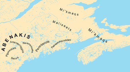
Wabanaki Confederacy
(wah-bah-nah-kee-con-fed-dur-ah-see)
The Wabanaki Confederacy is a confederacy of five Native American tribes (Abenaki, Mi'kmaq, Maleceet, Passamaquoddy and Penobscot) in the New England / eastern Canada region. It was formed in the 1680s to resist English colonization, often allying with the French against them. Eventually though, the British won, and the confederacy fizzled out. However, it was ceremoniously revived in 1993, and since then has existed as an indigenous rights activist group.
Capital: Various
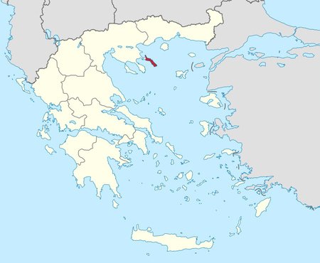
Mount Athos
(mount-ay-those)
Mount Athos is an autonomous community of Eastern Orthodox Christian monks that exists in northern Greece. The region is home to twenty monasteries, with about 2,000 monks between them, and is geographically very mountainous. While it is technically a part of Greece and the EU as a whole, it exercises a high degree of independence from both. In fact, since it can ignore the EU's free movement rules, all women and most female animals are banned. This is partially to help the monks practice celibacy, but also originates from a legend of the Virgin Mary visiting the peninsula, with the rationale being that only she can represent her gender there.
Capital: Karyes
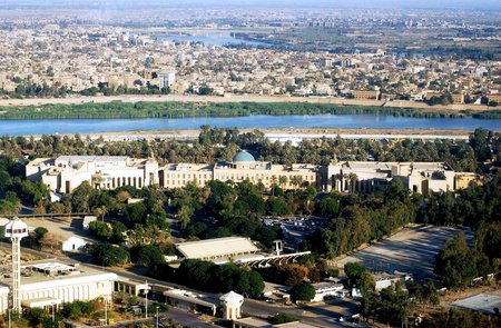
International Zone of Baghdad
(green-zone)
The International Zone of Baghdad, or more commonly known as the Green Zone, is a ten-square kilometer restricted area in Baghdad, Iraq. From 2003 to 2009, it served as the American base of operations during its occupation of Iraq, and was officially an international zone for the U.S. and its allies. In 2009, it was handed back over to Iraq, but was still off-limits to the public. Since then, some parts have been made public, but most of the zone is still restricted. Today, it serves as a hub for the Iraqi government and international activity.
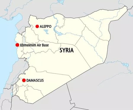
Khmeimim Air Base
Khmeimim Air Base is an airbase on the Syrian coast that is currently operated by Russia. It began operation in 2015 as the base of Russian intervention in the Syrian Civil War, and was allowed by a treaty signed with the Syrian government. In 2017, Russia turned it into a permanent fixture of its operations in Syria. Since then, it has been the subject of several terrorist attacks, though the base still operates to this day.
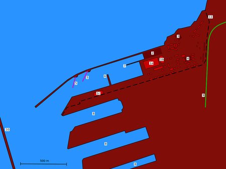
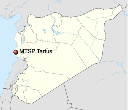
720th Material-Technical Support Point of the Russian Navy in Syria
(I'm not writing a pronunciation for this)
Our first double-line entry. How fun.
The 720th Materi... uh, the Russian naval facility in Tartus is a leased naval base of the Russian Navy in the Syrian city of Tartus. It was leased to Russia by Syria back in 2017 for 49 years (though they'd been using it in some capacity since 1971). However, later that year Russia announced they would make it a permanent fixture of their operations in Syria, along with the aforementioned Khmeimim Air Base.
Critically, it is Russia's only naval base on the Mediterranean Sea, sparing ships from having to travel back to their bases on the Black Sea.
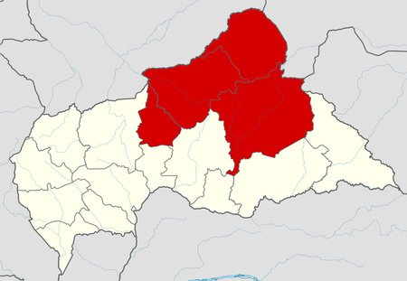
Dar al-Kuti
(dahr-all-coo-tee)
The Republic of Logone, sometimes known as Dar al-Kuti (the name of a pre-colonial emirate in the area) was an unrecognized state formed by Muslim rebel groups in the Central African Republic. It was formed in 2015 during the Central African Republic's civil war, as Muslims in the country wanted an Islamic state of their own (only about 15% of the CAR practices Islam, mostly in the north). However, it dissolved in 2021 after government forces captured the capital of Kaga-Bandoro.
Capital: Kaga-Bandoro (formerly)
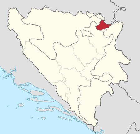
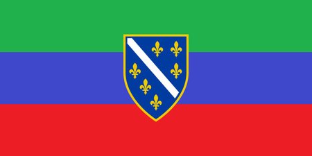
Brčko District
Brčko District is a self-governing administrative unit in northeastern Bosnia and Herzegovina. Officially, it is a condominium of the Federation of Bosnia and Herzegovina and the Republika Srpska (the country's two other administrative divisions), and was created to reflect the region's diversity. In reality, though, it functions as a local government, much like any other municipality in Bosnia and Herzegovina.
Capital: Brčko
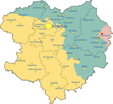
Russian-occupied Kharkiv
(rush-in-ock-oo-pied-car-keev)
Ukraine's Kharkiv Oblast has been under partial Russian occupation since 2022, though currently they only control a very small portion. At one point, they had captured nearly half the oblast, but failed to get the capital, Kharkiv, resulting in Ukraine's recapture of most of the oblast. While there is a civilian-military government installed by the Russian government, it is not a federal subject of Russia (though a referendum was planned).
Capital: Unknown
IMPORTANT NOTICE!
The rest of this series will be posted from Nickelz's account, so go ahead and subscribe to him. Thanks for reading!
I don't get Ravin de Sainte Dévote, though. It seems just like any other Monacan ward, unless I'm missing something?