Featured Quizzes
User Quizzes
Create Quiz
Data and Charts
Badges and Games
About JetPunk
JetPunk Shop
Dark Mode
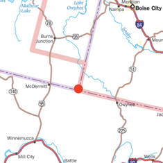
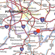
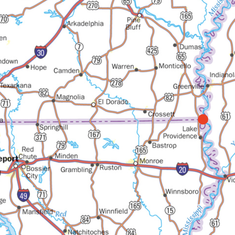
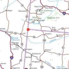
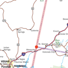
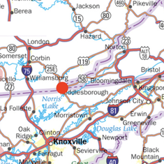
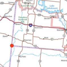
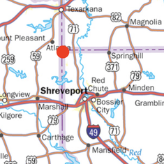
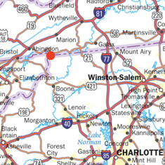
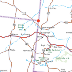
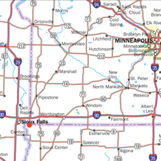
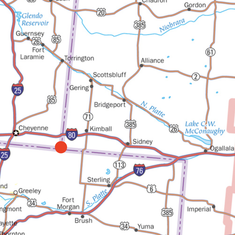
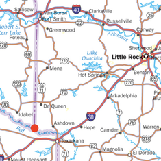
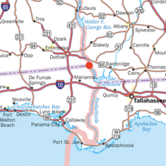
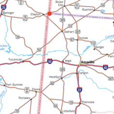
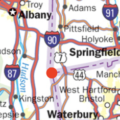
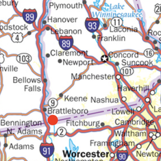
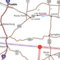
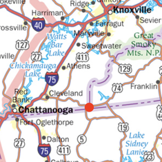
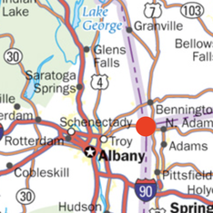
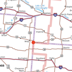
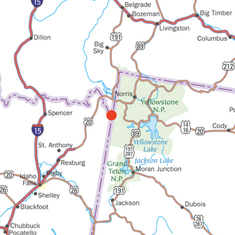
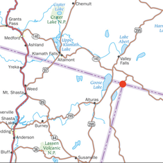
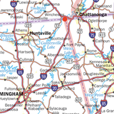
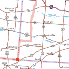
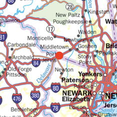
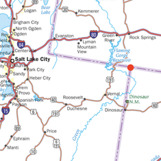
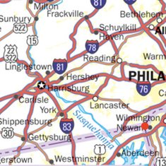
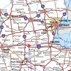
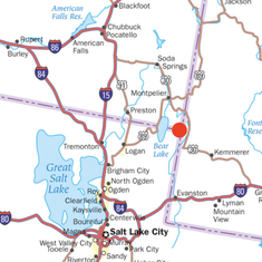
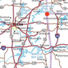
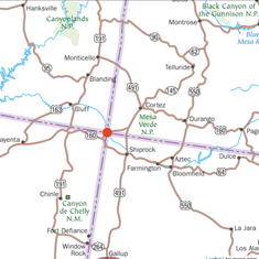
Tri-State Borders
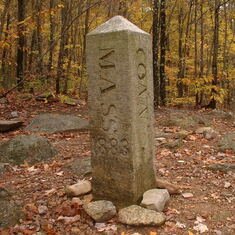
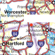
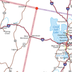
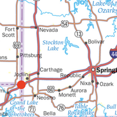
Identify the three states that make up each land border using the provided map close-up. The actual point is denoted by a red dot. (Hint: Many places show up on multiple maps!)
Bonus: the Four Corners!
Purple lines/dashed lines are state borders, pink lines are time zone borders
Please list the three states in alphabetical order. Abbreviations accepted
Click on each photo for a larger image
See comments for sources
Rate:
Last updated: July 29, 2022
You have not attempted this quiz yet.
More quiz info >>
| First submitted | July 29, 2022 |
| Times taken | 32 |
| Average score | 63.9% | Report this quiz | Report |
20:00
Enter answer here
0
/ 36 guessed
Time Used
00:00
Best Time
00:00
The quiz is paused. You have remaining.
Scoring
You scored / = %
This beats or equals
% of test takers
also scored 100%
The average score is
Your high score is
Your fastest time is
Keep scrolling down for answers and more stats ...
|
|
|
|
|
|
|
|
|
|
|
|
|
|
|
|
|

|
|
|
|
|
|
|
|
|
|
|
|
|
|
|
|
|
|
|
New and Popular
Save Your Progress
Geography/History
Quiz series by nromero02
...
Copyright H Brothers Inc, 2008–2024
Contact Us | Go To Top | View Mobile Site
Maps source: https://usa.zoom-maps.com/
This is my first picture quiz, so any and all comments are appreciated!