Looking at population vs. name recognition for U.S. urban areas
Last updated: Monday June 28th, 2021
Report this blog
Everyone can identify New York City, Los Angeles, and Chicago on a map. Most people can identify Memphis, Cleveland, and El Paso. Not many can identify Bowling Green, Kentucky; Eau Claire, Wisconsin; or Fort Smith, Arkansas. There's a pretty clear pattern here: the bigger the city and its surrounding urban area, the more recognizable the city is to the average person.
Now, the average JetPunk user isn't exactly the average person. You have to be somewhat strange to enjoy taking quizzes in your spare time; even more so for a monstrous quiz like the 500 Biggest U.S. Cities on a Map. Still, the results of this wonderful quiz by FlabberBapper track closely with what one would expect if the average American were to take the same quiz. (At least when it comes to the order of the results). New York City is predictably guessed correctly by 98% of users. Memphis can be identified by 72% of users. And only 3% of users can identify the most obscure urban areas, most of which occupy spots 450 to 500 in the population rankings.
When we plot the log of an urban area's population (this makes the relationship easier to see because the biggest cities are way bigger than most of the others) versus the percent of users that correctly guessed it in the quiz, we get a clear upward linear relationship. After removing urban areas that share a name with a much larger urban area (such as Cleveland, Tennessee, or Albany, Oregon), and were thus most likely guessed by accident, we get a trend line with an R2 of 0.724. This means that 72.4% of the variance in the percent of users that identified a city correctly is explained by the log of its population. Here is a link to a picture of the plot.
Now that we have a trend line that can predict what percent of JetPunk users correctly guessed an urban area based on that urban area's population, we can look at the urban areas that deviate furthest from the trend. Here are the 20 urban areas that are guessed the most compared to what's expected.
| Urban Area | Population | Pct correct | Expected | Actual - expected |
|---|---|---|---|---|
| Santa Fe, NM | 89,284 | 59% | 11.4% | 47.6% |
| Cheyenne, WY | 73,588 | 54% | 7.8% | 46.2% |
| Carson City, NV | 58,079 | 48% | 3.5% | 44.5% |
| Bismarck, ND | 81,955 | 51% | 9.8% | 41.2% |
| Anchorage, AK | 251,243 | 68% | 30.5% | 37.5% |
| Tallahassee, FL | 240,223 | 67% | 29.7% | 37.3% |
| Jefferson City, MO | 58,533 | 37% | 3.6% | 33.4% |
| Boise, ID | 349,684 | 69% | 36.6% | 32.4% |
| Honolulu, HI | 802,459 | 83% | 51.9% | 31.1% |
| New Orleans, LA | 899,703 | 85% | 54.0% | 31.0% |
| Lincoln, NE | 258,719 | 61% | 31.0% | 30.0% |
| Dover, DE | 110,769 | 44% | 15.4% | 28.6% |
| Fairbanks, AK | 64,513 | 34% | 5.4% | 28.6% |
| Topeka, KS | 150,003 | 49% | 21.0% | 28.0% |
| Oklahoma City, OK | 861,505 | 80% | 53.2% | 26.8% |
| Salt Lake City, UT | 1,021,243 | 83% | 56.4% | 26.6% |
| Salem, OR | 236,632 | 55% | 29.4% | 25.6% |
| Flagstaff, AZ | 71,957 | 32% | 7.4% | 24.6% |
| Las Vegas, NV | 1,886,011 | 92% | 67.7% | 24.3% |
| Albany, NY | 594,962 | 69% | 46.4% | 22.6% |
The most obvious thing to jump out from this list is that 15 of them are state capitals. It makes sense that people would know the state capitals more than other cities of similar size. JetPunkers maybe even more than usual, because they are likely to have mastered the state capitals quiz before taking this one. People also seem to be fond of Alaskan cities, and frequent vacation destinations New Orleans and Las Vegas.
Now, here are the 20 urban areas that are guessed the least compared to what's expected based on their population.
| Urban Area | Population | Pct correct | Expected | Actual - expected |
|---|---|---|---|---|
| Mission Viejo–Lake Forest–San Clemente, CA | 583,681 | 8% | 46.1% | -38.1% |
| Murrieta–Temecula–Menifee, CA | 441,546 | 9% | 40.9% | -31.9% |
| Bonita Springs, FL | 310,298 | 4% | 34.4% | -30.4% |
| Sarasota–Bradenton, FL | 643,260 | 18% | 47.9% | -29.9% |
| Indio–Cathedral City, CA | 345,580 | 7% | 36.4% | -29.4% |
| Round Lake Beach–McHenry–Grayslake, IL–WI | 290,373 | 4% | 33.2% | -29.2% |
| McAllen, TX | 728,825 | 22% | 50.2% | -28.2% |
| Poughkeepsie–Newburgh, NY–NJ | 423,566 | 12% | 40.1% | -28.1% |
| Victorville–Hesperia, CA | 328,454 | 9% | 35.5% | -26.5% |
| Antioch, CA | 277,634 | 6% | 32.3% | -26.3% |
| Port St. Lucie, FL | 376,047 | 13% | 37.9% | -24.9% |
| Conroe–The Woodlands, TX | 239,938 | 5% | 29.7% | -24.7% |
| Kissimmee, FL | 314,071 | 10% | 34.6% | -24.6% |
| Denton–Lewisville, TX | 366,174 | 13% | 37.5% | -24.5% |
| Palm Bay–Melbourne, FL | 452,791 | 17% | 41.4% | -24.4% |
| Barnstable Town, MA | 246,695 | 6% | 30.2% | -24.2% |
| Ogden–Layton, UT | 546,026 | 22% | 44.8% | -22.8% |
| Riverside–San Bernardino, CA | 1,932,666 | 46% | 68.2% | -22.2% |
| Bridgeport–Stamford, CT–NY | 923,311 | 33% | 54.5% | -21.5% |
| Oxnard, CA | 367,260 | 16% | 37.5% | -21.5% |
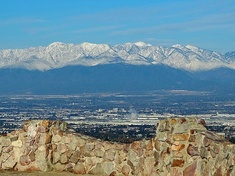
Here things get interesting. One thing we can see from this list is that in some cases, the Census Bureau has a tough job on its hands for deciding where one urban area ends and another begins. I encourage you to use citypopulation.de's map to explore the defined boundaries for these urban areas (click on a name to see the borders). For the first urban area on this list, the Census Bureau has somewhat strangely defined a new urban area south of Los Angeles centered on the cities of Mission Viejo, Lake Forest, and San Clemente that has more than 580,000 residents. It looks pretty connected to the rest of the LA urban area to me, but I'm not a professional demographer. Something similar is the case for Denton northwest of Dallas–Ft. Worth, and Round Lake Beach northwest of Chicago. Then of course, there is Riverside–San Bernardino, also known as the Inland Empire, which many just consider part of metro LA, but is somewhat infamously considered its own metro area with the 13th largest population in the US. Here it is the 21st largest urban area but only guessed by 46% of JetPunk users.
Other urban areas on this list are simply cities that have grown rapidly in recent decades but have not really been noticed by the wider culture. Most of these are in the Sun Belt, where many Americans are moving these days. My favorite example is McAllen, Texas, which has quadrupled in size since 1970 and whose urban area is now larger than much better-known cities such as Dayton, Ohio and Rochester, New York. Bonita Springs, Florida, the third urban area on the list, is interesting because it includes the city of Naples, which is much more widely known, but Naples is not big enough to be included in the name of the urban area; Bonita Springs' city proper has a population of 60,000 to Naples' 22,000.
If you'd like to explore the full data, you may find it here. Thanks for reading.