Exploring Canada's Provinces - #3 Atlantic Canada
First published: Saturday December 11th, 2021
Report this blog
Back on the Trail!
Last entry, I managed to cover all four provinces in Western Canada. This proved to be quite the undertaking, and I nearly ran out of characters in the process (Blogs may contain 50,000 characters)! This entry may be a little shorter, due to the small size of (most) of these provinces, but I'll do my best to avoid the trap that so many other Canadians from outside of the region make by generalising this region as a whole.
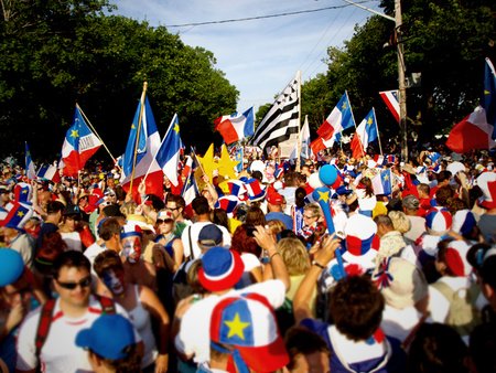
Grab a delicious donair and have a French-English dictionary ready (and perhaps a phrasebook in a mystery language, soon to be covered). Enjoy :)
Atlantic Canada
Be sure to use the term "Atlantic Canada" and not the Maritimes if you want to include the entire region, as the Maritimes region doesn't refer to Newfoundland and Labrador. This is a direct result of that province joining Confederation much later, in 1949, compared to its other seaside neighbours.
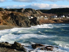
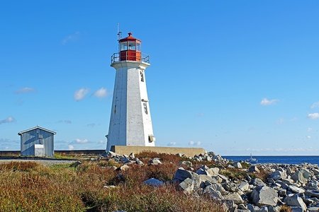
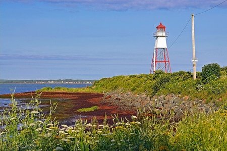
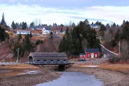
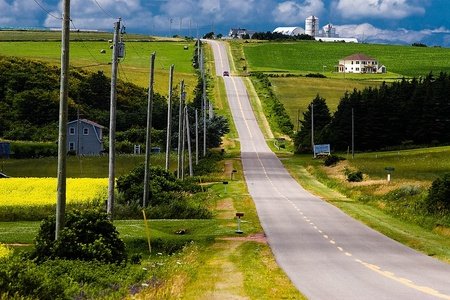
Atlantic Canada has a much more modest population compared to Central or Western Canada. As a whole, the region houses roughly 6% of Canada's population, and the largest city in the region has 316,000 people with a steep drop after this. The region has also struggled economically in the past and present, as industries rise and fall, however it makes up for this with its stunning scenery. Atlantic Canada often has a very distinct flavour of scenery, comprising craggy lighthouses and low-density houses strewn across fields, forests or rocky harbours.
• Nova Scotia
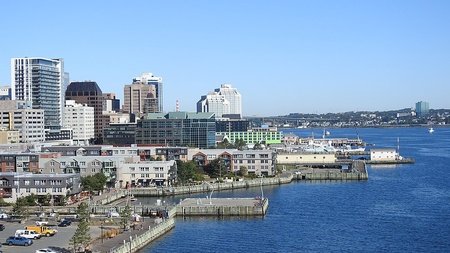
Nova Scotia is home to almost a million people and remains the most populous province in the region. The first French colonies in what is today Canada where founded here, although after the deportation of the Acadians in the mid 18th Century, there is only a limited Francophone presence here.
Formerly, fishing used to be a major pillar of the economy, however the once plentiful banks were overfished resulting in decline and massive job-loss. In addition, mining, forestry and steel industries have either disappeared or decreased, and in 2019 it had the lowest GDP per capita of any Canadian province or territory. Service sectors are taking off, and the tourist industry is also growing, helping remedy Nova Scotia's problem, and its market income was the second highest in the region at the same time, at around $30,000 per capita.
A food item often associated with Nova Scotia (but also the broader Atlantic Region) is the donair. Essentially a Canadian version of the doner kebab, a Turkish wrap with rotisserie meat. It is said to have come from a Greek immigrant to Halifax, who tried selling gyros with little success. He then modified the dish to include spiced beef and donair sauce, the word donair being a corruption of doner. Now donair is available and popular across Canada, and you can even find donair pizza, among other adaptations.
Nova Scotia is Latin for 'New Scotland', a name given to the land when Sir William Alexander attempted to found a Scottish colony at Port-Royal in 1632. This was not to be a success, however the name has continued to define Nova Scotia to this very day. 'Scottish' is the second most common ancestry of Nova Scotians today, after Canadian, after the Scottish Highland Clearances resulted in mass Gaelic migration. Somewhat fascinatingly, the Scottish Gaelic language has survived in the province to the present day, although only around 2000 people are estimated to speak it, and these numbers are constantly shrinking. Antigonish hosts a Highlands game annually, which includes activities such as piping, games and Highland dancing. Nova Scotia is known as Alba Nuadh in Scottish Gaelic.
Another, perhaps surprising minority are the Black Nova Scotians. Many freed slaves, primarily from the United States, ended up in Canada after the gradual abolition of slavery in the British Empire. Some had joined Britain during the American Revolution and were promised freedom in British North America. This eventually led to the creation of Sierra Leone as a place for freed slaves in the British Empire, however some did remain in Nova Scotia, founding this unique community. In an oddly parallel manner to many places in the U.S., segregation was practised in Nova Scotia until 1954, after Viola Desmond sat in the whites-only section of a cinema. Today, there are small, rural towns surrounding Halifax which have majority black populations, a fact I only recently learnt. This is a unique story in a country where most of the black population are much more recent immigrants from the Caribbean or Africa.

Nova Scotia has a few stereotypes related to the province. A popular television series, Trailer Park Boys, is set in a trailer park in Dartmouth, Nova Scotia and is an iconic part of the province's image. More particular stereotypes are that people from Nova Scotia are hardworking, enjoy fiddling/Celtic music and liquor.

For the first time, I didn't have a map to use. Wikimedia came to the rescue here, but due to the limited number of maps in the public domain the divisions are electoral districts rather than counties. Regardless, it will not change how I describe each region.
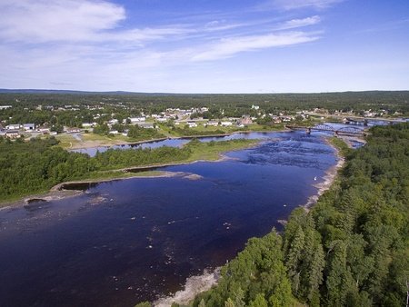
Eastern Shore - This is a region of major contrast, as moving north from the Halifax-Dartmouth area, the most heavily urbanised place in all of Atlantic Canada, the population takes a massive drop. In fact, the largest settlement, Guysborough, has around 900 people in total. The problem is that the area used to be dependent on fishing, and so the massive decline in this industry. This region is quite beautiful, with scenic ocean vistas, and therefore it is a popular place for Nova Scotians to buy cottages.
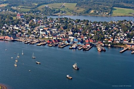
Southern Nova Scotia - Further south than anywhere else in the country, bar for Southern Ontario, this region is home to a number of historical sites. Lunenburg is a UNESCO world heritage site, retaining much of its appearance from the 1800s. The town was settled by Protestants from Germany and later New England, brought in to offset the Acadian Catholic population, and later to repopulate the area after their expulsion, respectively. As a result, a distinct Lunenburg English rose out of the area, influenced by German but also being not-rhotic (the R-sound is not pronounced unless followed by a vowel, simply put), although this unique dialect is moribund/spoken only by a small number of older people today. Port-Royal, France's first permanent settlement in North America, was also located here, and is commemorated by a replica of the site which you can explore. Despite a (somewhat) milder climate due to its southerly position, this region has a high degree of population-loss.
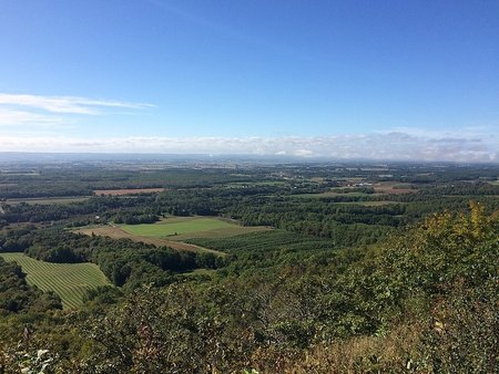
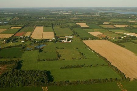
Annapolis Valley - Between two gentle, sloping mountain ranges lies the Annapolis Valley. The mountains shelter this valley from the oceans on either side, giving the valley a mild-ish climate fit for crops (especially apples). As a result, agriculture is a major pillar of the economy, and the region contains a healthy number of towns and villages.
North Shore - Primarily defined as an economic region, the North Shore is forested and home to pulp mills. Some towns, such as Pugwash, have bilingual English-Gaelic street signs (although not a single person in the town spot Scottish Gaelic in 2016). The Mi'kmaq First Nations (pronounced MEEG-maw) have a distinct culture/language and are of high numbers here, and historically they shared a strong relationship with the Acadians.
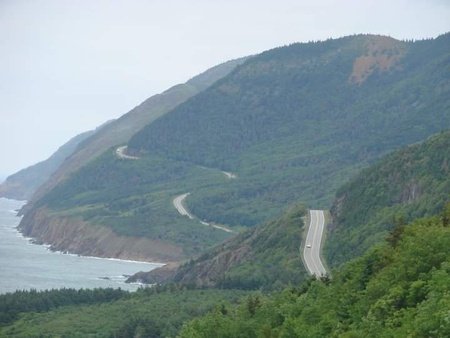
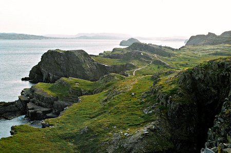
Cape Breton - Cape Breton is probably the most distinct region of Nova Scotia, having a strong history of coal mining but also some of the strongest Gaelic ties in the region. The Gaelic language used to have a large presence here, although it was ignored and stigmatised due to the poverty of the Gaelic population, so the language began to be lost in the early 20th Century. Today, only 40 people on the island speak it natively, although knowledge as a second language is higher. These Scottish migrants brought their fiddling with them, now a recognisable part of the island's culture. Cape Breton even has its own 'Highlands', a particularly stunning plateau area in the northwest of the island, accessible via the Cabot Trail (a popular route for motorists).
Some important cities include:
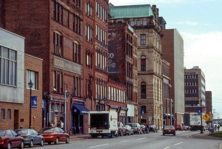
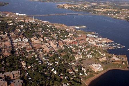
Halifax - Home of donair, Pier 21 (the port where cross-Atlantic immigration was received) and the Halifax Citadel (a reminder of the city's military past). In 1917, a French munitions ship collided with a Belgian relief vessel, creating the largest, non-nuclear manmade explosion to date, completely destroying the community of Richmond and killing 2000 people in the process. Boston, Massachusetts, gave a great deal of aid and today the cities share close connections. Historically, Halifax competed with rival city Saint John, New Brunswick, however where it lacked in heavy industry it specialised in both government/administrative and post-secondary sectors. In particular, Dalhousie University ranks highly amongst Canadian institutions.
Sydney - Officially part of the Cape Breton Regional Municipality, this city is the centre for the island as a whole, and formerly had booming steel and mining operations. As a result of these industries dwindling, Sydney has had a large population decrease, losing people every single census since 1971, except for in 2011 when the census boundaries were expanded. Cultural tourism is helping diversify the economy of this centre, which is also connected to Newfoundland via ferry service.
Truro - A transportation hub, Truro is nestled at the end of the Cobequid Bay (part of the Bay of Fundy). Many prominent Black Nova Scotians came from Truro, such as the concert singer, Portalia White. The Dalhousie Agricultural Campus north of the Salmon River contains six sections of the Berlin Wall, in case you are interested in historically significant slabs of concrete.
Kentville - Just south of the popular tourist town of Wolfville, nestled in the Annapolis Valley lies the peaceful community of Kentville. Unfortunately for Kentville, the decline it its apple industry, as well as the loss of cultural institutions to nearby Wolfville has resulted in the bulldozing of every single one of its remaining heritage buildings since WWII, including the historic railway station in 1990, making enemies with the (since renamed) Heritage Canada Foundation. (There still are some grand old buildings, just nothing listed).
New Glasgow - Yet another Scottish connection, only with more economic depression than Old Glasgow and fewer fried Mars Bars. New Glasgow, like Sydney, has suffered from the diminishing steel industry as well as the pulp mill.

• New Brunswick
In an officially bilingual country, New Brunswick is the only part of the country to be bilingual at the provincial level (In Quebec, only French is official). A third of the population are Francophone (mostly all Acadians), concentrated in the north of New Brunswick and alongside the northern coast. Their ancestors either fled to this region during the deportation of Acadians (as this region was not yet colonised, therefore they were safe from the British), otherwise they returned to the region once they were permitted to do so. Many New Brunswickers lead bilingual lives, although from what I've heard it is less common for Anglophones to be bilingual, even if it puts them at a disadvantage in the professional sphere.
The first Anglophones to settle in the region where the American Loyalists, although later waves of Irish and Scottish immigrants changed the balance, and as an impact of the Irish immigration in particular (plus the Acadian population), over half the province practises Roman Catholicism. A unique aspect to the province, is that just half of New Brunswick lives in urban centres, with the rest scattered mainly in rural areas along the perimeter of the province. The interior is almost entirely forested, with a much lower population density.
New Brunswick has a long history of building covered bridges, having built around 400 all the way up to the 1950s (not including a couple which were replaced). Covered bridges are no longer practical, and are sadly easy targets for arson. Today, 58 covered bridges remain in New Brunswick, and although Quebec has a higher total number, this is something the province is known for in particular. The world's longest covered bridge, Hartland Covered Bridge, is located in New Brunswick. See here for a complete list + map of where each one is.
Acadian French is quite different from its neighbours in Quebec. Older speakers may use an alveolar flap/trill for their 'r' sound (similar to how it's pronounced in Spanish, for example), although nowadays it is spoken the same as in Parisian French. New pronunciations have arisen, such as a softening of velar stops /k/ and /g/ to [tʃ] and [d͡ʒ] before front vowels (so, for example, quelqu'un/someone sounds like tchelqu'un). There are tons of interesting vocabulary words, and you can check them out here if you are interested. Sorry for the technical description.
Chiac is an interesting dialect with loads of code-switching with English, a result of contact between the two languages. Daniel Leblanc's Acadieman is a Chiac-speaking Acadian superhero who gains his strength via coffee.
New Brunswick is not a province the rest of the country thinks about all too often. The region is sometimes mentioned for its economic woes, which have unfortunately plagued the province ever since its shipbuilding days. Along with Saskatchewan and Manitoba, New Brunswick could be considered the closest thing to a 'drive-through' province (essentially meaning a 'boring' place you just drive on through as quick as possible, without stopping), but from what I've heard those who dare venture past the TransCanada Highway realise just what a beautiful place they've been missing out on. Therefore, I believe that New Brunswick is a strong contender for "most underrated province".
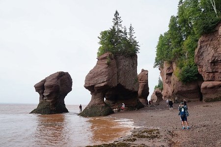
New Brunswick is also known for the Bay of Fundy, home to the world's highest tidal ranges.
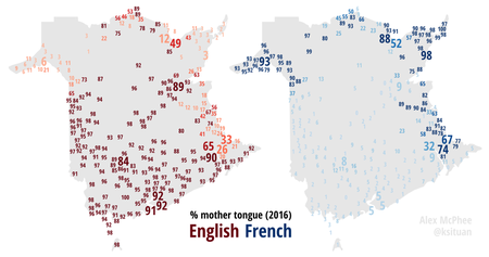
Apologies for the lack of regions. I am really not sure about the best way to split up the province/if it's even large enough to have proper divisions (aside from English/French speaking areas). Instead, I'll give you this fascinating map showing different settlements and what language they speak. The numbers are percentages, and the size correlated to how big each settlement is. This map was made by the legendary Canadian mapper, Alex McPhee, who seems to be behind around half of all maps relating to this country on Wikimedia.
But don't worry, I won't cheap out on the photos :)
Some important cities include:
Saint John - Not to be confused with the Newfoundland city, this port town is known for being a historical centre for industry. Saint John's signature red, brick buildings line the old town, a reminder of past prosperity, although this city has been declining with the fall of its industries, including the shipbuilding. Thanks to its position on the Bay of Fundy, Saint John is home to the Reserving Falls, a set of rapids from the Saint John River into the bay, which reserve direction during high tides. The Loyalist House, one of the oldest structures in town due to the Great Fire of 1877, was built by an American Loyalist family in 1817 and is now a museum.
Moncton - Located on the chocolate-coloured Petitcodiac River, Moncton is a versatile city which has manage to rebuild itself multiple times. Both the closure of shipbuilding in the 1860s and the railway industry in the 1980s have not managed to stop this town, earning it the motto "I rise again". Moncton is one of the only towns in the Maritimes to have a population increase. It is also notable for its bilingualism, with a third of the population being Francophone and nearly half of all Monctonians having achieved bilingualism. This places Moncton alongside Canada's most bilingual cities, such as Ottawa, Montreal and Sudbury.
Fredericton - As the provincial capital (despite only being the third largest city in New Brunswick), Fredericton has also managed to retain a population increase as it holds more service/government employment, rather than precarious industrial positions.
Miramichi - Founded in 1995 via the amalgamation of several smaller towns, Miramichi is the largest city in the north of the province. Despite its position amongst Francophone locales, only 9% of the city speaks French as a native language.
Edmundston - Now this is a Francophone city! 92% of people in Edmundston reported speaking French natively in 2016. However, this is not a typical Francophone Maritimes city, as the majority of people do not identify as Acadians, as they are of Quebecois descent, and they have their own accent. This is yet another pulp and paper town, on the Madawaska River opposite the border from the American town of Madawaska. Madawaska (town) is also French-speaking, showing that borders are rarely hard lines in any other realm other than political definitions.

• Prince Edward Island
Canada's smallest province, by both area and population, yet the one that left the biggest impact (at least according to their licence plate). Prince Edward Island (PEI for short) prides itself for being the Birthplace of Confederation, as the capital of Charlottetown held a conference in 1864. Originally this conference was on a potential union of Britain's Atlantic colonies, but ended up leading to a union of all of British North America in 1867. PEI didn't join until 1873, however.
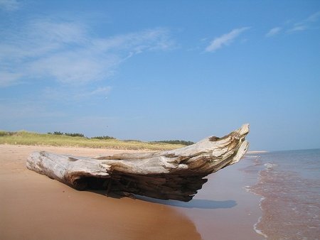
Despite its proximity to other provinces, Prince Edward Island assumes a distinct looks/feel from its sister provinces. For example, on the island sand and soil is typically red, thanks to high levels of iron-oxide (rust). On top of this soil, it is very common to find potato farms. Potatoes are by far the dominant crop in this agriculture-heavy region, and 25% of Canada's potatoes come from PEI. In Basin Head Provincial Park, near Souris, you can find the "singing sands", a beach which makes an interesting scrubbing sound when you tread on it.
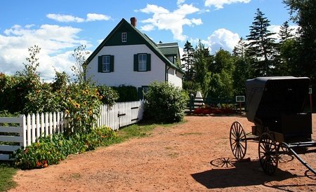
Lucy Laud Montgomery was born in a small rural community on the island, and used it as the setting for her book, Anne of Green Gables. This classic 1908 children's tale became a massive hit, and was translated into 36 languages. However, the setting for the novel was based on Montgomery's relatives' house in Cavendish, and the property was later purchased and refurbished by the Canadian government, and made into a tourist attraction with period furniture. Anne of Green Gables is popular in Japan, where it is included in the national school curriculum, therefore scores of Japanese tourists make the pilgrimage to the site.
Another interesting phenomenon has to be the PEI red-orange dirt shirts. These shirts are soaked (and therefore coloured) in the signature island soil. I don't know if people on the island really wear these or if it's simply a tourist gimmick.

Prince Edward Island has a few stereotypes which echo like a broken record, an interesting combo of seafood, potatoes and Anne of Green Gables, (and maybe Confederation for all two Canadian history nerds). Speaking of which, the island is also known for the massive, 12-kilometre-long Confederation Bridge, making it finally possible to drive in from the mainland since 1997. PEI is also famous for its folk Celtic music, which I dare you to try searching up!
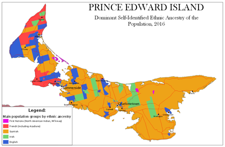
Once again, I cannot divide the island into its specific regions, as it is very small and lacks regional distinctions. Here is an interesting map on ethnic ancestry in PEI. Ancestry isn't terribly pronounced in Canada, on average, and I find it is much less common to say "I'm Irish-Canadian" as it is for Americans to identify as "Irish-American". However, ancestry still influences factors such as religion, but also some of the island's heritage such as the Celtic folk music I mentioned earlier. In addition, there is a small Francophone part of PEI in the red area by Abram Village (sorry to make you zoom in).
Some important cities include:
Charlottetown - Situated on a peninsula-like area on a natural harbour, where three rivers converge, this is where Canadian Confederation began talks. Charlottetown is the smallest of Canada's provincial capitals, with only 36,000 people in 2016, although this is comparable to the total size of each of the territories' populations. The CBD features beautiful Victorian architecture and colourful houses, and the university attracts a somewhat younger population than the average PEI population.
Summerside - A service centre for the west of the island, and one of just two cities in PEI. Summerside is located on a very narrow portion of PEI, and technically touches both the south and north shore of the island. The city is known for fishing and its silver fox population, formerly the world's largest.

• Newfoundland and Labrador
Known locally as 'The Rock', Newfoundland and Labrador is by far the most distinct province in Atlantic Canada, and it is not considered part of the Maritimes for historical reasons (as it joined Canada as recently as 1949).
I should preface this by saying that Newfoundland (pronounced new-fin-LAND, rhymes with 'understand') is the island off of the coast of Canada, and is home to 94% of the provinces population. Meanwhile, Labrador is the massive, distinct parcel of land on the Labrador peninsula, which shares a border with Quebec. Before 2001, the province's name was just 'Newfoundland', until the name was finally changed.
Newfoundland is the most easterly part of North America second to Greenland, and as a result it has seen some of the earliest contact with Europeans. Circa 1001, Leif Erikson landed here and established a Norse settlement, as chronicled in the Icelandic Sagas. Later, the Portuguese lay claims to the area during the early 16th Century, while at the same time Basque fishermen founded the first continuous outposts. Finally, in 1583, Newfoundland became a British possession, which it remained until 1949. For a number of years prior to 1933. The Dominion of Newfoundland was its own country with the same level of autonomy as Canada (prior to 1931), although it was forced to give up independence due to a suffering economy. Due to it being one of the earliest places of contact between Europeans and First Nations people, the Indigenous Beothuk of Newfoundland completely died off in 1829 thanks to violence and disease, and we have very few records of their culture.
Newfoundland and Labrador is well known for its economic problems, ever since the dramatic and abrupt collapse of cod fishing. Increases in fishing technology yielded higher than ever returns during the 1970s-80s, but this overfishing directly led to the collapse in 1992. This had huge implications for Newfoundland, where fishing has been part of the traditional culture and lifestyle, and caused a great deal of unemployment. Mining and oil production has picked up, warranting the building of the 278-metre-tall behemoth, the Hebron Oil Platform, which was towed out to sea in 2012. Tourism is also a major industry.
Nazi Germany deployed Weather Station Kurt on the northern tip of Labrador, in order to give more accurate weather predictions in order to get an edge over the Allies. This station, the only German military operation in North America, was forgotten and rediscovered in 1977 and now sits in a museum in Ottawa.
Newfoundland and Labrador have a very unique identity, in part due to their history.
One part of Newfoundland, which I believe is known throughout Canada, is the unique Newfoundland accent(s). Influenced primarily by dialects of the West Country in England, or by accents from the southeast of Ireland, depending on the dialect, Newfoundland English is best known for the word "b'y", a sort of contraction of the word 'boy'. The Irish-influenced accent is arguably the most famous, and I've heard of it causing a lot of confusion to Irish people, who may even assume a Newfoundlander to be from Wexford. At one point, a sizeable portion of Newfoundland actually spoke the Irish language.
Not everyone has such a recognisable accent, and from what I can understand the accents have somewhat of a stigma attached to them. I heard about young people from rural areas moving to towns and trying to make their accent more of a 'Standard Canadian/North American' (although Newfoundland English typically lacks the Canadian Rising I talked about last blog entry). I also learnt that the Newfoundlander pejorative skeet can be associated with having an accent, unfortunately. This is all anecdotal evidence so don't take it too seriously, however.
Newfoundland Dialects are also notable for their ingressive sounds, which, contrary to most speech, is produced by breathing in rather than out. Typically, you hear this with the affirmative word "yeah" and this is most common amongst the older generations.
Half of Newfoundland lives on the island, the other half lives in Fort McMurray and six people live in Labrador. I think it's safe to say that Newfoundlanders are stereotyped as all spending time working up north in the 'patch. Otherwise, people go for the accents or the fishing industry. In its quest to attract tourists, a ceremony known as the 'screech-in' has become popularised. Using the Newfoundland Screech rum, several pubs host screech-ins where the participant is typically asked whether or not they would like to become a Newfoundlander. The participant should then take a shot of the Screech, reply "Yes b'y" and kiss a cod fish. It's exactly as touristy and authentic as it sounds.
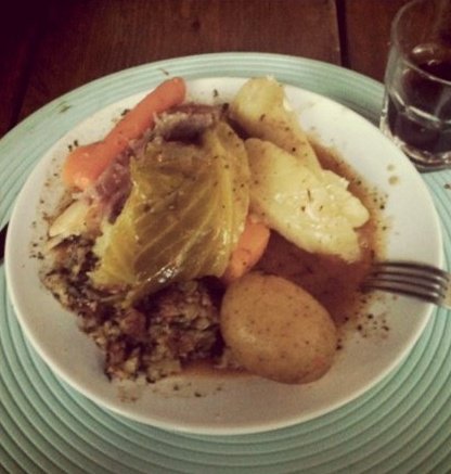
Newfoundland is also one of the only regions in Canada to have spawned unique cuisine items. For breakfast, why not try a touton, a kind of fried bread eaten at breakfast or lunch? Sunday? May I recommend Jiggs Dinner (a kind of rural staple full meal with a salt beef base)? Jiggs dinner is kind of complex to explain, so I will link this Wikipedia page so you can learn more.
The Newfoundland Tricolour is an unofficial, possibly Irish-inspired flag with green, white and pink colours. Sometimes Newfoundlanders use this flag, although it is typically associated with Catholic Newfoundlanders, while the official, Union Jack-esque flag is more popular overall, as of a 2005 government poll.

I promise this public use map is better than the other (SVG) map I have on Newfoundland and Labrador. Anyways, here is a division of the province.
Avalon Peninsula - This is by far the most populated and urbanised region, home to St. John's and its suburbs. A large number of other towns and villages line the coastline of this region, as it extends into the fish-rich Grand Banks. From 1994-94, Canada and Spain fought over the Spanish vessels, which docked right outside of Canada's EEZ and fished for Greenland turbot fish. This was known as the Turbot Wars. No one was killed.
Burin Peninsula - Known locally as 'The Boot'. Like Moose Jaw, Saskatchewan, it is part of the local legend that Chicago mobster, Al Capone visited this region. Located within shouting distance from the French overseas territory of Saint Pierre and Miquelon, the town of Fortune runs ferry services to this territory. Therefore, you can find the unlikely Canada-France Customs Building/Border Crossing here.
Central Newfoundland - This area of Newfoundland is home to the Bonavista Peninsula, home to many of the oldest communities on The Rock. Aside from this peninsula, the whole region isn't terribly defined and is more a convenience grouping on my half. The interior regions are almost exclusively rocks and forests, aside from the communities linked by the TransCanada Highway + a couple other (former) resource towns such as Buchans. Off the north coast, you can settled islands, such as Fogo Island, home to the beautifully named community of Joe Batt's Arm.
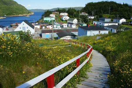
South Coast - The South Coast is much more remote than other parts of Newfoundland, and few communities here are connected via road. Many of the communities are known as Outports, remote communities that consist of groups of houses without roads. Based on fishing, this unique way of life, which survives into the 21st Century, is endangered and the controversial Resettlement program incentivises the abandonment of said communities through cash. Hundreds of communities were relocated from the 1950s-70s, and eight communities relocated from 2002-2020, based off of community referendums.
West Coast - The TransCanada Highway connects to Channel-Port aux Basques via Sydney, Nova Scotia. Further north (but still south of Corner Brook), Port au Port Peninsula, a historical Francophone community and at present designated a bilingual district.
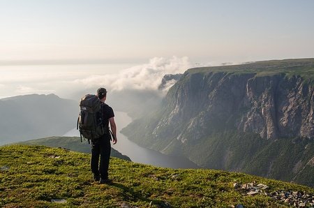
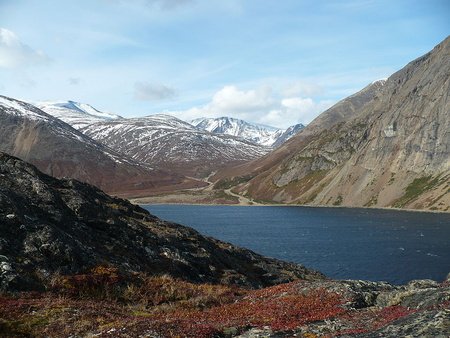
Great Northern Peninsula - This is what gives Newfoundland its signature shape. The landscape here is dramatic, looking like a combination of the Scottish Highlands, with a touch of Norse fjords in the awe-inspiring Gros Morne National Park. Pissing Mare Falls has an unbroken drop of 250 metres, one of the tallest in Canada, as it tumbles into the fjord. On the northern tip of the peninsula lies L'Anse aux Meadows, an archeological site of an early Norse settlement, containing reconstructed houses. A Norwegian couple discovered the site in the 1960s, and to date this is the only Pre-Columbus, confirmed area that Europeans visited in North America, aside from Greenland. The growth of butternuts here implies that the Norse could have reached as far south as New Brunswick, given that they grow natively here, and possible Norse sites have been found in Labrador, however this remains the only confirmed site of Norse settlement in Canada. The Norse even had a word for the Indigenous people, skrælingjar (plural) whom contributed to the abandonment of the site not long after it was founded.
Labrador - To put it bluntly, Labrador has a greater resemblance to one of the Canadian territories than it does to Newfoundland proper. This region, which has its own unofficial flag, can be split into the southern region, reachable either by road (via Quebec), or ferry (from Newfoundland, technically through the Quebec Anglophone town of Blanc-Sablon on the Labrador border), and this region has an ethnic European majority. The other region contains the autonomous Inuit region of Nunatsiavut, the Inuit-Métis unrecognised region of NunatuKavut (in the southeast of Labrador) and the Innu (First Nations group not Inuit) unrecognised region of Nitassinan. Both Nunatsiavut and Labrador itself have movements to become territories independent from Newfoundland. Nain is the capital of Nunatsiavut, and you can only reach the community, the northernmost in the province, via air or ferry. Labrador borders the territory of Nunavut via the remote island of Killiniq.
Some important cities include:
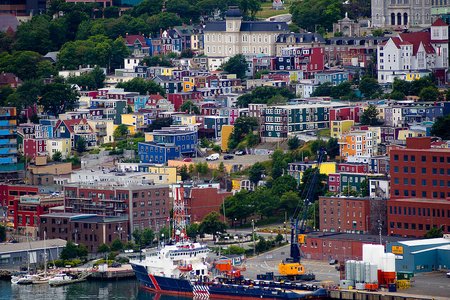
St. John's - A historic city famed for its colourful row houses, St. John's is the capital and largest city in the province. The Basilica of St. John the Baptist rises from the skyline, one of a few buildings to survive the Great Fire of 1892. Meanwhile, the iconic Signal Hill is where the first Trans-Atlantic wireless transmissions were sent in 1901. St. John's downtown area is a tourist site, comprising historical streets, such as Water Street, lines with businesses. Memorial University is the only university institution in the province.
Corner Brook - Seven hours west of St. John's lies the pulp and paper town of Corner Brook. The second largest population-centre in the province, Corner Brook lies on a scenic bay and has a favourable position to those wanting to visit some of the natural splendour in and around Gros Morne National Park.
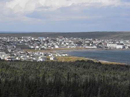
Gander - Gander was born out of the aviation industry, and its history as one of Newfoundland's largest inland centres begins with the construction of the airport in 1935, thanks to its position between New York City and London. Following the 9/11 attacks, North America's airspace was closed and 38 civilian flights were forced to land in this small Newfoundland town. 6600 passenger and crew were stranded here for six days, and they were aided by the Gander locals, then just under 10,000 strong.
Grand Falls-Windsor - This is the largest of the interior towns, founded in the Exploits Valley. Separate towns until 1991, the two pulp and paper towns voted to amalgamate. Despite cutbacks in to the precarious industry, Grand Falls-Windsor has found success as a service centre for all of Central Newfoundland.
Happy Valley-Goose Bay - Labrador's largest town, established in 1941 as the Goose Bay Air Force Bay by the Royal Canadian Air Force. The town has a borderline subarctic climate and experiences bucketloads of snow during the winter. This isolated northern town has been designated a Tier 3 community by the Introvert Society of Canada, and sees mass scale migration from more populated areas where social interaction is virtually unavoidable. Happy Valley-Goose Bay has a very transient, young population, and it's common for people to come, make a quick buck and get out.

This concludes my blog entry. I was a little worried to approach Atlantic Canada, as it is both a place I've never been but also a faraway place that many Western Canadians such as myself known little about. I learnt a lot during my writing and I hope I was able to capture a good snapshot of this wonderful region!
I am excited to attack the three Canadian Territories in the next blog entry. Stay tuned :D
Newfoundland and Labrador is probably one of the most interesting provinces in Canada. Everything from history, to the different accents, to remote outposts, to the massive territory that is Labrador. I hope I can visit someday :)
So, New Brunswick (e.g.) is a territory as like Yukon, Nunavut, and Northwest Territories, or I misunderstood something? That’s quite interesting! And maybe I’m being a fool asking that, but is Ottawa a “subdivision” like the case of Brazilian Federal District (Brasília), or Columbia District (Washington)? Or is part of Ontario? And PEI... the kind of province you learn only with 11 years old (although I’m 12 lol)... the Canadian Acre. These blogs are outstanding and I don’t wanna their end lol
EDIT: And how many characters now? Lol
EDIT: I misunderstood something, or Labrador has about 27k people
New Brunswick is indeed a province. Just as a fun fact but all territories are at least bilingual in French/English. And to answer your question about Ottawa, it is part of Ontario, and neighbouring Gatineau is part of Quebec. These two cities form a greater metropolitan area known as the "National Capital Region" but this doesn't mean it is separate from Ontario, I should clarify.
Fortunately more than 6 people live in Labrador! Otherwise it would have been ranked a tier 5 or 6 place to live by the Introvert Society of Canada. They rarely give out scores that high :)
(Fingers, check ✅Yeah, my error. I didn’t read correctly lol. And, oh. Now I understand. Already knew about Gatineau being on Quebec, but didn’t knew Ottawa was exclusively on Ontario (without making a proper... “district” if it make sense). And after reading 6 people in Labrador, I felt dizziness lol. But what that mean then?I like how you started a paragraph with "Nova Scotia is Latin for 'New Scotland'", and you ended it talking about how Antigonish hosts many different games annually lol
Eagerly awaiting the last installment!
I'm happy to say that the last one is up, big thanks for reading :D